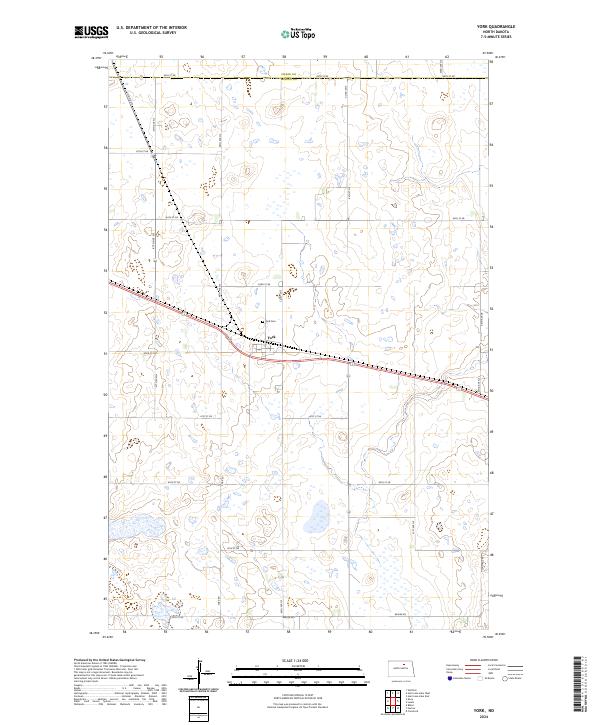
2024 Map of York
USGS Topo · Published 2024About this map
York is the primary settlement on this North Dakota prairie landscape, situated along a prominent east-west transportation corridor that bisects the terrain. The town's grid is surrounded by a dense network of wetlands and small glacial potholes that characterize this region of the Great Plains. Just north of the town center lies the York Cem, a significant site for local genealogical research. The map also delineates the county line where Pierce Co meets Benson Co, illustrating the administrative divisions of this agricultural area. A systematic grid of rural roads, including York Rd and Beaver Rd, connects the scattered farmsteads and provides access to the numerous small bodies of water and marshlands that define the local topography.
Find a feature on this map
29 named features on this map. Tap any name to fly to it.
Don’t see what you’re looking for? This feature index may not catch every label — zoom into the map to look around manually.
Map Details
Editions of this 2024 York Map
This is the sole edition of this map. No revisions or reprints were ever made.
Other maps of this area

1953 · Devils Lake
USGS Topo · 1:250,000

1956 · Devils Lake
USGS Topo · 1:250,000

1957 · Comstock
USGS Topo · 1:24,000

1958 · Baker
USGS Topo · 1:24,000

1958 · Harlow
USGS Topo · 1:24,000

1971 · Wolford
USGS Topo · 1:24,000

1971 · Knox
USGS Topo · 1:24,000

1971 · Hurricane Lake West
USGS Topo · 1:24,000

1971 · York
USGS Topo · 1:24,000

1971 · Leeds
USGS Topo · 1:24,000