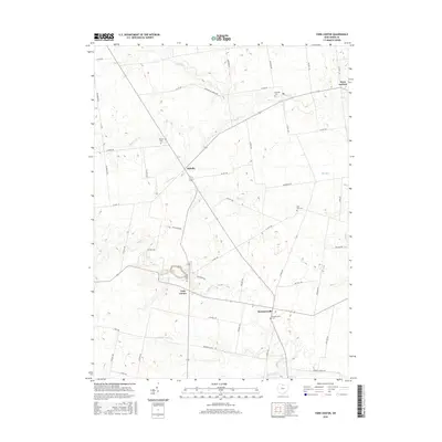
2016 Map of York Center
USGS Topo · Published 2016About this map
The agricultural landscape of northwest Union County is anchored by the rural settlements of Byhalia and York Center. This 2016 survey illustrates the persistent township road grid that has defined this portion of Ohio for generations, connecting small communities and family burial grounds such as Burnside Cem and East York Cem. The hydrology of the region is characterized by a series of parallel creeks and runs, including Bokes Cr, Fulton Cr, and Rocky Fork, which carve subtle drainage patterns through the till plains. For researchers, the map provides precise locations for local landmarks like Summersville and West Jackson, along with specialized terrain features such as Powder Lick Run and Brush Run. The placement of Byhalia Cem and Summersville Cem near their respective villages offers a clear look at the traditional spatial relationship between central Ohio's rural populations and their community institutions.
Find a feature on this map
53 named features on this map. Tap any name to fly to it.
Don’t see what you’re looking for? This feature index may not catch every label — zoom into the map to look around manually.
Map Details
Editions of this 2016 York Center Map
This is the sole edition of this map. No revisions or reprints were ever made.
Other maps of this area

1913 · East Liberty
USGS Topo · 1:62,500

1913 · Richwood
USGS Topo · 1:62,500

1915 · Richwood
USGS Topo · 1:62,500

1915 · East Liberty
USGS Topo · 1:62,500

1915 · Kenton
USGS Topo · 1:62,500

1915 · La Rue
USGS Topo · 1:62,500

1944 · East Liberty
USGS Topo · 1:62,500

1944 · Kenton
USGS Topo · 1:62,500

1944 · Richwood
USGS Topo · 1:62,500

1950 · Marion
USGS Topo · 1:250,000