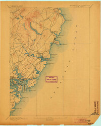
1893 Map of York
USGS Topo · Published 1904About this map
York Village and Kittery anchor a coastal landscape defined by maritime industry and early tourism in the late nineteenth century. The coastline is dotted with critical navigation aids such as The Nubble Light and Whale's Back Light, marking the entrance to the busy Portsmouth Harbor. Inland, the terrain rises toward Mt Agamenticus and the headwaters of the York River, while the York Beach Railroad traces a path toward the shore, illustrating the era's growing connection between rail travel and seaside resorts.
Find a feature on this map
56 named features on this map. Tap any name to fly to it.
Don’t see what you’re looking for? This feature index may not catch every label — zoom into the map to look around manually.
Map Details
Editions of this 1893 York Map
5 editions found
Other maps of this area

1888 · Newburyport
USGS Topo · 1:62,500

1890 · Newburyport
USGS Topo · 1:62,500

1891 · Biddeford
USGS Topo · 1:62,500

1891 · Berwick
USGS Topo · 1:62,500

1891 · Kennebunk
USGS Topo · 1:62,500

1893 · Kennebunk
USGS Topo · 1:62,500

1893 · Dover
USGS Topo · 1:62,500

1893 · Berwick
USGS Topo · 1:62,500

1893 · York
USGS Topo · 1:62,500

1893 · Biddeford
USGS Topo · 1:62,500