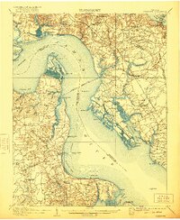
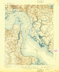
1907 Map of Yorktown
USGS Topo · Published 1921About this map
Yorktown and the surrounding Tidewater region are captured here in a moment of deep historical layers, showing the landscape as it appeared in the early twentieth century. The map highlights the heavy military and maritime heritage along the James River and York River, marking sites like Old Fort and the National Cem alongside numerous Old Earthworks. The area is characterized by large necks of land and islands, including Hog Island and Jamestown Island, where the terrain transitions from marshy points to cultivated bluffs.
Find a feature on this map
84 named features on this map. Tap any name to fly to it.
Don’t see what you’re looking for? This feature index may not catch every label — zoom into the map to look around manually.
Map Details
Editions of this 1907 Yorktown Map
6 editions found
Other maps of this area

1906 · Williamsburg
USGS Topo · 1:62,500

1907 · Norfolk
USGS Topo · 1:125,000

1907 · Yorktown
USGS Topo · 1:62,500

1907 · Hampton
USGS Topo · 1:62,500

1916 · Mathews
USGS Topo · 1:62,500

1917 · Mathews
USGS Topo · 1:62,500

1917 · Toano
USGS Topo · 1:62,500

1918 · Toano
USGS Topo · 1:62,500

1919 · Smithfield
USGS Topo · 1:62,500

1919 · Surry
USGS Topo · 1:62,500