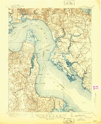
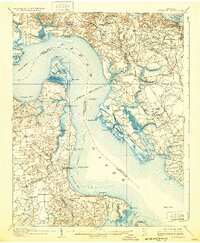
1907 Map of Yorktown
USGS Topo · Published 1944About this map
The Tidewater region of Virginia is captured here during the first years of the twentieth century, focusing on the strategic and historical landscape where the James River and York River define the peninsula. The map reveals a post-Civil War landscape still heavily marked by defensive history, showing numerous Old Earthworks and fortifications such as the Fort Crawford (Ruins) on Mulberry Island and Old Fort Mc Pherson. Land use follows the water, with the Steamboat Route navigating between Hog Island and Deepwater Shoals LH.
Find a feature on this map
80 named features on this map. Tap any name to fly to it.
Don’t see what you’re looking for? This feature index may not catch every label — zoom into the map to look around manually.
Map Details
Editions of this 1907 Yorktown Map
6 editions found
Other maps of this area

1906 · Williamsburg
USGS Topo · 1:62,500

1907 · Norfolk
USGS Topo · 1:125,000

1907 · Yorktown
USGS Topo · 1:62,500

1907 · Hampton
USGS Topo · 1:62,500

1916 · Mathews
USGS Topo · 1:62,500

1917 · Mathews
USGS Topo · 1:62,500

1917 · Toano
USGS Topo · 1:62,500

1918 · Toano
USGS Topo · 1:62,500

1919 · Smithfield
USGS Topo · 1:62,500

1919 · Surry
USGS Topo · 1:62,500