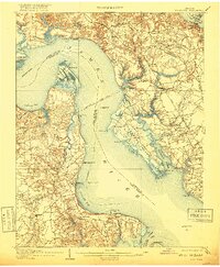
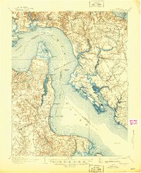
1907 Map of Yorktown
USGS Topo · Published 1918About this map
Yorktown and its historic surroundings are captured here at the start of the 20th century, revealing a landscape still deeply marked by defensive fortifications. Multiple sites labeled Old Earthworks and Old Fort dot the terrain, alongside Fort Crawford (Ruins) on Mulberry Island and Fort Boykin (Ruins) near the James River. These features, along with the Yorktown Monument and the National Cem, underscore the military significance of this peninsula.
Find a feature on this map
85 named features on this map. Tap any name to fly to it.
Don’t see what you’re looking for? This feature index may not catch every label — zoom into the map to look around manually.
Map Details
Editions of this 1907 Yorktown Map
6 editions found
Other maps of this area

1906 · Williamsburg
USGS Topo · 1:62,500

1907 · Norfolk
USGS Topo · 1:125,000

1907 · Yorktown
USGS Topo · 1:62,500

1907 · Hampton
USGS Topo · 1:62,500

1916 · Mathews
USGS Topo · 1:62,500

1917 · Mathews
USGS Topo · 1:62,500

1917 · Toano
USGS Topo · 1:62,500

1918 · Toano
USGS Topo · 1:62,500

1919 · Smithfield
USGS Topo · 1:62,500

1919 · Surry
USGS Topo · 1:62,500