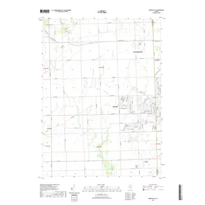
2018 Map of Yorkville SE
USGS Topo · Published 2018About this map
Aux Sable Creek and its many branches, including E Aux Sable Cr and Middle Aux Sable Cr, dominate the drainage of this prairie landscape at the intersection of Kendall and Will counties. The transition from agricultural land to suburban expansion is visible as the western reaches of Joliet and Plainfield move into previously open fields. While modern developments like the neighborhood around W Theodore Rd appear in the southeast, the map preserves older local landmarks including the NaAuSay Cem and the small rural settlement of Plattville.
Find a feature on this map
91 named features on this map. Tap any name to fly to it.
Don’t see what you’re looking for? This feature index may not catch every label — zoom into the map to look around manually.
Map Details
Editions of this 2018 Yorkville SE Map
This is the sole edition of this map. No revisions or reprints were ever made.
Other maps of this area

1892 · Morris
USGS Topo · 1:62,500

1892 · Joliet
USGS Topo · 1:62,500

1892 · Wilmington
USGS Topo · 1:62,500

1918 · Wilmington
USGS Topo · 1:62,500

1918 · Morris
USGS Topo · 1:62,500

1923 · Joliet
USGS Topo · 1:62,500

1925 · Yorkville
USGS Topo · 1:62,500

1953 · Plattville
USGS Topo · 1:24,000

1953 · Lisbon
USGS Topo · 1:24,000

1953 · Yorkville
USGS Topo · 1:24,000