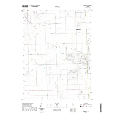
2021 Map of Yorkville SE
USGS Topo · Published 2021About this map
Plattville and the western reaches of Plainfield and Joliet converge on this 2021 survey, where the prairie landscape is defined by the complex drainage of the Aux Sable Creek system. The map documents the branching paths of E Aux Sable Cr, Middle Aux Sable Cr, and W Aux Sable Cr as they cut through the agricultural and developing lands along the Kendall and Will County border. One of the most historically significant markers on the landscape is the Old Indian Boundary Line Rd, which cuts diagonally across the regular township grid, a physical reminder of early nineteenth-century treaties and survey origins. Local history is further grounded at the Aux Sable Grove Cem, situated near E Schoolhouse Rd, while the evolving residential patterns of the Joliet-Plainfield corridor are visible through modern street networks like Clubhouse Pkwy and Whitetail Ridge Dr.
Find a feature on this map
92 named features on this map. Tap any name to fly to it.
Don’t see what you’re looking for? This feature index may not catch every label — zoom into the map to look around manually.
Map Details
Editions of this 2021 Yorkville SE Map
This is the sole edition of this map. No revisions or reprints were ever made.
Other maps of this area

1892 · Morris
USGS Topo · 1:62,500

1892 · Joliet
USGS Topo · 1:62,500

1892 · Wilmington
USGS Topo · 1:62,500

1918 · Wilmington
USGS Topo · 1:62,500

1918 · Morris
USGS Topo · 1:62,500

1923 · Joliet
USGS Topo · 1:62,500

1925 · Yorkville
USGS Topo · 1:62,500

1953 · Plattville
USGS Topo · 1:24,000

1953 · Lisbon
USGS Topo · 1:24,000

1953 · Yorkville
USGS Topo · 1:24,000