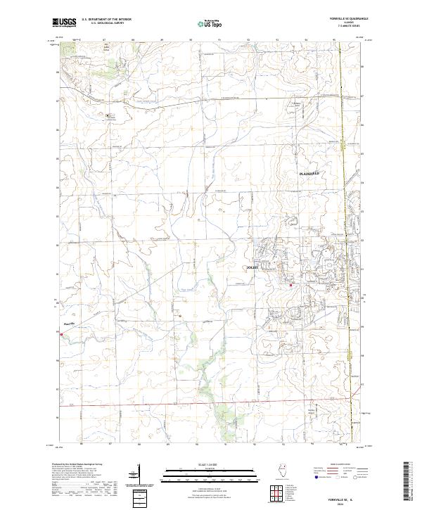
2024 Map of Yorkville SE
USGS Topo · Published 2024About this map
Aux Sable Grove and the nearby Aux Sable Grove Cem represent the quiet rural legacy of this region, where farm roads like E Schoolhouse Rd and Caton Farm Rd cut across a landscape defined by an intricate network of waterways. The drainage pattern is dominated by the various branches of the Aux Sable system, including Middle Aux Sable Creek, East Aux Sable Creek, and West Aux Sable Creek, which converge as they move toward the southern edge of the quadrangle.
Find a feature on this map
101 named features on this map. Tap any name to fly to it.
Don’t see what you’re looking for? This feature index may not catch every label — zoom into the map to look around manually.
Map Details
Editions of this 2024 Yorkville SE Map
This is the sole edition of this map. No revisions or reprints were ever made.
Other maps of this area

1892 · Morris
USGS Topo · 1:62,500

1892 · Joliet
USGS Topo · 1:62,500

1892 · Wilmington
USGS Topo · 1:62,500

1918 · Wilmington
USGS Topo · 1:62,500

1918 · Morris
USGS Topo · 1:62,500

1923 · Joliet
USGS Topo · 1:62,500

1925 · Yorkville
USGS Topo · 1:62,500

1953 · Plattville
USGS Topo · 1:24,000

1953 · Lisbon
USGS Topo · 1:24,000

1953 · Yorkville
USGS Topo · 1:24,000