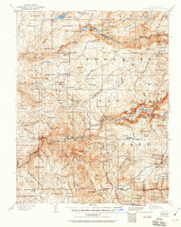
1909 Map of Yosemite
USGS Topo · Published 1951About this map
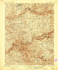
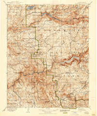
The Merced River and Middle Fork Tuolumne River canyons dominate this turn-of-the-century reconnaissance of the high Sierras, recorded by R.B. Marshall and H.E.C. Feusier in the 1890s. The landscape reflects an era of early conservation and transition, showing the Yosemite National Park boundary alongside the Stanislaus National Forest. Human presence is marked by historic ranching and transit hubs like Crockers, Harden Ranch, and the Yosemite Valley RR terminal at El Portal.
Find a feature on this map
152 named features on this map. Tap any name to fly to it.
Don’t see what you’re looking for? This feature index may not catch every label — zoom into the map to look around manually.
Map Details
Editions of this 1909 Yosemite Map
7 editions found

Other maps of this area

1891 · Big Trees
USGS Topo · 1:125,000

1893 · Sonora
USGS Topo · 1:125,000

1894 · Big Trees
USGS Topo · 1:125,000

1896 · Dardanelles
USGS Topo · 1:125,000

1896 · Sonora
USGS Topo · 1:125,000

1897 · Sonora
USGS Topo · 1:125,000

1897 · Big Trees
USGS Topo · 1:125,000

1897 · Yosemite
USGS Topo · 1:125,000

1898 · Dardanelles
USGS Topo · 1:125,000

1898 · Sonora
USGS Topo · 1:125,000