
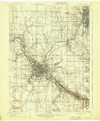
1908 Map of Youngstown
USGS Topo · Published 1937About this map
The Mahoning River valley serves as the industrial spine of this region during the first decade of the 1900s, anchoring a dense network of iron and steel towns. In the city of Youngstown, urban development clusters along the riverbanks, reaching out to recreation sites like Idora Park and outlying neighborhoods like East Youngstown. The industrial character is underscored by the convergence of major transit lines, including the Erie Railroad, Baltimore And Ohio Railroad, and the Pittsburgh And Lake Erie Railroad System.
Find a feature on this map
68 named features on this map. Tap any name to fly to it.
Don’t see what you’re looking for? This feature index may not catch every label — zoom into the map to look around manually.
Map Details
Editions of this 1908 Youngstown Map
2 editions found
Other maps of this area

1902 · New Castle
USGS Topo · 1:62,500

1904 · Newcastle
USGS Topo · 1:62,500

1905 · Bristolville
USGS Topo · 1:62,500

1905 · Neshannock
USGS Topo · 1:62,500

1906 · Youngstown
USGS Topo · 1:62,500

1907 · Neshannock
USGS Topo · 1:62,500

1907 · Kinsman
USGS Topo · 1:62,500

1907 · Bristolville
USGS Topo · 1:62,500

1907 · Columbiana
USGS Topo · 1:62,500

1908 · Shenango
USGS Topo · 1:62,500