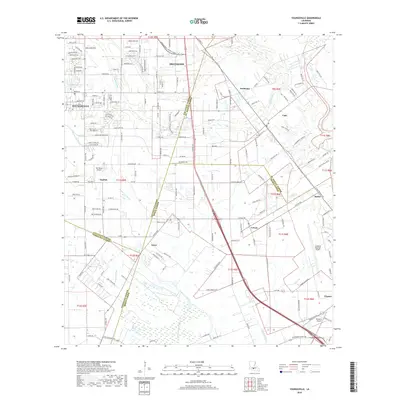
2018 Map of Youngsville
USGS Topo · Published 2018About this map
Youngsville and Broussard anchor this section of Lafayette Parish, showing the transition from suburban residential developments to the managed water systems of Acadiana. The landscape is defined by the natural flow of LaSalle Coulee and Bayou Parc Perdu, alongside man-made drainage such as the Norris Branch Canal. Transport infrastructure is prominent, featuring the BNSF Railway corridor and local aviation sites including Sky Ranch Airport and a portion of the Acadiana Regional Airport. Smaller communities such as Cade, Coteau, and Lozes are visible where the parish boundaries of St. Martin, Iberia, and Vermilion meet. This survey captures the complex intersection of historic Bayou country drainage patterns with the modern expansion of the Lafayette metropolitan area.
Find a feature on this map
93 named features on this map. Tap any name to fly to it.
Don’t see what you’re looking for? This feature index may not catch every label — zoom into the map to look around manually.
Map Details
Editions of this 2018 Youngsville Map
This is the sole edition of this map. No revisions or reprints were ever made.
Other maps of this area

1932 · Abbeville NE
USGS Topo · 1:31,680

1937 · Derouen
USGS Topo · 1:62,500

1939 · St. Martinsville
USGS Topo · 1:62,500

1945 · New Orleans
USGS Topo · 1:250,000

1946 · Milton
USGS Topo · 1:31,680

1946 · Lafayette
USGS Topo · 1:31,680

1952 · Lake Charles
USGS Topo · 1:250,000

1954 · Lafayette
USGS Topo · 1:31,680
1954 · Milton
USGS Topo · 1:31,680

1954 · Port Arthur
USGS Topo · 1:250,000