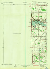
1942 Map of Ypsilanti East
USGS Topo · Published 1942About this map
Belleville Lake dominates the central landscape of this 1940 survey, a significant reservoir on the Huron River that shaped the development of nearby Rawsonville and Edgewater Heights. The map documents a period of transition along the Washtenaw and Wayne County line, where agricultural land was increasingly intersected by critical transportation corridors like the Wabash railroad and Huron River Drive.
Find a feature on this map
46 named features on this map. Tap any name to fly to it.
Don’t see what you’re looking for? This feature index may not catch every label — zoom into the map to look around manually.
Map Details
Editions of this 1942 Ypsilanti East Map
This is the sole edition of this map. No revisions or reprints were ever made.
Other maps of this area

1902 · South Lyon
USGS Topo · 1:62,500

1902 · Ypsilanti
USGS Topo · 1:62,500

1904 · Ann Arbor
USGS Topo · 1:125,000

1905 · Wayne
USGS Topo · 1:62,500

1906 · Ypsilanti
USGS Topo · 1:62,500

1906 · South Lyon
USGS Topo · 1:62,500

1906 · Romulus
USGS Topo · 1:62,500

1908 · Ann Arbor
USGS Topo · 1:125,000

1912 · Wayne
USGS Topo · 1:62,500

1928 · Romulus
USGS Topo · 1:62,500
Featured Places
- Ypsilanti Charter Township, MI
- Van Buren Charter Township, MI
- Ypsilanti, MI
- Sumpter Township, MI
- Augusta Charter Township, MI