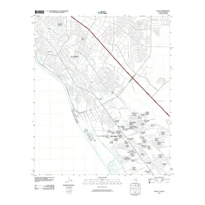
2010 Map of Ysleta
USGS Topo · Published 2010About this map
The Rio Grande and its intricate network of irrigation channels define the landscape of El Paso and Socorro in this 2010 survey. The map documents a dense grid of residential colonias and additions, such as Moon Addition Colonia and Sunshine Colonia, reflecting the unique borderland growth patterns of the era. Water management is a central theme, evidenced by features like the Riverside Diversion Dam and the Franklin Canal, which weave through historic communities like Ysleta and Belen. The Rio Vista Farm Historic District stands as a significant landmark in the southern reaches, preserved amidst a landscape dominated by lateral drains and agricultural infrastructure. This survey provides an essential view of the region's transition into a modern metropolitan corridor while maintaining the structural footprint of its earlier ranching and farming origins.
Find a feature on this map
108 named features on this map. Tap any name to fly to it.
Don’t see what you’re looking for? This feature index may not catch every label — zoom into the map to look around manually.
Map Details
Editions of this 2010 Ysleta Map
This is the sole edition of this map. No revisions or reprints were ever made.
Other maps of this area

1896 · El Paso
USGS Topo · 1:125,000

1908 · El Paso
USGS Topo · 1:125,000

1939 · Ysleta
USGS Topo · 1:62,500

1939 · Heuco Tanks
USGS Topo · 1:62,500

1940 · Heuco Tanks
USGS Topo · 1:62,500

1941 · El Paso
USGS Topo · 1:31,680

1941 · Clint
USGS Topo · 1:62,500

1941 · Ysleta
USGS Topo · 1:62,500

1942 · Fort Bliss
USGS Topo · 1:62,500

1943 · El Paso
USGS Topo · 1:31,680