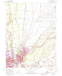
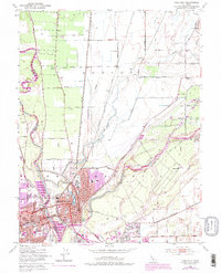
1952 Map of Yuba City
USGS Topo · Published 1975About this map
Marysville and Yuba City sit at the strategic confluence of the Feather River and Yuba River during this mid-century period. The map documents a dense urban core in Marysville, characterized by civic landmarks like the Court House, City Hall, and Notre Dame Convent, alongside the central Ellis Lake. Significant post-war expansion is visible in the suburban growth of Linda to the south and purple-shaded revisions reflecting urban development through the early 1970s.
Find a feature on this map
55 named features on this map. Tap any name to fly to it.
Don’t see what you’re looking for? This feature index may not catch every label — zoom into the map to look around manually.
Map Details
Editions of this 1952 Yuba City Map
5 editions found
Other maps of this area

1888 · Marysville
USGS Topo · 1:125,000

1888 · Smartsville
USGS Topo · 1:125,000

1891 · Marysville
USGS Topo · 1:125,000

1891 · Smartsville
USGS Topo · 1:125,000

1892 · Smartsville
USGS Topo · 1:125,000

1894 · Smartsville
USGS Topo · 1:125,000

1894 · Marysville
USGS Topo · 1:125,000

1895 · Marysville
USGS Topo · 1:125,000

1895 · Smartsville
USGS Topo · 1:125,000

1910 · Wheatland
USGS Topo · 1:31,680