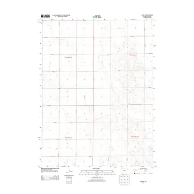
2013 Map of Yuma NE
USGS Topo · Published 2013About this map
The High Plains landscape of Northeast Colorado is defined by a rigorous surveyor's grid in this early 21st-century study. The land is partitioned into township and range blocks, including t003n r047w and t003n r046w, where the topography consists of subtle undulations and depressions characteristic of the eastern plains. A dense network of local routes, such as Co Road 45 and Co Road N, facilitates movement across the agricultural territory, reflecting the enduring importance of the Public Land Survey System in organizing the rural west. The map traces the precise layout of the county's infrastructure, from Co Road 47 at the northern boundary to Co Road 39 in the south, illustrating how the section lines dictate the modern road network.
Find a feature on this map
22 named features on this map. Tap any name to fly to it.
Don’t see what you’re looking for? This feature index may not catch every label — zoom into the map to look around manually.
Map Details
Editions of this 2013 Yuma NE Map
This is the sole edition of this map. No revisions or reprints were ever made.
Other maps of this area

1954 · Sterling
USGS Topo · 1:250,000

1958 · Sterling
USGS Topo · 1:250,000

1961 · Eckley
USGS Topo · 1:24,000

1969 · Schramm
USGS Topo · 1:24,000

1971 · Yuma NE
USGS Topo · 1:24,000

1971 · Clarkville SE
USGS Topo · 1:24,000

1971 · Old Baldy
USGS Topo · 1:24,000
1971 · Eckley NW
USGS Topo · 1:24,000

1972 · Clarkville SW
USGS Topo · 1:24,000

1972 · Yuma South
USGS Topo · 1:24,000