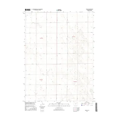
2016 Map of Yuma NE
USGS Topo · Published 2016About this map
The high plains of eastern Colorado are defined by a rigid section-line grid in this 2016 survey of the Yuma Northeast quadrangle. The landscape is dominated by agricultural parcels and drainage patterns, with the local infrastructure concentrated along a network of numbered county routes. Significant thoroughfares like Co Rd 46 and Co Rd L provide the primary means of traversal through the townships of t3n r47w and t2n r46w. While largely a study of land management and rural geography, the map identifies specific routes such as Trail Rd that deviate from the standard numbering system. This detailed record captures the spatial organization of the modern High Plains ranching and farming economy as it stood in the mid-2010s.
Find a feature on this map
20 named features on this map. Tap any name to fly to it.
Don’t see what you’re looking for? This feature index may not catch every label — zoom into the map to look around manually.
Map Details
Editions of this 2016 Yuma NE Map
This is the sole edition of this map. No revisions or reprints were ever made.
Other maps of this area

1954 · Sterling
USGS Topo · 1:250,000

1958 · Sterling
USGS Topo · 1:250,000

1961 · Eckley
USGS Topo · 1:24,000

1969 · Schramm
USGS Topo · 1:24,000

1971 · Yuma NE
USGS Topo · 1:24,000

1971 · Clarkville SE
USGS Topo · 1:24,000

1971 · Old Baldy
USGS Topo · 1:24,000
1971 · Eckley NW
USGS Topo · 1:24,000

1972 · Clarkville SW
USGS Topo · 1:24,000

1972 · Yuma South
USGS Topo · 1:24,000