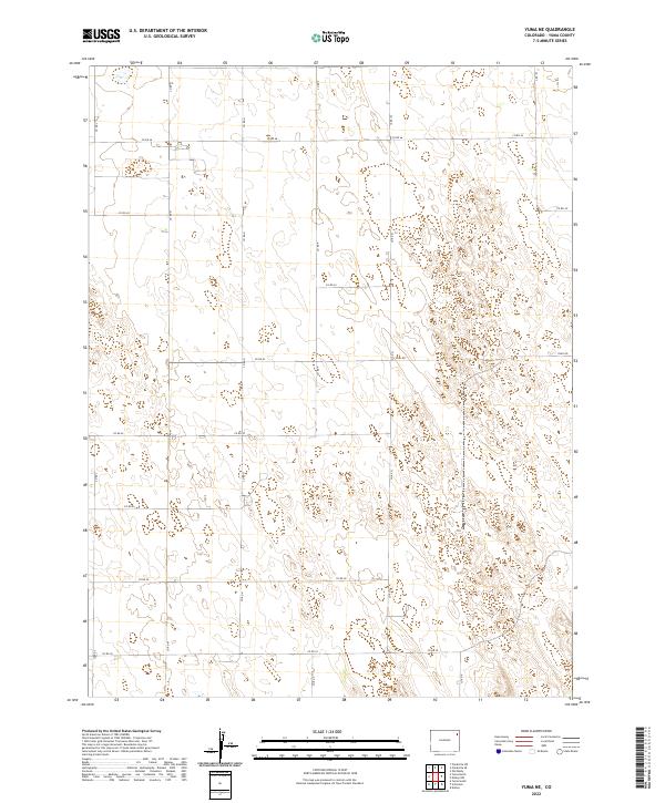
2022 Map of Yuma NE
USGS Topo · Published 2022About this map
The high plains northeast of Yuma, Colorado, are defined by a rhythmic grid of rural routes and the rolling topography of the Sand Hills. This 2022 survey details the land divisions across t3n r47w and t3n r46w, where the landscape is carved by seasonal depressions and complex contouring. The primary infrastructure is the extensive network of county roads, such as CO Rd 46 and CO Rd 45, which provide the backbone for agricultural access in this northeastern corner of Yuma County. Unlike the more densely settled river valleys, this area maintains a sparse, open character where transportation is confined to the strictly surveyed section lines. A notable exception to the numbered grid is Trail Rd, which cuts across the eastern sections of t3n r46w, following the natural curvature of the terrain rather than the rigid Cartesian boundaries typical of the region.
Find a feature on this map
20 named features on this map. Tap any name to fly to it.
Don’t see what you’re looking for? This feature index may not catch every label — zoom into the map to look around manually.
Map Details
Editions of this 2022 Yuma NE Map
This is the sole edition of this map. No revisions or reprints were ever made.
Other maps of this area

1954 · Sterling
USGS Topo · 1:250,000

1958 · Sterling
USGS Topo · 1:250,000

1961 · Eckley
USGS Topo · 1:24,000

1969 · Schramm
USGS Topo · 1:24,000

1971 · Yuma NE
USGS Topo · 1:24,000

1971 · Clarkville SE
USGS Topo · 1:24,000

1971 · Old Baldy
USGS Topo · 1:24,000
1971 · Eckley NW
USGS Topo · 1:24,000

1972 · Clarkville SW
USGS Topo · 1:24,000

1972 · Yuma South
USGS Topo · 1:24,000