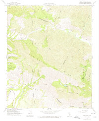
1964 Map of Zaca Lake
USGS Topo · Published 1975About this map
Zaca Lake rests within a high mountain basin, serving as a rare natural focal point in a landscape defined by the rugged San Rafael Mountains. Surveyed in the mid-1960s, this area of Santa Barbara County reveals a network of isolated outposts and early resource extraction sites. To the northwest, the Asphaltum Mine on Asphaltum Creek indicates the region's geological history, while Tunnel Ranch sits tucked along the Sisquoc River.
Find a feature on this map
49 named features on this map. Tap any name to fly to it.
Don’t see what you’re looking for? This feature index may not catch every label — zoom into the map to look around manually.
Map Details
Editions of this 1964 Zaca Lake Map
3 editions found
Other maps of this area

1902 · Santa Ynez
USGS Topo · 1:125,000

1905 · Santa Ynez
USGS Topo · 1:125,000

1905 · Lompoc
USGS Topo · 1:125,000

1941 · San Rafael Mtn.
USGS Topo · 1:62,500

1941 · McPherson Peak
USGS Topo · 1:62,500

1942 · Lompoc
USGS Topo · 1:125,000

1942 · San Rafael Mtn.
USGS Topo · 1:62,500

1942 · Tepusquet Peak
USGS Topo · 1:62,500

1942 · Los Olivos
USGS Topo · 1:62,500

1943 · San Rafael Mtn.
USGS Topo · 1:62,500