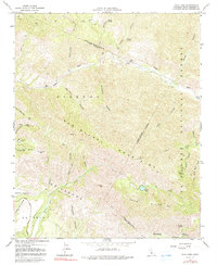
1964 Map of Zaca Lake
USGS Topo · Published 1991About this map
The San Rafael Mountains dominate this rugged section of the Los Padres National Forest, where high ridges and deep canyons define the landscape. Near the southern edge, Zaca Lake sits beneath the prominent Zaca Peak and the sprawling Zaca Ridge. The presence of the Asphaltum Mine along Asphaltum Creek and scattered ruins near the Sisquoc River suggests a history of remote industrial activity and early ranching efforts in this isolated terrain.
Find a feature on this map
51 named features on this map. Tap any name to fly to it.
Don’t see what you’re looking for? This feature index may not catch every label — zoom into the map to look around manually.
Map Details
Editions of this 1964 Zaca Lake Map
3 editions found
Other maps of this area

1902 · Santa Ynez
USGS Topo · 1:125,000

1905 · Santa Ynez
USGS Topo · 1:125,000

1905 · Lompoc
USGS Topo · 1:125,000

1941 · San Rafael Mtn.
USGS Topo · 1:62,500

1941 · McPherson Peak
USGS Topo · 1:62,500

1942 · Lompoc
USGS Topo · 1:125,000

1942 · San Rafael Mtn.
USGS Topo · 1:62,500

1942 · Tepusquet Peak
USGS Topo · 1:62,500

1942 · Los Olivos
USGS Topo · 1:62,500

1943 · San Rafael Mtn.
USGS Topo · 1:62,500