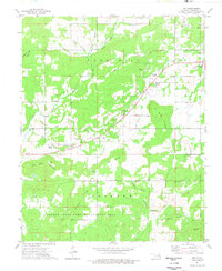
1974 Map of Zeb
USGS Topo · Published 1978About this map
The tiny settlement of Zeb sits along a winding rail line in Cherokee County, serving as a focal point for the surrounding hills and creek valleys. This 1970s topographic study reveals a landscape where rural lifeways are etched into the terrain through family-named landmarks and local burial grounds such as Jones Cem and Holland Cem. The northern portion is characterized by the Park Hill area, where Gulager Creek and Eureka Valley drain toward the southwest. These watercourses are flanked by prominent rises like Bob Warren Mountain and Rider Mountain, while the southern reaches are dominated by the Gruber State Game Management Area and the Cookson region. The density of small schools and churches, including the Stone Chapel Sch and Pentecostal Holiness Ch, suggests a closely knit community structure defined by the geography of Wild Horse Prairie and the deep hollows of Greenleaf Hollow.
Find a feature on this map
43 named features on this map. Tap any name to fly to it.
Don’t see what you’re looking for? This feature index may not catch every label — zoom into the map to look around manually.
Map Details
Editions of this 1974 Zeb Map
This is the sole edition of this map. No revisions or reprints were ever made.
Other maps of this area

1898 · Tahlequah
USGS Topo · 1:125,000

1901 · Muscogee
USGS Topo · 1:125,000

1901 · Tahlequah
USGS Topo · 1:125,000

1905 · Muscogee
USGS Topo · 1:125,000

1905 · Tahlequah
USGS Topo · 1:125,000

1946 · Fort Smith
USGS Topo · 1:250,000

1948 · Hulbert
USGS Topo · 1:62,500

1948 · Webbers Falls
USGS Topo · 1:62,500

1950 · Hulbert
USGS Topo · 1:62,500

1950 · Webbers Falls
USGS Topo · 1:62,500