2022 Map of Zenda
USGS Topo · Published 2022About this map
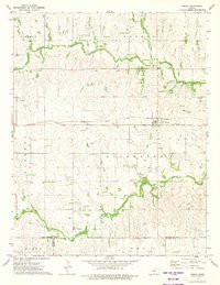
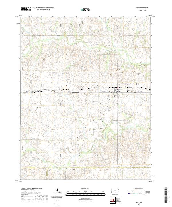
Zenda sits at the junction of S Main St and SW 140 St, serving as a primary settlement node where Kingman, Barber, and Harper counties converge. This 2022 U.S. Geological Survey representation of the Kansas plains illustrates a landscape shaped by a grid of rural roads and the meandering paths of several waterways, including the N Fork Chikaskia River in the northwest and Goose Cr through the center. Local history and genealogy are anchored by sites such as Saint Johns Cem just east of town and Pleasant Hill Cem located further south. The map provides a detailed view of the section lines and township boundaries, including t29s r9w and t30s r9w, which continue to define land ownership and navigation in this agricultural region.
Find a feature on this map
50 named features on this map. Tap any name to fly to it.
Don’t see what you’re looking for? This feature index may not catch every label — zoom into the map to look around manually.
Map Details
Editions of this 2022 Zenda Map
This is the sole edition of this map. No revisions or reprints were ever made.