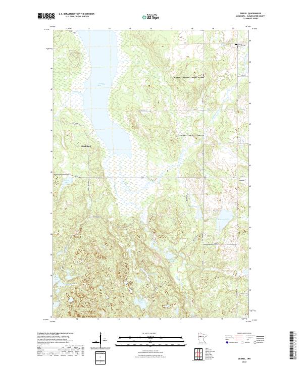
2022 Map of Zerkel
USGS Topo · Published 2022About this map
Lower Rice Lake and the wetlands of the Wild Rice River dominate this portion of Clearwater County, reflecting the watery landscape of northern Minnesota. The settlement of Zerkel sits at a junction on the eastern side of the quadrangle, while South End marks the southern shore of the major lake basin. The terrain is characterized by numerous smaller water bodies, including Rockstad Lake, Blakely Lake, and the uniquely named Teapail Lake.
Find a feature on this map
37 named features on this map. Tap any name to fly to it.
Don’t see what you’re looking for? This feature index may not catch every label — zoom into the map to look around manually.
Map Details
Editions of this 2022 Zerkel Map
This is the sole edition of this map. No revisions or reprints were ever made.
Other maps of this area

1954 · Bemidji
USGS Topo · 1:250,000

1957 · Bemidji
USGS Topo · 1:250,000

1958 · Bemidji
USGS Topo · 1:250,000

1969 · Ebro
USGS Topo · 1:24,000

1969 · Roy Lake
USGS Topo · 1:24,000

1969 · Tulaby Lake
USGS Topo · 1:24,000

1969 · Anchor Hill
USGS Topo · 1:24,000

1969 · Long Lost Lake
USGS Topo · 1:24,000
1969 · Zerkel
USGS Topo · 1:24,000

1969 · Heart Lake
USGS Topo · 1:24,000