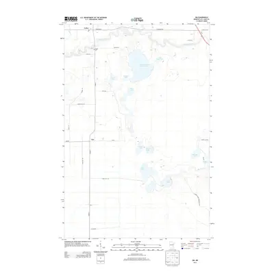
2013 Map of Zim
USGS Topo · Published 2013About this map
The Saint Louis River snakes through this northern Minnesota landscape, where the legacy of industrial mining and rural settlement meet. The most prominent human-altered feature is the Eveleth Taconite Tailings Basin, a massive water-filled engineering structure used for iron ore processing. Surrounding this industrial footprint are traditional settlements like Zim, Forbes, and Fens, often linked by long-established routes like Co HWY-7. Local family history is preserved at the Forbes Cem and via the network of secondary roads such as Zupetz Dr and Graff Rd. The area is characterized by a high density of water bodies, from the larger Stone Lake and Hammer Lake to smaller basins like Little Tony Lake and Perch Lake, illustrating the glacial topography of the Iron Range region.
Find a feature on this map
34 named features on this map. Tap any name to fly to it.
Don’t see what you’re looking for? This feature index may not catch every label — zoom into the map to look around manually.
Map Details
Editions of this 2013 Zim Map
This is the sole edition of this map. No revisions or reprints were ever made.
Other maps of this area

1951 · Gilbert
USGS Topo · 1:24,000

1951 · Eveleth
USGS Topo · 1:24,000

1951 · Kirk
USGS Topo · 1:24,000

1951 · Central Lakes
USGS Topo · 1:24,000

1951 · Zim
USGS Topo · 1:24,000

1951 · Casco
USGS Topo · 1:24,000

1954 · Hibbing
USGS Topo · 1:250,000

1956 · Cotton
USGS Topo · 1:24,000

1957 · Hibbing
USGS Topo · 1:250,000

1958 · Hibbing
USGS Topo · 1:250,000