1950s Maps of Mohave County, Arizona
Explore 90 historic maps of Mohave County from the 1950s. These maps offer a rare glimpse into what life looked like during the 1950s — showing old roads, neighborhoods, homes, and landmarks that have changed or disappeared over time.
Whether you're researching your family's past, planning a metal detecting trip, or studying how Mohave County's landscape evolved across the 1950s, these high-resolution maps are a powerful tool for exploring the history of this region.
- Focus on a specific era: All maps on this page are from the 1950s, giving you a focused view of this time period.
- See what’s changed: Compare century-old streets, trails, and buildings to today's modern landscape using overlays and satellite layers.
- Research with precision: Use these maps for genealogy, historical research, land use analysis, or educational projects.
- View, download, or print: Maps are fully viewable online in high resolution, and can be downloaded or printed for your own records.
Start exploring Mohave County's history through authentic maps from the 1950s. This is your window into the past.
Mohave County, AZ maps
(90)- 1950 Map of Parker Dam Area
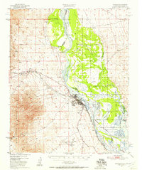
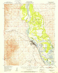
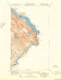 1950 Parker Dam Area1950 Print · USGSThe California-Arizona borderlands come into focus at the mid-century mark, centered on the engineering of the Parker Dam. Trace the river economy through the Colorado River Indian Reservation and remote landmarks like Bandit Pass and Cienega Springs.2 unique versions available
 - 1950 Map of Prescott, 1951 Print
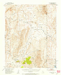
 1950 Prescott1951 Print · USGSArizona's mining and ranching frontiers were in full operation during the early fifties, from the vertical streets of Jerome to the remote western desert. Genealogists and researchers can trace rural life via the Bland School, the United Verde Mine, and stops along the Atchison Topeka and Santa Fe Railway.
 - 1950 Map of Davis Dam, 1955 Print
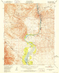
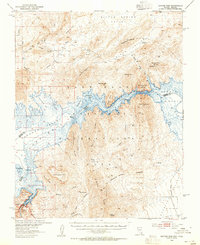
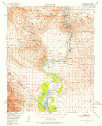 1950 Davis Dam1955 Print · USGSThe Colorado River corridor was undergoing a massive transformation in the early fifties as the newly completed Davis Dam began reshaping the tri-state border. Researchers can trace vanished river landings and frontier outposts such as the Hardyville Site, Mohave City, and the Fort Mohave Ruins.2 unique versions available
 - 1950 Map of Topock, 1957 Print
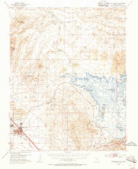
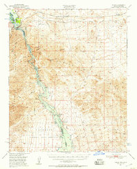 1950 Topock1957 Print · USGSThe Colorado River borderlands in the early postwar era show a desert landscape being reshaped by infrastructure and conservation. Genealogists and historians can trace the rail corridor through Franconia and locate remote mining sites like the Gold Dome Mine or the Jackpot Mine.3 unique versions available
 - 1950 Map of Sawtooth Range, 1957 Print
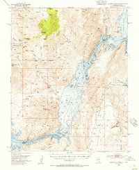
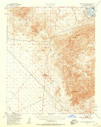 1950 Sawtooth Range1957 Print · USGSThe Mojave Desert frontier at the midpoint of the century shows a landscape defined by the Colorado River and the rugged Sawtooth Range. Trace early transportation routes like the Old Trails Road and discover the location of scattered desert mines and isolated springs.3 unique versions available
 - 1950 Map of Needles, 1957 Print
 1950 Needles1957 Print · USGSThe Colorado River valley at the California-Arizona border comes to life in the mid-1950s as a vital transit and tribal corridor. Researchers can trace the path of U.S. 66, find the Soto Ranch, and locate industrial sites like the Mingus Mine.2 unique versions available
 - 1950 Map of Whipple Mts, 1958 Print
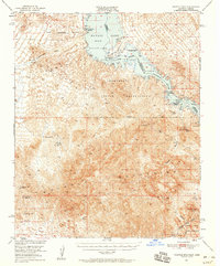 1950 Whipple Mts1958 Print · USGSThe Colorado River and Whipple Mountains define this mid-century desert borderland between California and Arizona. Researchers can trace remote mining history and early lakefront settlements through landmarks like Needles Boat Landing, Roulette Mine, and Chambers Well.3 unique versions available
 - 1951 Map of Topock
 1951 Topock1951 Print · USGSThe Colorado River valley and Mohave Mountains are captured here in the early fifties, showing a landscape defined by desert mining and river life. Trace the path of the National Old Trails Road and locate remote sites like Jackpot Mine or Jops Landing.2 unique versions available
 - 1951 Map of Sawtooth Range
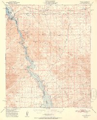
 1951 Sawtooth Range1951 Print · USGSThe California-Arizona borderlands in the early fifties show a vast desert landscape defined by the Colorado River and the rugged Sawtooth Range. Trace the historic Santa Fe rail line and mines near landmarks like Snaggletooth and Whale Mtn.
 - 1952 Map of Whipple Mts
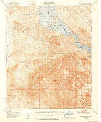 1952 Whipple Mts1952 Print · USGSThe Lower Colorado River borderlands are captured here in the early fifties as desert mining gave way to new shoreline developments. You can trace the locations of numerous historic prospects like the Roulette Mine and Islander Mine, alongside early river landings such as Needles Boat Landing.
 - 1952 Map of Needles
 1952 Needles1952 Print · USGSNeedles was a desert hub for the Santa Fe Railway and cross-country motorists just after the war. Trace the historic route of the National Old Trails Road or locate family sites at Soto Ranch and Riverview Cem.
 - 1952 Map of Davis Dam
 1952 Davis Dam1952 Print · USGSThe Colorado River valley emerges in a period of significant change during the early fifties, as modern infrastructure meets pioneer history. Genealogists and historians can trace family-named locations such as Hardyville Ranch alongside significant landmarks like Fort Mohave (Ruins) and Bullhead City.2 unique versions available
 - 1952 Map of Henderson, 1956 Print
 1952 Henderson1956 Print · USGSHenderson and the shores of Lake Mead are shown here in the early fifties during an era of significant industrial expansion. Researchers can trace the layout of worker housing at Victory Village and Carver Park or locate the sprawling Magnesium Plant and Three Kids Mine.2 unique versions available
 - 1953 Map of Iceberg Canyon, 1955 Print
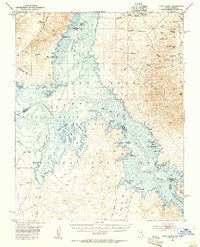
 1953 Iceberg Canyon1955 Print · USGSThe northern reaches of the Colorado River and Lake Mead appear here in the early fifties, documenting a landscape of remote mines and deep desert canyons. Genealogists and historians can trace old routes like the Scanlon Dugway or locate the Union Mine and Lakeshore Mine.3 unique versions available
 - 1953 Map of Gold Butte, 1955 Print
 1953 Gold Butte1955 Print · USGSThe Clark County desert comes alive in the early fifties, showing the remote mining camps and peaks between the Virgin Mountains and the Arizona border. Researchers can trace the haul roads to the Gold Butte Mine, Tramp Mine, and the unique geological sinkhole at Devils Throat.3 unique versions available
 - 1953 Map of Hoover Dam, 1955 Print
 1953 Hoover Dam1955 Print · USGSThe Clark County desert and the Colorado River border appear here in the early fifties during the height of the post-war recreation era. Researchers can trace the original shoreline access via Bonelli Landing Road and locate remote desert workings like the Old Pope Mine.3 unique versions available
 - 1953 Map of Virgin Basin, 1955 Print
 1953 Virgin Basin1955 Print · USGSThe rising waters of Lake Mead are the focus of this mid-fifties study of the Nevada-Arizona borderlands. Researchers can trace the submerged river geography and find land-based markers like the Lakeside Mine, Bonelli Landing, and the Ferry Road.3 unique versions available
 - 1953 Map of Cedar City, 1966 Print
 1953 Cedar City1966 Print · USGSSouthwestern Utah's high plateaus and desert basins are mapped here during the mid-fifties, showing the region before the modern interstate system. Researchers can trace historic mining at Silver Reef, follow the Union Pacific line, and locate early settlements like Kanarraville and Toquerville.3 unique versions available
 - 1953 Map of Grand Canyon, 1967 Print
 1953 Grand Canyon1967 Print · USGSArizona's northern frontier is captured here in the mid-twentieth century, from the high plateaus to the desert basins. Trace early routes like Arizona 67, explore the isolated Moccasin settlement, or locate early landmarks such as Mount Trumbull.3 unique versions available
 - 1954 Map of La Verkin 4 SE
 1954 La Verkin 4 SE1954 Print · USGSThe high desert plateaus of the Utah-Arizona border are captured here in the mid-1950s. Researchers can trace the layout of the Canaan Ranch, locate water sources like Canaan Wash, and identify landmarks from Smithsonian Butte to Canaan Gap.2 unique versions available
 - 1954 Map of Las Vegas
 1954 Las Vegas1954 Print · USGSLas Vegas and the Mojave Desert are shown in the early fifties as the region's military and recreational footprint expanded. Genealogists and historians can trace the early layout of North Las Vegas, the sites of Indian Springs Air Force Base, and long-established towns like Bunkerville.5 unique versions available
 - 1954 Map of Needles
 1954 Needles1954 Print · USGSThe Mojave Desert at the height of the mid-century era shows a landscape defined by the Atchison Topeka and Santa Fe railroad and the legendary U S Highway 66. Genealogists and historians can trace rail stops like Goffs, mining sites such as the Bonanza King Mine, and the early borders of the Chemehuevi Indian Reservation.
 - 1954 Map of Kanab SW, 1956 Print
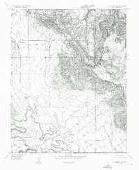
 1954 Kanab SW1956 Print · USGSThe Utah-Arizona borderlands in the mid-1950s reveal a landscape of isolated springs and deep drainages. Researchers can trace the rugged terrain of Yellowjacket Canyon and locate remote water sources like Sand Spring and Harris Springs.
 - 1954 Map of La Verkin 4 SW, 1956 Print
 1954 La Verkin 4 SW1956 Print · USGSThe high plateau country along the Utah-Arizona border is surveyed here in the early 1950s. Trace the remote trails and seasonal water sources that sustained early ranching, from Gould Spring to the isolated high grounds of Little Creek Mountain and Abs Clearing.
 - 1954 Map of Hurricane Cliffs 2 NW, 1956 Print
 1954 Hurricane Cliffs 2 NW1956 Print · USGSThe Arizona Strip during the mid-fifties was a land of high mesas and vital water holes for cattle ranching along the Mohave county line. Researchers can trace the historic Sunshine Trail across West Mesa to find remote landmarks like Blake Pond and Joe Blake Hill.
Showing maps 1-25 of 90
Top cities of Mohave County
- Lake Havasu City historical maps
- Bullhead City historical maps
- Kingman historical maps
- Fort Mohave historical maps
- New Kingman-Butler historical maps
- Golden Valley historical maps
See more
Frequently asked questions
- What are the different types of historical maps available for Mohave County?
- What is the oldest map of Mohave County?
- Where can I purchase historical maps of Mohave County for my home or office?
- Where can I download high-res historical maps of Mohave County?
- Are there historical topographic maps available for Mohave County?
- Is there historical aerial imagery available for Mohave County?
- Where are historical maps of Mohave County sourced from?