1960s Maps of Mohave County, Arizona
Explore 109 historic maps of Mohave County from the 1960s. These maps offer a rare glimpse into what life looked like during the 1960s — showing old roads, neighborhoods, homes, and landmarks that have changed or disappeared over time.
Whether you're researching your family's past, planning a metal detecting trip, or studying how Mohave County's landscape evolved across the 1960s, these high-resolution maps are a powerful tool for exploring the history of this region.
- Focus on a specific era: All maps on this page are from the 1960s, giving you a focused view of this time period.
- See what’s changed: Compare century-old streets, trails, and buildings to today's modern landscape using overlays and satellite layers.
- Research with precision: Use these maps for genealogy, historical research, land use analysis, or educational projects.
- View, download, or print: Maps are fully viewable online in high resolution, and can be downloaded or printed for your own records.
Start exploring Mohave County's history through authentic maps from the 1960s. This is your window into the past.
Mohave County, AZ maps
(109)- 1960 Map of Williams
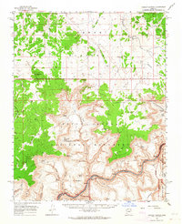
 1960 Williams1960 Print · USGSNorthern Arizona in the mid-twentieth century was defined by its massive canyons and the vital rail line connecting its remote ranches. Genealogists and historians can trace the development of Peach Springs, the high-altitude Bill Williams Mountain, and isolated outposts like Diamond Bar Ranch.
 - 1960 Map of Grand Canyon
 1960 Grand Canyon1960 Print · USGSThe Arizona strip and the Colorado River corridor appear in the 1950s as a vast network of isolated plateaus and remote outposts. Researchers can trace historic ranching and tribal lands including Supai, the Kaibab Indian Reservation, and the Mt Trumbull Post Office.
 - 1960 Map of Prescott
 1960 Prescott1960 Print · USGSYavapai County and the surrounding high-desert mining districts are captured here during a period of steady industrial and rail activity. Researchers can trace the routes of the Atchison Topeka and Santa Fe Railway and locate historic sites like the United Verde Mine and Bland School.2 unique versions available
 - 1960 Map of Kingman
 1960 Kingman1960 Print · USGSThe high desert landscape of the Arizona-Nevada border comes alive in the mid-twentieth century, showcasing the rise of recreation alongside deep-rooted mining history. Genealogists and historians can trace the roots of towns like Kingman and Oatman, or locate remote sites like the Lucky Dutchman Mine and Santa Claus.3 unique versions available
 - 1960 Map of Senator Mountain, 1961 Print
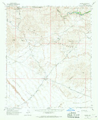
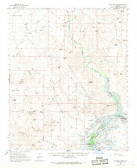
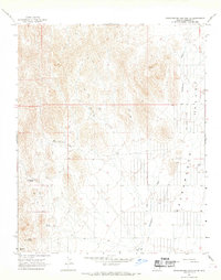
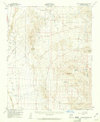 1960 Senator Mountain1961 Print · USGSMohave County's arid mining and ranching frontiers are captured here at the start of the 1960s. Researchers can trace the desert infrastructure of the era, from remote workings like Senator Mine and Owens Mine to local landmarks such as Spear Ranch.3 unique versions available
 - 1960 Map of White Hills, 1961 Print
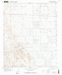
 1960 White Hills1961 Print · USGSArizona's mining and ranching legacy is preserved here in the early sixties, centered on the old White Hills (Site) and its surrounding silver claims. Researchers can trace dozens of individual mines like the Bonanza Mine alongside remote outposts including Kemple Camp and Turkeytrack Ranch.3 unique versions available
 - 1960 Map of Garnet Mtn., 1961 Print
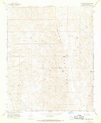
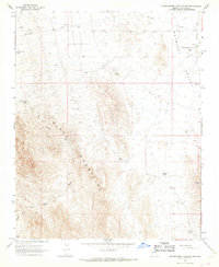
 1960 Garnet Mtn.1961 Print · USGSThe mining camps and remote ranchlands of Mohave County come into focus in this early 1960s survey of the Gold Basin area. Researchers can trace the desert's industrial and agricultural history through labels like the King Tut Placer Mine, Burnt Mill Ranch, and Patterson Well.3 unique versions available
 - 1961 Map of Williams
 1961 Williams1961 Print · USGSNorthern Arizona in the mid-fifties reveals a high-desert landscape of rail towns and deep canyons along the Atchison Topeka and Santa Fe. Researchers can trace old Route 66 through Peach Springs, Seligman, and Ash Fork, or find remote sites like Music Mountain Mine.
 - 1962 Map of Las Vegas
 1962 Las Vegas1962 Print · USGSSouthern Nevada is captured here during a period of significant military and industrial growth in the early sixties. Researchers can trace the development of Las Vegas alongside the Magnesium Plant in Henderson and the expansive Nellis Air Force Base.
 - 1962 Map of Cedar City
 1962 Cedar City1962 Print · USGSSouthern Utah in the early sixties showcases a landscape of dramatic plateaus and historic mining outposts. Trace the early settlement patterns at the Silver Reef (ruins), locate the Iron Mine near the Hurricane Cliffs, or find the Fort Harmony Monument.
 - 1962 Map of Kanab Point, 1964 Print
 1962 Kanab Point1964 Print · USGSThe deep canyons of the Colorado River and the ancestral lands of the Havasupai Indian Reservation are captured in the early sixties. Researchers can trace the famous cascades of Havasu Falls and Mooney Falls or locate a remote Mine and Cem near the canyon floor.2 unique versions available
 - 1962 Map of Tuckup Canyon, 1964 Print
 1962 Tuckup Canyon1964 Print · USGSArizona's high plateau and the deep canyon floor are captured here in the early sixties, showing the overlap of park and monument lands. Researchers can trace remote water sources like Buckhorn Spring, historic stock tanks, and river features including the Cork.2 unique versions available
 - 1962 Map of National Canyon, 1964 Print
 1962 National Canyon1964 Print · USGSThe Grand Canyon rim country and the Hualapai Indian Reservation are captured here in the early sixties before modern park expansions. Trace the winding Tuckup Trail and locate remote landmarks like Bishop Camp and Gateway Rapids.2 unique versions available
 - 1965 Map of Prescott
 1965 Prescott1965 Print · USGSArizona's mining heartland is captured during the mid-sixties, from the copper mines of Jerome to the cattle country of Williamson Valley Wash. Genealogists and historians can trace old mining camps at Octave and Stanton or the historic Whipple Military Reservation.
 - 1966 Map of Swansea, 1967 Print
 1966 Swansea1967 Print · USGSThe Arizona desert of the mid-sixties reveals its mining history here along the Bill Williams River. Genealogists and industrial historians can trace the Old Railroad Grade connecting Swansea and Planet, alongside a Retort Oven and local Cemeteries.2 unique versions available
 - 1966 Map of Ives Peak, 1967 Print
 1966 Ives Peak1967 Print · USGSThe high desert of western Arizona comes into focus in the mid-1960s, showing a landscape shaped by water management and mineral extraction. Researchers can locate remote family outposts like Rankin Ranch and trace mining operations at the Bluebell Mine or Arizona-Montana Mine.2 unique versions available
 - 1966 Map of Castaneda Hills, 1967 Print
 1966 Castaneda Hills1967 Print · USGSNorth of the Bill Williams River in the mid-1960s, this area shows a landscape shaped by mining and rugged isolation. Researchers can trace remote desert outposts and mineral prospects like McCracken Mine, Keenan Camp, and the Rockhouse Cabin.
 - 1966 Map of Artillery Peak, 1968 Print
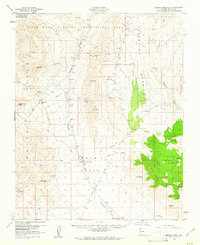
 1966 Artillery Peak1968 Print · USGSThe desert landscape of Mohave and Yuma counties is shown in the mid-1960s just as the Alamo Reservoir project began to alter the river forks. Genealogists and historians can trace numerous remote mining sites like the Cactus Queen Mine and the historic settlement at Signal (Site).2 unique versions available
 - 1967 Map of Burns Spring, 1968 Print
 1967 Burns Spring1968 Print · USGSThe Black Mountains of western Arizona were a landscape of remote ranching and mining during the late sixties. Researchers can trace historic water sources like Burns Spring and Basin Well alongside industrial sites such as Black Jack and Twin Mills.
 - 1967 Map of Kingman, 1968 Print
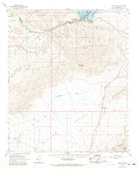
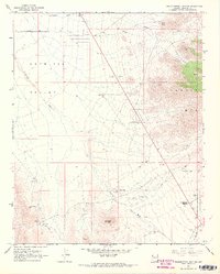
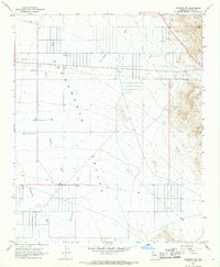
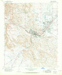 1967 Kingman1968 Print · USGSKingman and the surrounding Mohave County highlands come alive in this late-sixties survey as the town expanded into the Sacramento Valley. Genealogists and historians can trace the development of Hilltop, locate the Mountain View Cem, and follow the Atchison Topeka and Santa Fe RR through McConnico.2 unique versions available
 - 1967 Map of Grasshopper Junction, 1968 Print
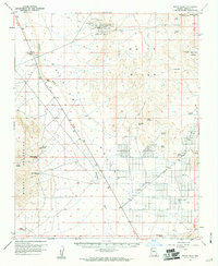
 1967 Grasshopper Junction1968 Print · USGSMohave County's arid ranching and mining country is captured here during the late sixties. Trace the isolation of the high desert through landmarks like Grasshopper Junction, remote corrals, and signs of mineral exploration at Tailings.2 unique versions available
 - 1967 Map of Grasshopper Junction SE, 1968 Print
 1967 Grasshopper Junction SE1968 Print · USGSThe high desert of Mohave County comes into focus in the late 1960s, showing a land of isolated ranches and critical water sources. Researchers can trace the legacy of desert life at the HJH Ranch and locate remote springs like Mud Spring or Red Rock Spring.3 unique versions available
 - 1967 Map of Secret Pass, 1968 Print
 1967 Secret Pass1968 Print · USGSThe Mojave desert landscape of the late sixties is captured here as the Black Mountains meet the Sacramento Valley. Researchers can trace old jeep trails to remote water sources like Trough Spring and locate a lonely Mine near Secret Pass.2 unique versions available
 - 1967 Map of Grasshopper Junction NW, 1968 Print
 1967 Grasshopper Junction NW1968 Print · USGSThe high desert of Mohave County was defined by its water sources and mining claims during the late 1960s. Genealogists and historians can trace the remote ranching infrastructure of the day, including Portland Mine, Lost Cabin Spring, and the network of corral sites.2 unique versions available
 - 1967 Map of Kingman NW, 1968 Print
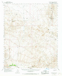
 1967 Kingman NW1968 Print · USGSThe high desert of Mohave County comes into focus in the late sixties, revealing a landscape of vital water infrastructure and early industry. Trace the desert's development through landmarks like the Aqueduct, local Mines, and family-named sites such as Jones Deep Well.2 unique versions available
Showing maps 1-25 of 109
Top cities of Mohave County
- Lake Havasu City historical maps
- Bullhead City historical maps
- Kingman historical maps
- Fort Mohave historical maps
- New Kingman-Butler historical maps
- Golden Valley historical maps
See more
Frequently asked questions
- What are the different types of historical maps available for Mohave County?
- What is the oldest map of Mohave County?
- Where can I purchase historical maps of Mohave County for my home or office?
- Where can I download high-res historical maps of Mohave County?
- Are there historical topographic maps available for Mohave County?
- Is there historical aerial imagery available for Mohave County?
- Where are historical maps of Mohave County sourced from?