1990s Maps of Mohave County, Arizona
Explore 16 historic maps of Mohave County from the 1990s. These maps offer a rare glimpse into what life looked like during the 1990s — showing old roads, neighborhoods, homes, and landmarks that have changed or disappeared over time.
Whether you're researching your family's past, planning a metal detecting trip, or studying how Mohave County's landscape evolved across the 1990s, these high-resolution maps are a powerful tool for exploring the history of this region.
- Focus on a specific era: All maps on this page are from the 1990s, giving you a focused view of this time period.
- See what’s changed: Compare century-old streets, trails, and buildings to today's modern landscape using overlays and satellite layers.
- Research with precision: Use these maps for genealogy, historical research, land use analysis, or educational projects.
- View, download, or print: Maps are fully viewable online in high resolution, and can be downloaded or printed for your own records.
Start exploring Mohave County's history through authentic maps from the 1990s. This is your window into the past.
Mohave County, AZ maps
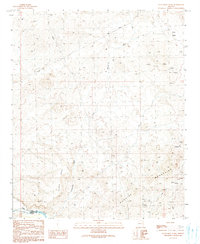
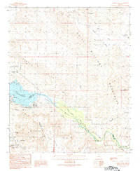
(16)- 1990 Map of Artillery Peak
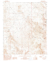
 1990 Artillery Peak1990 Print · USGSWest-central Arizona in the 1990s shows a landscape of desert mining and water management centered on the Bill Williams River. You can trace early mineral strikes at the Black Diamond Mine and Priceless Mine or locate the outpost at Loves Camp.
 - 1990 Map of Alamo Dam
 1990 Alamo Dam1990 Print · USGSWestern Arizona’s desert landscape is captured here in the late twentieth century as it transitions from a mining frontier to a recreational hub. Researchers can trace land use through a mine shaft and several prospects near the shoreline of Alamo Lake.
 - 1990 Map of Centennial Wash
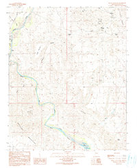
 1990 Centennial Wash1990 Print · USGSThe desert frontier of Mohave County is captured here in the late twentieth century, where the Rawhide Mountains meet the Bill Williams River. Genealogists and historians can locate remote outposts like Fisher Camp or trace mining activity through several prospects and an old Mine Shaft.
 - 1990 Map of Signal Mountain
 1990 Signal Mountain1990 Print · USGSNorthwestern Arizona at the end of the twentieth century was a landscape of deep canyons and mining prospects. Trace the path of the Big Sandy River as it flows toward Alamo Lake, and locate remote water sources like Hackberry Spring and Cattail Spring.
 - 1990 Map of McCracken Peak
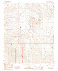
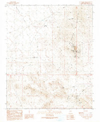 1990 McCracken Peak1990 Print · USGSThe high desert of Mohave County reveals its industrial past in the late twentieth century, centered on the mineral-rich heights of the McCracken Mountains. Researchers can trace the extensive network of tunnels and digs at the McCracken Mine or locate historical habitations like Keenan Camp (Site) and Rockhouse Cabin.
 - 1990 Map of Swansea
 1990 Swansea1990 Print · USGSThe mining district at Swansea is documented here during the late twentieth century, showing the settlement's footprint between the mountains. Trace the Swansea Old RR Grade, the local Cem, and dozens of prospects.
 - 1990 Map of Monkeys Head
 1990 Monkeys Head1990 Print · USGSThe Mohave and La Paz county line follows the river and reservoir during the late twentieth century. Researchers can trace desert water management and local landmarks from the Hayden-Rhodes Aqueduct to Kohen Ranch and the Monkeys Head peaks.
 - 1990 Map of Mohave Springs
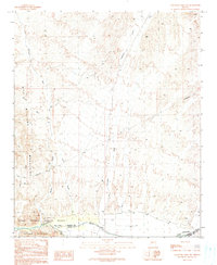
 1990 Mohave Springs1990 Print · USGSThe arid reaches of Mohave County appear in the 1990s as a landscape of remote settlements and rugged mining prospects. Researchers can trace historic activity at Rowland, locate old Adits, and follow the path of the 4WD Mohave trail.
 - 1990 Map of Castaneda Hills SW
 1990 Castaneda Hills SW1990 Print · USGSThe arid desert border of Mohave and La Paz counties is captured here in the late twentieth century. Researchers can trace the Bill Williams River corridor and identify remote sites like the Landing Strip, desert wells, and various mining prospects.
 - 1990 Map of Reid Valley
 1990 Reid Valley1990 Print · USGSArizona’s desert mining and ranching frontier is captured here in the late twentieth century as it spans the river-cut valley between two mountain ranges. Researchers can trace historic mineral claims at the Arizona-Montana Mine and ranching sites like Rankin Ranch or the Lincoln Ranch.
 - 1990 Map of Castaneda Hills
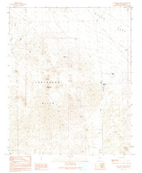 1990 Castaneda Hills1990 Print · USGSMohave County in the early nineties is a landscape of remote desert infrastructure and water management. You can trace the tracks of prospectors and ranchers through features like Castaneda Well, the Landing Strip, and several 4WD routes.
 - 1990 Map of Signal
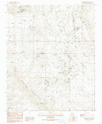
 1990 Signal1990 Print · USGSThe Mojave Desert near the Artillery Mountains shows a landscape defined by prospecting and remote ranching in the late twentieth century. Researchers can trace the layout of mining claims like the Goldbug Mine and water sources such as Signal Spring and Maggie Tank.
 - 1990 Map of Planet
 1990 Planet1990 Print · USGSThe Arizona desert along the Bill Williams River is captured here in the late twentieth century, showing a landscape shaped by mining and ranching. Genealogists and historians can trace the Planet (Site), numerous Mine Shafts, and the transition into the Cactus Plain.
 - 1990 Map of Rawhide Wash
 1990 Rawhide Wash1990 Print · USGSThe Rawhide Mountains were a hive of mineral exploration in the late twentieth century, marked by dozens of claims and pits. Researchers can trace the footprint of desert industry through the Cleopatra Mine, Rawhide Mine Adit, and Cactus Queen Mine near Rawhide Wash.
 - 1994 Map of Lake Havasu City South, 1997 Print
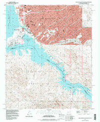 1994 Lake Havasu City South1997 Print · USGSLake Havasu City enters a period of modern expansion in the mid-nineties, centering on the relocated London Bridge and the developing waterfront. Genealogists and researchers can trace the city's growth alongside older desert landmarks like the Roulette Mine and the Lake Havasu City Airport (Abandoned).
 - 1997 Map of Hoover Dam, 1998 Print
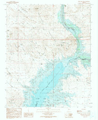
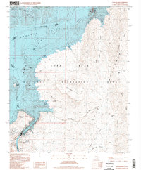 1997 Hoover Dam1998 Print · USGSThe Colorado River borderlands are seen here in the late 1990s as the reservoir meets the high desert. Trace the engineering and terrain around Hoover Dam, from Promontory Point to the heights of Fortification Hill.
End of results
Showing maps 1-16 of 16
Top cities of Mohave County
- Lake Havasu City historical maps
- Bullhead City historical maps
- Kingman historical maps
- Fort Mohave historical maps
- New Kingman-Butler historical maps
- Golden Valley historical maps
See more
Frequently asked questions
- What are the different types of historical maps available for Mohave County?
- What is the oldest map of Mohave County?
- Where can I purchase historical maps of Mohave County for my home or office?
- Where can I download high-res historical maps of Mohave County?
- Are there historical topographic maps available for Mohave County?
- Is there historical aerial imagery available for Mohave County?
- Where are historical maps of Mohave County sourced from?