1980s Maps of Mohave County, Arizona
Explore 112 historic maps of Mohave County from the 1980s. These maps offer a rare glimpse into what life looked like during the 1980s — showing old roads, neighborhoods, homes, and landmarks that have changed or disappeared over time.
Whether you're researching your family's past, planning a metal detecting trip, or studying how Mohave County's landscape evolved across the 1980s, these high-resolution maps are a powerful tool for exploring the history of this region.
- Focus on a specific era: All maps on this page are from the 1980s, giving you a focused view of this time period.
- See what’s changed: Compare century-old streets, trails, and buildings to today's modern landscape using overlays and satellite layers.
- Research with precision: Use these maps for genealogy, historical research, land use analysis, or educational projects.
- View, download, or print: Maps are fully viewable online in high resolution, and can be downloaded or printed for your own records.
Start exploring Mohave County's history through authentic maps from the 1980s. This is your window into the past.
Mohave County, AZ maps
(112)- 1980 Map of Fort Rock Ranch
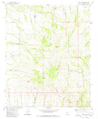
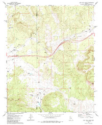 1980 Fort Rock Ranch1980 Print · USGSArizona's ranching frontier at the border of Mohave and Yavapai counties is detailed in the late 1970s. Trace local history through family-named landmarks like Carl F Well and Fort Rock Ranch, or locate remote Ruins and a lone Grave.2 unique versions available
 - 1980 Map of Pilot Knob
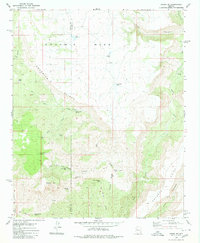
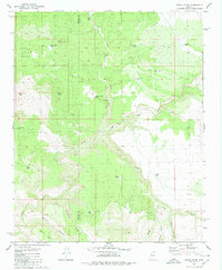
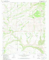 1980 Pilot Knob1980 Print · USGSThe high desert border of Mohave and Yavapai counties is captured here in the late seventies, showing a landscape shaped by ranching and remote outposts. Researchers can locate named ranch sites like Old Cofer Hdqrs and water sources such as Devils Bathtub and Pilot Knob Spring.
 - 1980 Map of Cherokee Point
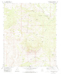
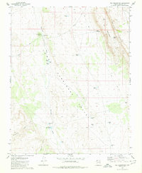
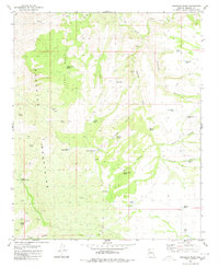
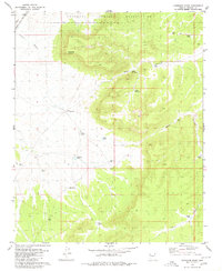 1980 Cherokee Point1980 Print · USGSThe northern edge of the Hualapai lands meets the high-desert plateaus of Mohave County during the late twentieth century. Genealogists and historians can trace the vital ranching infrastructure of the day, from the Atchison Topeka and Santa Fe line to local landmarks like Cherokee Point and North Blye Tank.
 - 1980 Map of Grayback Mts.
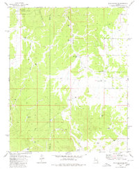
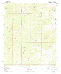 1980 Grayback Mts.1980 Print · USGSThe Mohave and Yavapai county line was a landscape of remote prospecting and cattle tanks in the late 1970s. Researchers can locate early mineral claims like the Bland Mine and Key Mine or trace water sources like Coors Well and Agate Well.
 - 1980 Map of Elephant Mtn
 1980 Elephant Mtn1980 Print · USGSThe Aquarius Mountains were a hub of remote ranching activity in the early 1980s, defined by a network of essential water sources. Researchers can trace the movement of early residents through named landmarks like Sycamore Camp, Trinidad Well, and Arrowweed Springs.
 - 1980 Map of Hildale
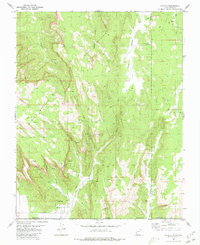 1980 Hildale1980 Print · USGSThe borderlands of Utah and Arizona are captured here in the late seventies, showing the development of Hildale against the Vermilion Cliffs. Follow old routes like the Pack Trail to find backcountry water sources like Cappies Rock Spring and Goat Springs.2 unique versions available
 - 1980 Map of Kaiser Spring
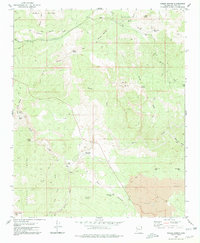 1980 Kaiser Spring1980 Print · USGSThe high desert of Mohave County was a landscape of remote mining and ranching when this survey was updated in the late seventies. Researchers can trace the rugged topography of the Poachie Range and find isolated sites like Shipp Ranch, Burro Mine, and Andys Hole.2 unique versions available
 - 1980 Map of Cedar Basin
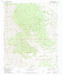 1980 Cedar Basin1980 Print · USGSThe Aquarius Mountains and Goodwin Mesa define this high-desert ranching landscape in the early 1980s. Researchers can trace remote water sources and cattle infrastructure at Cedar Basin Camp, Sunburn Windmill, and Willow Springs Well.
 - 1980 Map of Bull Spring
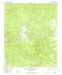 1980 Bull Spring1980 Print · USGSThe high desert of Mohave County is documented here in 1980, showing a landscape shaped by water rights and ranching. Genealogists and historians can trace essential water sources from Knight Creek Spring to White Rock Tank and the infrastructure at Lookout.2 unique versions available
 - 1980 Map of Elephant Butte
 1980 Elephant Butte1980 Print · USGSThe Utah and Arizona borderlands come into focus in the 1970s, showing a high-desert landscape divided by the Kaibab Indian Reservation Bdy. Researchers can locate vital water sources like Wyatt Spring and trace travel routes along a Jeep Trail through Elephant Gap.
 - 1980 Map of Tuckayou Spring
 1980 Tuckayou Spring1980 Print · USGSIn the high Mohave desert during the late seventies, this survey captures a landscape defined by ranching water works and the Cottonwood Mountains. Researchers can locate remote cattle tanks like Hazen Tank and trace early routes such as the Jeep Tr near Tuckayou Spring.
 - 1980 Map of Penitentiary Mtn
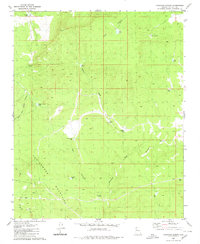
 1980 Penitentiary Mtn1980 Print · USGSThe Aquarius Mountains of western Arizona are mapped here in the late seventies, showing a landscape of high mesas and remote ranching outposts. Researchers can trace early water infrastructure and land use via the Ruth Cowden Well, Paso Robles Well, and Penitentiary Mountain.
 - 1980 Map of Blye Canyon SE
 1980 Blye Canyon SE1980 Print · USGSThe high-desert ranching country of Arizona's interior is captured here as it appeared in 1980. Researchers can trace the water infrastructure of the era through sites like Greeley Dam, the Section 8 Well, and family-named landmarks such as Jim Smith Tanks.3 unique versions available
 - 1980 Map of Mohon Peak
 1980 Mohon Peak1980 Print · USGSThe high country of Yavapai and Mohave counties is captured here in the early 1980s, centered on the heights of the Mohon Mountains. Researchers can trace the network of vital water sources like Mohon Spring, Palomino Tank, and Walnut Spring across this remote ranching landscape.
 - 1980 Map of Negro Ed
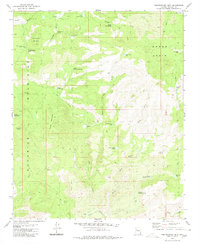
 1980 Negro Ed1980 Print · USGSThe high plateau of Yavapai County was a landscape of remote ranching outposts and vital water tanks in the late twentieth century. Researchers can trace historic routes to Salt Creek Camp and locate isolated water sources like Trot and Holler Well and Negro Ed Spring.
 - 1980 Map of The Grandstand
 1980 The Grandstand1980 Print · USGSThe Arizona Strip during the late seventies is captured here, centered on the dramatic rise of the Hurricane Cliffs. Researchers can trace the path of the historic Temple Trail and locate essential desert water sources like Higley Twin Tanks and Toquer Tank.
 - 1980 Map of Blye Canyon NE
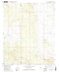
 1980 Blye Canyon NE1980 Print · USGSThe high desert rangelands of Yavapai and Mohave counties are shown here in the early 1980s, dominated by a vast network of water catchments. Researchers can locate remote outposts like Denoys Ranch and the X Bar One Ranch alongside the Hualapai Indian Reservation.
 - 1980 Map of Devils Hump
 1980 Devils Hump1980 Print · USGSArizona's high desert ranching country comes into focus in the mid-1970s, showing a landscape shaped by remote water sources and rugged canyons. Trace the development of local cattle operations through named landmarks like Last Minute Well, Mohon Tank, and the winding Trout Creek.
 - 1980 Map of Gonzales Wash
 1980 Gonzales Wash1980 Print · USGSMohave County's high desert ranching country comes into focus in the early 1980s, centered on the rugged peaks of the Aquarius Mountains. Local history researchers can trace water-rights and land-use patterns through features like Wagon Bow Ranch, Lower Simmons Well, and several remote Quarries.
 - 1980 Map of Little Creek Mountain, 1981 Print
 1980 Little Creek Mountain1981 Print · USGSThe high plateaus of southern Utah are captured here in the early 1980s, revealing a landscape of cinder pits and isolated springs. Researchers can trace the drainages of Gould Wash or locate specific landmarks like Abs Clearing and Gray Knoll.
 - 1980 Map of St. George, 1981 Print
 1980 St. George1981 Print · USGSThe St. George region underwent significant expansion in the early eighties as ranching traditions met new modern development. Researchers can trace the heritage of the Virgin River valley through sites like Grafton, the Apex Mine, and Snow Canyon State Park.2 unique versions available
 - 1980 Map of Kanab, 1981 Print
 1980 Kanab1981 Print · USGSSouthern Utah in the late seventies is a landscape of massive geologic terraces and isolated ranching towns. Trace the growth of Kanab and Springdale or locate vanished sites like Shunesburg among the White Cliffs and Vermilion Cliffs.
 - 1980 Map of Smithsonian Butte, 1981 Print
 1980 Smithsonian Butte1981 Print · USGSThe high desert borderlands of Washington County and Mohave County are captured here in the early eighties. Researchers can locate remote landmarks like Canaan Ranch and Big Plain Junction or trace water sources like Sawmill Spring.2 unique versions available
 - 1981 Map of Needles, 1987 Print
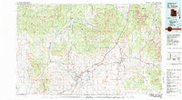
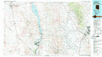
 1981 Needles1987 Print · USGSThe High Desert and Colorado River valley are seen here in the early 1980s through the unique lens of satellite imagery. Trace the isolated outposts of the AT & SF railroad at Goffs and Essex, or explore the sprawling shores of Lake Havasu.
 - 1982 Map of Davis Dam, 1983 Print
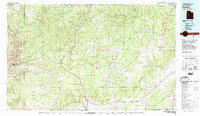
 1982 Davis Dam1983 Print · USGSThe Colorado River corridor and the Tri-State area come into focus in the early eighties, showing the growth of Bullhead City and Laughlin near the Davis Dam. Researchers can trace extensive mining operations like the Searchlight Mine or follow the Atchison Topeka and Santa Fe rail line into Kingman.2 unique versions available
Showing maps 1-25 of 112
Top cities of Mohave County
- Lake Havasu City historical maps
- Bullhead City historical maps
- Kingman historical maps
- Fort Mohave historical maps
- New Kingman-Butler historical maps
- Golden Valley historical maps
See more
Frequently asked questions
- What are the different types of historical maps available for Mohave County?
- What is the oldest map of Mohave County?
- Where can I purchase historical maps of Mohave County for my home or office?
- Where can I download high-res historical maps of Mohave County?
- Are there historical topographic maps available for Mohave County?
- Is there historical aerial imagery available for Mohave County?
- Where are historical maps of Mohave County sourced from?