1920s Maps of Yavapai County, Arizona
Explore 4 historic maps of Yavapai County from the 1920s. These maps offer a rare glimpse into what life looked like during the 1920s — showing old roads, neighborhoods, homes, and landmarks that have changed or disappeared over time.
Whether you're researching your family's past, planning a metal detecting trip, or studying how Yavapai County's landscape evolved across the 1920s, these high-resolution maps are a powerful tool for exploring the history of this region.
- Focus on a specific era: All maps on this page are from the 1920s, giving you a focused view of this time period.
- See what’s changed: Compare century-old streets, trails, and buildings to today's modern landscape using overlays and satellite layers.
- Research with precision: Use these maps for genealogy, historical research, land use analysis, or educational projects.
- View, download, or print: Maps are fully viewable online in high resolution, and can be downloaded or printed for your own records.
Start exploring Yavapai County's history through authentic maps from the 1920s. This is your window into the past.
Yavapai County, AZ maps
(4)- 1922 Map of Williams
 1922 Williams1922 Print · USGSNorthern Arizona's high plateau during the early 1920s reveals a landscape of forestry and rail expansion. Trace early ranger stations and small rail stops like Fairview, Meath, and the Wood Spur logging line.
 - 1923 Map of Camp Verde
 1923 Camp Verde1923 Print · USGSCentral Arizona's river valleys and high plateaus appear here during the early twenties, showing the region's shift toward tourism and settlement. Trace the routes to Montezuma Castle Nat Monument or locate early sites like Cornville and Aultman.
 - 1923 Map of Signal
 1923 Signal1923 Print · USGSWestern Arizona in the early twenties was a landscape of isolated mining camps and vital desert springs. Genealogists and historians can trace the footprint of early settlements like Signal and Swansea or locate remote outposts such as Owen and Butler well.
 - 1929 Map of Turret Peak, 1958 Print
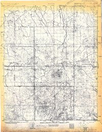
 1929 Turret Peak1958 Print · USGSYavapai County ranching and mining reach their peak in the late twenties along the winding Verde River. Researchers can trace the legacy of early families and industrial ventures at the United Arizona Mine, Brown Springs Ranch, and Anchor Ranch.3 unique versions available
End of results
Showing maps 1-4 of 4
Top cities of Yavapai County
- Prescott historical maps
- Prescott Valley historical maps
- Cottonwood historical maps
- Camp Verde historical maps
- Williamson historical maps
- Paulden historical maps
See more
Frequently asked questions
- What are the different types of historical maps available for Yavapai County?
- What is the oldest map of Yavapai County?
- Where can I purchase historical maps of Yavapai County for my home or office?
- Where can I download high-res historical maps of Yavapai County?
- Are there historical topographic maps available for Yavapai County?
- Is there historical aerial imagery available for Yavapai County?
- Where are historical maps of Yavapai County sourced from?