1980s Maps of Yavapai County, Arizona
Explore 45 historic maps of Yavapai County from the 1980s. These maps offer a rare glimpse into what life looked like during the 1980s — showing old roads, neighborhoods, homes, and landmarks that have changed or disappeared over time.
Whether you're researching your family's past, planning a metal detecting trip, or studying how Yavapai County's landscape evolved across the 1980s, these high-resolution maps are a powerful tool for exploring the history of this region.
- Focus on a specific era: All maps on this page are from the 1980s, giving you a focused view of this time period.
- See what’s changed: Compare century-old streets, trails, and buildings to today's modern landscape using overlays and satellite layers.
- Research with precision: Use these maps for genealogy, historical research, land use analysis, or educational projects.
- View, download, or print: Maps are fully viewable online in high resolution, and can be downloaded or printed for your own records.
Start exploring Yavapai County's history through authentic maps from the 1980s. This is your window into the past.
Yavapai County, AZ maps
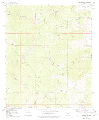
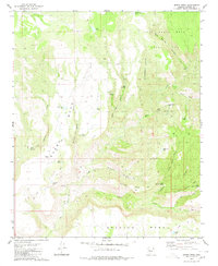
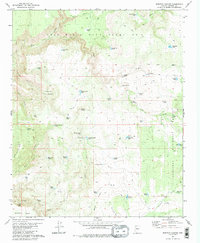
(45)- 1980 Map of Fort Rock Ranch
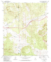 1980 Fort Rock Ranch1980 Print · USGSArizona's ranching frontier at the border of Mohave and Yavapai counties is detailed in the late 1970s. Trace local history through family-named landmarks like Carl F Well and Fort Rock Ranch, or locate remote Ruins and a lone Grave.2 unique versions available
 - 1980 Map of Anvil Rock Ranch
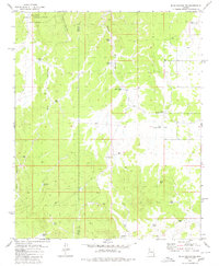
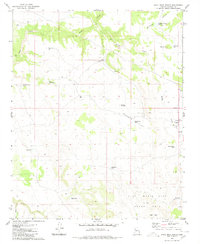 1980 Anvil Rock Ranch1980 Print · USGSYavapai County ranching country is captured here during the 1980s, centered on the historic Luis Maria Baca Float No 5 land grant. Researchers can trace remote water sources and landmarks like the Anvil Rock Ranch, Badger Flat Windmill, and One More Day Tank.
 - 1980 Map of Mount Hope
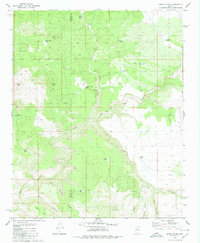
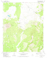 1980 Mount Hope1980 Print · USGSArizona's cattle country in the 1980s is defined here by the massive Luis Maria Baca Grant Float No 5 and its rugged ranching infrastructure. Researchers can locate the historic O Ro Ranch, several remote outposts like Sandstone Camp, and vital water sources including Muddy Mill.
 - 1980 Map of Pilot Knob
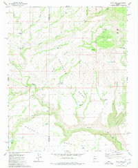 1980 Pilot Knob1980 Print · USGSThe high desert border of Mohave and Yavapai counties is captured here in the late seventies, showing a landscape shaped by ranching and remote outposts. Researchers can locate named ranch sites like Old Cofer Hdqrs and water sources such as Devils Bathtub and Pilot Knob Spring.
 - 1980 Map of Anvil Rock
 1980 Anvil Rock1980 Print · USGSHigh-desert ranching and historic land grants define this Yavapai County landscape in the early eighties. Genealogists and local historians can trace family-named water sources like Henry Brown Tank and explore the unique boundaries of the Luis Maria Baca Float No 5.
 - 1980 Map of Grayback Mts.
 1980 Grayback Mts.1980 Print · USGSThe Mohave and Yavapai county line was a landscape of remote prospecting and cattle tanks in the late 1970s. Researchers can locate early mineral claims like the Bland Mine and Key Mine or trace water sources like Coors Well and Agate Well.
 - 1980 Map of Sunrise Peak
 1980 Sunrise Peak1980 Print · USGSYavapai County ranching country is mapped here in the early 1980s, centered on the high ridges of the Mohon Mountains. Researchers can trace the legacy of Spanish land grants at Luis Maria Baca Float No 5 and locate remote outposts like Tri N Camp and Bear Creek Camp.
 - 1980 Map of Cross Mountain
 1980 Cross Mountain1980 Print · USGSThe high ranching country of Yavapai County is captured here in the early 1980s. Researchers can trace historic water management and land use through features like Cross Mountain Dam, Pickett Coral, and family-named landmarks such as Hoggy John Tank.
 - 1980 Map of Squaw Peak
 1980 Squaw Peak1980 Print · USGSHigh in the Juniper Mountains during the late seventies, this survey captures a landscape defined by ranching and forest management. Researchers can trace land use through features like H-Ranch, the Red Lake Well, and numerous named water catchments such as Big Purcell Tank.2 unique versions available
 - 1980 Map of Burro Mesa
 1980 Burro Mesa1980 Print · USGSYavapai County ranching country is documented here during the late twentieth century, showing the critical water sources of the high mesas. Researchers can trace the Burro Trail, locate remote Ruins, and find named livestock tanks like Lovelace Tank and Suicide Tank.2 unique versions available
 - 1980 Map of Blye Canyon SE
 1980 Blye Canyon SE1980 Print · USGSThe high-desert ranching country of Arizona's interior is captured here as it appeared in 1980. Researchers can trace the water infrastructure of the era through sites like Greeley Dam, the Section 8 Well, and family-named landmarks such as Jim Smith Tanks.3 unique versions available
 - 1980 Map of Mohon Peak
 1980 Mohon Peak1980 Print · USGSThe high country of Yavapai and Mohave counties is captured here in the early 1980s, centered on the heights of the Mohon Mountains. Researchers can trace the network of vital water sources like Mohon Spring, Palomino Tank, and Walnut Spring across this remote ranching landscape.
 - 1980 Map of Negro Ed
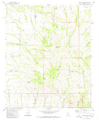
 1980 Negro Ed1980 Print · USGSThe high plateau of Yavapai County was a landscape of remote ranching outposts and vital water tanks in the late twentieth century. Researchers can trace historic routes to Salt Creek Camp and locate isolated water sources like Trot and Holler Well and Negro Ed Spring.
 - 1980 Map of Scratch Canyon
 1980 Scratch Canyon1980 Print · USGSYavapai County ranch lands and land grant territories are mapped here as they appeared in the early eighties. Researchers can trace historic grazing boundaries and remote outposts like Halfway House, Hole In The Ground, and Pine Creek Dam.2 unique versions available
 - 1980 Map of Blye Canyon NE
 1980 Blye Canyon NE1980 Print · USGSThe high desert rangelands of Yavapai and Mohave counties are shown here in the early 1980s, dominated by a vast network of water catchments. Researchers can locate remote outposts like Denoys Ranch and the X Bar One Ranch alongside the Hualapai Indian Reservation.
 - 1980 Map of Devils Hump
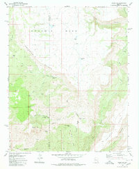
 1980 Devils Hump1980 Print · USGSArizona's high desert ranching country comes into focus in the mid-1970s, showing a landscape shaped by remote water sources and rugged canyons. Trace the development of local cattle operations through named landmarks like Last Minute Well, Mohon Tank, and the winding Trout Creek.
 - 1980 Map of Audley, 1981 Print
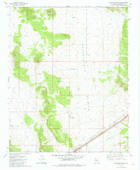
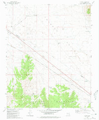 1980 Audley1981 Print · USGSThe Arizona high desert in the early 1980s is defined by the Atchison Topeka and Santa Fe line cutting through Aubrey Valley. Researchers can trace the ranching life at Pica Camp and Audley or locate a solitary Grave near the tracks.
 - 1980 Map of Sedona, 1996 Print
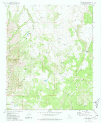
 1980 Sedona1996 Print · USGSThe red rock country around Sedona and the Verde Valley are captured in the late twentieth century, showing a mix of ancient sites and modern growth. Genealogists and researchers can trace local landmarks like Cornville, the Camp Verde Indian Reservation, and Montezuma Castle National Monument.
 - 1981 Map of Seligman East
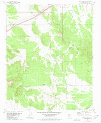
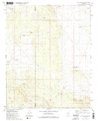
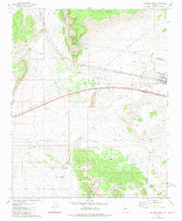
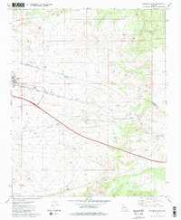 1981 Seligman East1981 Print · USGSSeligman sits at a historic crossroads in the early 1980s, where the high-desert rail economy met the interstate era. Genealogists and historians can trace the town layout near the Atchison Topeka and Santa Fe Railroad or locate local landmarks like Padre Reservoir and High Sch.2 unique versions available
 - 1981 Map of Grand Canyon Caverns
 1981 Grand Canyon Caverns1981 Print · USGSNorthern Arizona's high-desert landscape comes to life in the early 1980s, highlighting the remote settlements and infrastructure of the period. Researchers can trace the Atchison Topeka and Santa Fe railroad and locate landmarks like Grand Canyon Caverns and Hyde Park.
 - 1981 Map of Seligman West
 1981 Seligman West1981 Print · USGSThe high-desert crossroads at Seligman in the early 1980s reveals a landscape defined by the railroad and water management. Trace family-named landmarks like Buck Rogers Well and remote outposts such as Shorty Tank Corral along the Atchison Topeka and Santa Fe line.3 unique versions available
 - 1981 Map of Sugarloaf Peak
 1981 Sugarloaf Peak1981 Print · USGSIn the high-desert rangelands of Yavapai County in the early eighties, this area shows a landscape shaped by ranching and infrastructure. Trace the essential water network from Celedonio Tank to Old Well, and locate local landmarks like Sugarloaf Pk and the Pipeline.2 unique versions available
 - 1981 Map of Payson
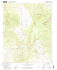
 1981 Payson1981 Print · USGSCentral Arizona's mountain country comes into focus in the early eighties, centered on the growing town of Payson. Trace the mining history at Gowan Mine, find old forest outposts like Kohls Ranch, and see the rugged Mogollon Rim terrain.2 unique versions available
 - 1981 Map of Yampai
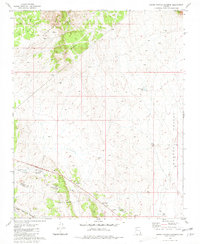
 1981 Yampai1981 Print · USGSRailroad and ranching life intersect at the border of Yavapai and Coconino Counties in the early eighties. Researchers can trace the path of the Atchison Topeka and Santa Fe past remote outposts like Rock House and Pica.
 - 1981 Map of Red Mesa
 1981 Red Mesa1981 Print · USGSNorthwestern Arizona’s high desert landscape comes into focus in the early eighties as ranching and rail interests intersect. Researchers can trace the Atchison Topeka and Santa Fe line and find remote water tanks like Caterpillar Tank and Chino Tank.2 unique versions available
Showing maps 1-25 of 45
Top cities of Yavapai County
- Prescott historical maps
- Prescott Valley historical maps
- Cottonwood historical maps
- Camp Verde historical maps
- Williamson historical maps
- Paulden historical maps
See more
Frequently asked questions
- What are the different types of historical maps available for Yavapai County?
- What is the oldest map of Yavapai County?
- Where can I purchase historical maps of Yavapai County for my home or office?
- Where can I download high-res historical maps of Yavapai County?
- Are there historical topographic maps available for Yavapai County?
- Is there historical aerial imagery available for Yavapai County?
- Where are historical maps of Yavapai County sourced from?