1960s Maps of Yavapai County, Arizona
Explore 84 historic maps of Yavapai County from the 1960s. These maps offer a rare glimpse into what life looked like during the 1960s — showing old roads, neighborhoods, homes, and landmarks that have changed or disappeared over time.
Whether you're researching your family's past, planning a metal detecting trip, or studying how Yavapai County's landscape evolved across the 1960s, these high-resolution maps are a powerful tool for exploring the history of this region.
- Focus on a specific era: All maps on this page are from the 1960s, giving you a focused view of this time period.
- See what’s changed: Compare century-old streets, trails, and buildings to today's modern landscape using overlays and satellite layers.
- Research with precision: Use these maps for genealogy, historical research, land use analysis, or educational projects.
- View, download, or print: Maps are fully viewable online in high resolution, and can be downloaded or printed for your own records.
Start exploring Yavapai County's history through authentic maps from the 1960s. This is your window into the past.
Yavapai County, AZ maps
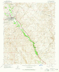
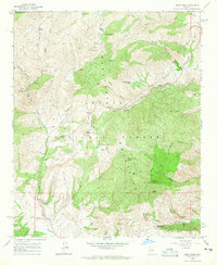
(84)- 1960 Map of Williams
 1960 Williams1960 Print · USGSNorthern Arizona in the mid-twentieth century was defined by its massive canyons and the vital rail line connecting its remote ranches. Genealogists and historians can trace the development of Peach Springs, the high-altitude Bill Williams Mountain, and isolated outposts like Diamond Bar Ranch.
 - 1960 Map of Prescott
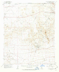
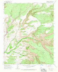
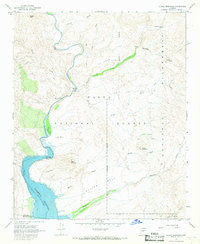
 1960 Prescott1960 Print · USGSYavapai County and the surrounding high-desert mining districts are captured here during a period of steady industrial and rail activity. Researchers can trace the routes of the Atchison Topeka and Santa Fe Railway and locate historic sites like the United Verde Mine and Bland School.2 unique versions available
 - 1960 Map of Holbrook
 1960 Holbrook1960 Print · USGSNorthern Arizona is captured here just as modern highways began to reshape the cattle and timber country of the Colorado Plateau. Genealogists and historians can trace the early footprints of Snowflake, Sedona, and Payson, alongside the Atchison Topeka & Santa Fe RR rail line.
 - 1960 Map of Mesa
 1960 Mesa1960 Print · USGSThe Salt River Valley and Superstition wilderness are captured here during a era of rapid post-war growth. Researchers can trace the mid-century footprints of Williams AF Base and Arizona State College or locate the deep-rock shafts of the Old Dominion Mine and Magma Mine.
 - 1960 Map of Phoenix
 1960 Phoenix1960 Print · USGSCentral Arizona in the mid-fifties reveals a landscape of rapid suburban growth alongside enduring desert mining and ranching. Genealogists and historians can trace rail-side settlements like Vicksburg Junction and Waddell, or locate the Vulture Mine and early sites like Agua Fria School.
 - 1961 Map of Williams
 1961 Williams1961 Print · USGSNorthern Arizona in the mid-fifties reveals a high-desert landscape of rail towns and deep canyons along the Atchison Topeka and Santa Fe. Researchers can trace old Route 66 through Peach Springs, Seligman, and Ash Fork, or find remote sites like Music Mountain Mine.
 - 1961 Map of Vulture Mountains, 1963 Print
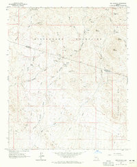
 1961 Vulture Mountains1963 Print · USGSThe Arizona desert around Wickenburg reveals its deep mining history and railroad heritage during the early 1960s. Researchers can locate the famed Vulture Mine, trace the Atchison Topeka and Santa Fe line, and find the Wickenburg Massacre Historical Monument.3 unique versions available
 - 1962 Map of Hearst Mtn., 1964 Print
 1962 Hearst Mtn.1964 Print · USGSHigh Arizona ranchlands and railroad life come into focus in this early 1960s survey of Coconino County. Researchers can trace historic ranching operations at Double A Ranch and FY Ranch, or follow the Atchison Topeka And Santa Fe rail line through the KY Hills.2 unique versions available
 - 1964 Map of Mesa
 1964 Mesa1964 Print · USGSCentral Arizona in the mid-1960s reveals a landscape defined by rapid desert urbanization and a massive copper mining industry. Genealogists and historians can trace the growth of Phoenix or explore the mining camps and operations at Miami Mine and Magma Mine.
 - 1964 Map of Garfias Mountain, 1965 Print
 1964 Garfias Mountain1965 Print · USGSThe Arizona desert at the boundary of Yavapai and Maricopa counties is captured here in the mid-1960s. Researchers can trace the legacy of local mining at the St Anthony Mine and Morgan City Mine, or locate family landmarks like L Ranch and Ramon Tank.3 unique versions available
 - 1964 Map of New River, 1965 Print
 1964 New River1965 Print · USGSMaricopa County's northern desert landscape comes into focus during the mid-sixties as the community of New River begins to take shape. Genealogists and historians can trace early landmarks like New River Sch, the Little Grand Canyon Rancho, and scattered Ruins near the Agua Fria River.5 unique versions available
 - 1964 Map of Wickenburg, 1965 Print
 1964 Wickenburg1965 Print · USGSWickenburg and the surrounding desert peaks were defined by the rail and river corridors of the mid-sixties. Researchers can trace the path of the Atchison Topeka and Santa Fe railroad past Allah, locate the Dragon Mine, or find the Remuda Ranch Landing Strip.4 unique versions available
 - 1964 Map of Red Picacho, 1965 Print
 1964 Red Picacho1965 Print · USGSThe Arizona desert at the Yavapai and Maricopa county line shows an active landscape of mid-century mineral exploration. You can trace early mining history and backcountry routes through the Wickenburg Mountains, locating sites like Pechan Camp, the Midnight Owl Mine, and the White Cloud Mine.5 unique versions available
 - 1964 Map of Lion Mountain, 1965 Print
 1964 Lion Mountain1965 Print · USGSThe high desert terrain of the Mazatzal Mountains is captured here in the mid-sixties, showing the rugged border of Yavapai and Maricopa counties. Researchers can trace historic access routes like the Pack Trail to the Story Mine or locate numerous water sources like Pats Shoe Spring and Jack Spring.3 unique versions available
 - 1964 Map of Governors Peak, 1965 Print
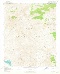
 1964 Governors Peak1965 Print · USGSThe Arizona desert at the Yavapai and Maricopa county line reveals a landscape of remote ranches and ancient rock art in the mid-1960s. Genealogists and historians can trace routes to Castle Hot Springs, locate Petroglyphs, and explore the shoreline of Lake Pleasant.5 unique versions available
 - 1964 Map of Reno Pass, 1965 Print
 1964 Reno Pass1965 Print · USGSThe Mazatzal Mountains landscape in the mid-sixties reveals a transition between old-world mining and modern forestry management. You can trace early Arizona industry and habitation through sites like the Sunflower Mine, Cross F Ranch, and Mt Ord.3 unique versions available
 - 1964 Map of Horseshoe Dam, 1965 Print
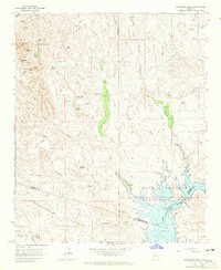
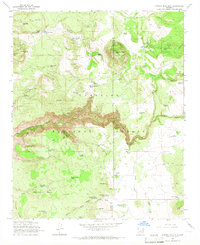
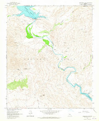 1964 Horseshoe Dam1965 Print · USGSThe Verde River corridor in the mid-1960s reveals a rugged landscape shaped by water management and ranching. Researchers can locate the K A Ranch, ancient Petroglyphs, and remote Mines tucked between St Clair Peak and the Horseshoe Dam.3 unique versions available
 - 1965 Map of Prescott
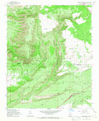
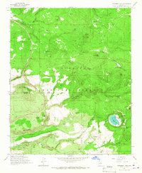
 1965 Prescott1965 Print · USGSArizona's mining heartland is captured during the mid-sixties, from the copper mines of Jerome to the cattle country of Williamson Valley Wash. Genealogists and historians can trace old mining camps at Octave and Stanton or the historic Whipple Military Reservation.
 - 1965 Map of Munds Mountain, 1967 Print
 1965 Munds Mountain1967 Print · USGSThe Coconino National Forest high country is shown here in the mid-sixties, highlighting the winding ascent of Schnebly Hill Road. Trace early backcountry routes and water sites like Robbers Roost, Woods Ranch, and the Stoneman Lake Interchange.3 unique versions available
 - 1965 Map of Buckhorn Mountain, 1967 Print
 1965 Buckhorn Mountain1967 Print · USGSRanching outposts and remote forest terrain define this central Arizona landscape in the mid-sixties. Trace historical grazing infrastructure like the V Lazy Y Cabin, Buckhorn Ranch, and the winding Walker Basin Jeep Trail.2 unique versions available
 - 1965 Map of Casner Butte, 1967 Print
 1965 Casner Butte1967 Print · USGSCoconino National Forest in the mid-sixties reveals a landscape of high mesas and vital water sources before modern development reached these canyons. Genealogists and historians can trace old homesteads like Beaver Creek Ranch and landmarks such as Sacred Mtn or Lawrence Crossing.3 unique versions available
 - 1965 Map of Stoneman Lake, 1967 Print
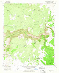
 1965 Stoneman Lake1967 Print · USGSThe high timber country of the Mogollon Rim transition is captured here in the mid-sixties, showing the rugged drainage systems south of Flagstaff. Researchers can trace historic water sources and early forest infrastructure, from Stoneman Lake to family-named landmarks like Bill Back Spring and Lee Spring.3 unique versions available
 - 1965 Map of Apache Maid Mtn, 1967 Print
 1965 Apache Maid Mtn1967 Print · USGSThe high plateau of the Coconino National Forest is documented here in the mid-1960s, showing a landscape of remote ranching outposts and fire lookouts. Genealogists and local historians can trace family-named sites like Mullican Ranch, the Waldroup Place, and Apache Maid Cabin.3 unique versions available
 - 1967 Map of Brooklyn Peak, 1968 Print
 1967 Brooklyn Peak1968 Print · USGSYavapai County ranching and forest land is captured here in the late sixties, showing the remote outposts of the Tonto National Forest. Local history researchers can trace the locations of isolated dwellings like Crockett Cabin, Six Bar Ranch, and Hogan Cabin.3 unique versions available
 - 1967 Map of Chalk Mountain, 1968 Print
 1967 Chalk Mountain1968 Print · USGSThe Verde River corridor south of the Mazatzal Wilderness appears here in the late sixties, showing a landscape defined by ranching trails and reservoir hydrology. Researchers can locate remote landmarks like Sheep Bridge, the Dutchman Grave Spring, and a Mine near Chalk Mountain.3 unique versions available
Showing maps 1-25 of 84
Top cities of Yavapai County
- Prescott historical maps
- Prescott Valley historical maps
- Cottonwood historical maps
- Camp Verde historical maps
- Williamson historical maps
- Paulden historical maps
See more
Frequently asked questions
- What are the different types of historical maps available for Yavapai County?
- What is the oldest map of Yavapai County?
- Where can I purchase historical maps of Yavapai County for my home or office?
- Where can I download high-res historical maps of Yavapai County?
- Are there historical topographic maps available for Yavapai County?
- Is there historical aerial imagery available for Yavapai County?
- Where are historical maps of Yavapai County sourced from?