1980s Maps of Del Norte County, California
Explore 21 historic maps of Del Norte County from the 1980s. These maps offer a rare glimpse into what life looked like during the 1980s — showing old roads, neighborhoods, homes, and landmarks that have changed or disappeared over time.
Whether you're researching your family's past, planning a metal detecting trip, or studying how Del Norte County's landscape evolved across the 1980s, these high-resolution maps are a powerful tool for exploring the history of this region.
- Focus on a specific era: All maps on this page are from the 1980s, giving you a focused view of this time period.
- See what’s changed: Compare century-old streets, trails, and buildings to today's modern landscape using overlays and satellite layers.
- Research with precision: Use these maps for genealogy, historical research, land use analysis, or educational projects.
- View, download, or print: Maps are fully viewable online in high resolution, and can be downloaded or printed for your own records.
Start exploring Del Norte County's history through authentic maps from the 1980s. This is your window into the past.
Del Norte County, CA maps
(21)- 1981 Map of Chimney Rock
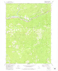
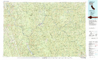
 1981 Chimney Rock1981 Print · USGSHigh in the Siskiyou Mountains during the early eighties, this survey captures the intersection of two national forests and their historical camps. Researchers can trace old sites like Rose Camp (Site), locate the Siskiyou Mine, and map the remote Forks of Blue settlement.
 - 1981 Map of Gasquet, 1982 Print
 1981 Gasquet1982 Print · USGSThe Middle Fork Smith River corridor in the early 1980s shows a landscape of timber management, mining, and isolated forest settlements. Genealogists and historians can trace family-named sites like Pappas Flat or locate the Mountain Sch and Tyson Chrome Mine.
 - 1981 Map of Summit Valley, 1982 Print
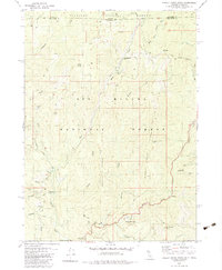
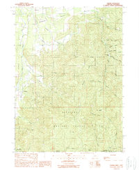
 1981 Summit Valley1982 Print · USGSDel Norte County's backwoods are documented here in the early 1980s, showcasing the high-elevation terrain of the Six Rivers National Forest. Hikers and historians can trace the Summit Valley Trail to Doctor Rock or locate the Summit Valley Shelter and Cedar Camp Spring.
 - 1981 Map of Devils Punchbowl, 1982 Print
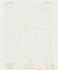 1981 Devils Punchbowl1982 Print · USGSThe high backcountry of Del Norte and Siskiyou counties is documented here in the early 1980s at the junction of three National Forests. Backcountry researchers can locate the Prescott Cabin ruins, the high waters of Devils Punchbowl, and the remote Trout Camp.4 unique versions available
 - 1981 Map of Prescott Mountain, 1982 Print
 1981 Prescott Mountain1982 Print · USGSThe Del Norte and Siskiyou county line runs through these national forest lands in the early 1980s. Researchers and hikers can locate remote landmarks such as the Bear Wallows Shelter, Harrington Lake, and the summit of Prescott Mtn.
 - 1982 Map of Cant Hook Mtn
 1982 Cant Hook Mtn1982 Print · USGSThe South Fork Smith River corridor in the early eighties was a landscape of remote forestry and mining. Genealogists and historians can trace family-named sites like Stevens Ranch, the historic China Mine, and the Big Flat Forest Service Sta.3 unique versions available
 - 1982 Map of Orick
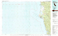
 1982 Orick1982 Print · USGSCoastal Humboldt County in the early eighties reveals a landscape of massive redwood preserves and protected lagoons. Genealogists and historians can trace the foundations of Orick and Trinidad alongside the Trinidad Lighthouse and Trinidad Rancheria.
 - 1982 Map of Broken Rib Mtn
 1982 Broken Rib Mtn1982 Print · USGSThe Oregon-California borderlands are captured here in the early eighties, showcasing a wilderness of high peaks and river forks. Researchers can trace the path of the Randolph Collier Tunnel, find the Camp Chicago (Site), and locate remote points like Stevens Camp.2 unique versions available
 - 1982 Map of Hurdygurdy Butte
 1982 Hurdygurdy Butte1982 Print · USGSThe Del Norte backcountry in the early eighties was a landscape of deep river canyons and high timber ridges. Geologists and local historians can trace the Old Gasquet Toll Road and locate remote landmarks like Hurdygurdy Butte and the Mine on Gordon Mountain.
 - 1982 Map of Blue Creek Mtn
 1982 Blue Creek Mtn1982 Print · USGSHumboldt and Del Norte counties meet along this remote mountain divide in the early eighties, where the Six Rivers National Forest spans deep river canyons. Genealogists and local historians can trace the paths to Bear Pen Flat, Stevens Prairie, and the heights of Blue Creek Mtn.2 unique versions available
 - 1982 Map of Polar Bear Mountain
 1982 Polar Bear Mountain1982 Print · USGSThe high Siskiyou mountains straddle the California-Oregon border in the early 1980s, where national forest boundaries meet. Researchers can locate remote mining sites like Orloff Mine and isolated landmarks such as Porters Camp, Sutcliffe Falls, and Polar Bear Mtn.
 - 1982 Map of Ship Mountain
 1982 Ship Mountain1982 Print · USGSDel Norte County's high forest ridges and the deep canyon of the Smith River are captured here in the early eighties. Researchers can trace remote forest outposts and river features like Lookout Tower No 4, Blackhawk Bar, and Muslatt Lake.
 - 1982 Map of Klamath Glen
 1982 Klamath Glen1982 Print · USGSThe Klamath River corridor near the Oregon border is captured here in the early eighties, showing the intersection of tribal lands and national forest. Researchers can trace the development of Klamath Glen and locate high-country landmarks like the Red Mountain Lookout Tower and Starwein Flat.2 unique versions available
 - 1982 Map of High Plateau Mtn.
 1982 High Plateau Mtn.1982 Print · USGSThe high country along the California-Oregon border is documented here in the early 1980s, showcasing a landscape defined by forestry and mineral exploration. Researchers can find precise locations for several mountain operations, including the Cleopatra Mine, Browns Mine, and a named Mill Site near High Plateau Mountain.
 - 1982 Map of Shelly Creek Ridge, 1983 Print
 1982 Shelly Creek Ridge1983 Print · USGSThe Oregon and California borderlands come into focus in the early 1980s, where mining history and forest management meet along the Middle Fork Smith River. Researchers can trace the legacy of remote mountain industry at the Holiday Mine, the Monumental (Site), and along the winding Wimer Road.2 unique versions available
 - 1983 Map of Hoopa
 1983 Hoopa1983 Print · USGSThe Klamath and Trinity Rivers converge in the early eighties at Weitchpec, carving through a landscape of national forests and the Hoopa Indian Reservation. Researchers can trace remote settlements like Orleans and Cecilville or locate landmarks like Tish Tang Creek and English Peak.
 - 1983 Map of Ah Pah Ridge
 1983 Ah Pah Ridge1983 Print · USGSThe Klamath River corridor near the Humboldt and Del Norte county line is shown here in the early eighties as a meeting point for national and state parks. Researchers can find family landmarks like McCovey Ranch alongside the Blue Creek Lodge (Site) and Starwein Flat.
 - 1983 Map of Crescent City
 1983 Crescent City1983 Print · USGSThe Del Norte coast in the early eighties shows a transition between industrial mining and the expansion of massive redwood parks. Genealogists and local researchers can locate coastal landmarks from McNamara Field to the Alta Mine and the riverfront settlement of Requa.
 - 1983 Map of Happy Camp, 1984 Print
 1983 Happy Camp1984 Print · USGSThe Northern California borderlands and the Klamath River corridor are documented here in the early eighties as a hub of mining and forestry. Researchers can trace historical extraction at the High Plateau Mine and Independence Mine or locate the remote riverside community of Scott Bar.
 - 1989 Map of Takilma
 1989 Takilma1989 Print · USGSThe Illinois Valley during the late twentieth century reveals a landscape defined by deep gulches and forest service roads. Genealogists and local historians can locate early settlement points like Bridgeview and Democrat near the Siskiyou National Forest boundary.
 - 1989 Map of Grants Pass, 1990 Print
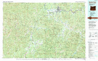 1989 Grants Pass1990 Print · USGSSouthern Oregon's river valleys and mountain ranges are captured here in the late eighties, just as the region’s recreation and transit networks were maturing. Local historians can trace old settlements like Waldo and Holland or follow the Southern Pacific line through Grants Pass.
End of results
Showing maps 1-21 of 21
Top cities of Del Norte County
Frequently asked questions
- What are the different types of historical maps available for Del Norte County?
- What is the oldest map of Del Norte County?
- Where can I purchase historical maps of Del Norte County for my home or office?
- Where can I download high-res historical maps of Del Norte County?
- Are there historical topographic maps available for Del Norte County?
- Is there historical aerial imagery available for Del Norte County?
- Where are historical maps of Del Norte County sourced from?