2020s Maps of Bakersfield, California
Explore 9 historic maps of Bakersfield from the 2020s. These maps offer a rare glimpse into what life looked like during the 2020s — showing old roads, neighborhoods, homes, and landmarks that have changed or disappeared over time.
Whether you're researching your family's past, planning a metal detecting trip, or studying how Bakersfield's landscape evolved across the 2020s, these high-resolution maps are a powerful tool for exploring the history of this region.
- Focus on a specific era: All maps on this page are from the 2020s, giving you a focused view of this time period.
- See what’s changed: Compare century-old streets, trails, and buildings to today's modern landscape using overlays and satellite layers.
- Research with precision: Use these maps for genealogy, historical research, land use analysis, or educational projects.
- View, download, or print: Maps are fully viewable online in high resolution, and can be downloaded or printed for your own records.
Start exploring Bakersfield's history through authentic maps from the 2020s. This is your window into the past.
Bakersfield, CA maps
(9)- 2021 Map of Lamont, 2021 Print
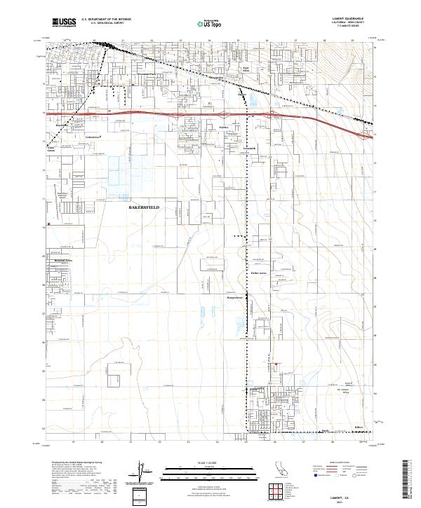 2021 Lamont2021 Print · USGSSoutheast Kern County and the Bakersfield outskirts are seen here in the early twenty-first century as agricultural industry meets suburban growth. Genealogists and local historians can trace the development of Lamont, locate the historic Union Cem, and study the canal systems of the San Joaquin Valley.
 - 2021 Map of Rio Bravo Ranch, 2021 Print
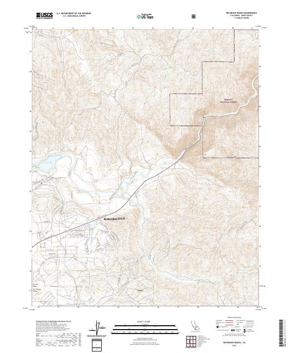 2021 Rio Bravo Ranch2021 Print · USGSBakersfield meets the Sierra foothills in the early twenty-first century as suburban growth pushes toward the Kern Canyon. Researchers can trace the development of Lake Ming and the settlement of Tarina alongside the natural curves of the Kern River.
 - 2021 Map of Stevens, 2021 Print
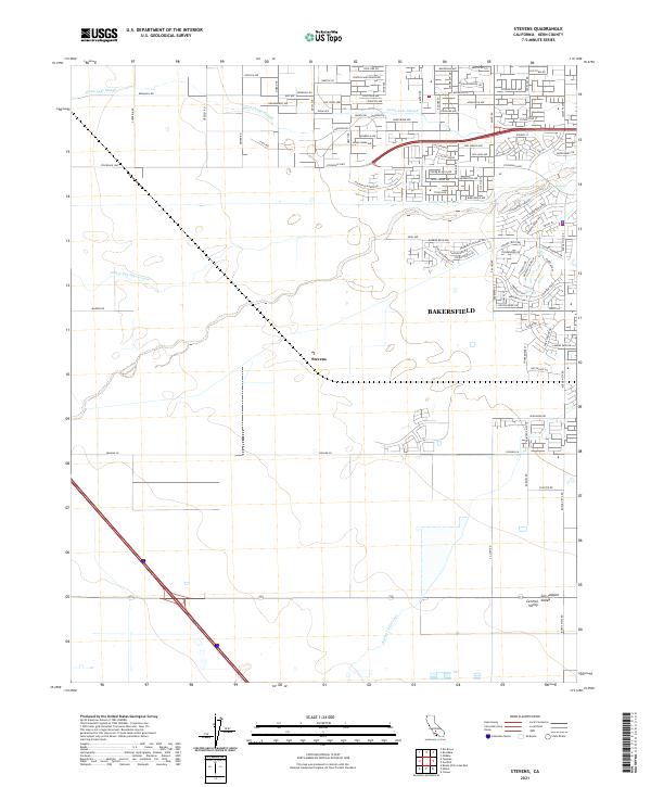 2021 Stevens2021 Print · USGSKern County agricultural lands meet the westward expansion of the San Joaquin Valley in this 2021 survey. Researchers can trace the path of the James and Dixon Canal and locate the community of Stevens near the Cross Valley Canal.
 - 2021 Map of Weed Patch, 2021 Print
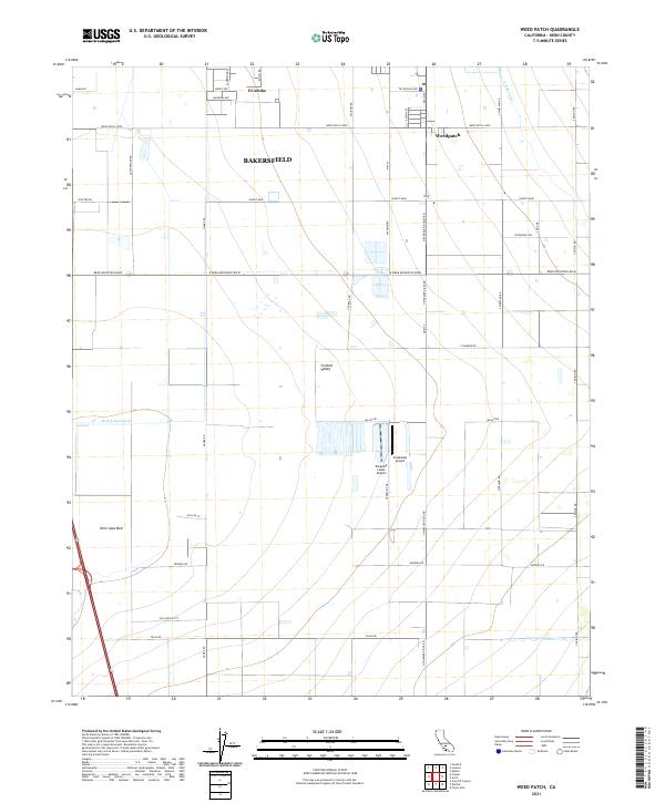 2021 Weed Patch2021 Print · USGSThe southern San Joaquin Valley comes into sharp focus in the early 2020s, revealing an intricate grid of irrigation and transport. Trace the development of Weedpatch and El Adobe or locate rural landmarks like Paradise Lakes Airport and the Kern Lake Bed.
 - 2021 Map of Gosford, 2021 Print
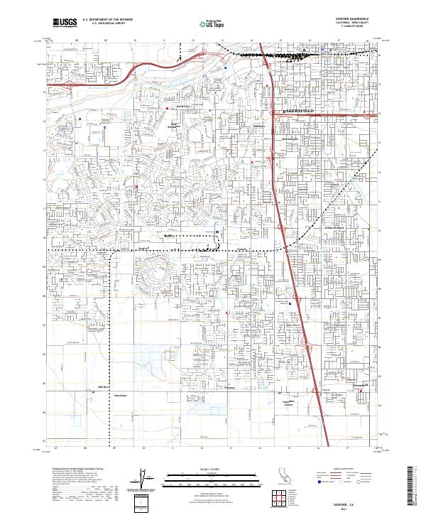 2021 Gosford2021 Print · USGSBakersfield and its southern agricultural outskirts appear here in the early twenty-first century as suburban growth meets historic irrigation networks. Researchers can trace local landmarks like Wible Orchard, Greenlawn Cem Southwest, and the community of Pumpkin Center.
 - 2021 Map of Rosedale, 2021 Print
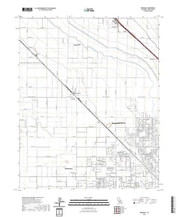 2021 Rosedale2021 Print · USGSKern County's agricultural and suburban landscape comes into focus in this recent survey of the areas north of Bakersfield. Researchers can trace the path of the Calloway Canal and locate local landmarks such as Shafter Cem or the community of Rosedale.
 - 2021 Map of Tupman, 2021 Print
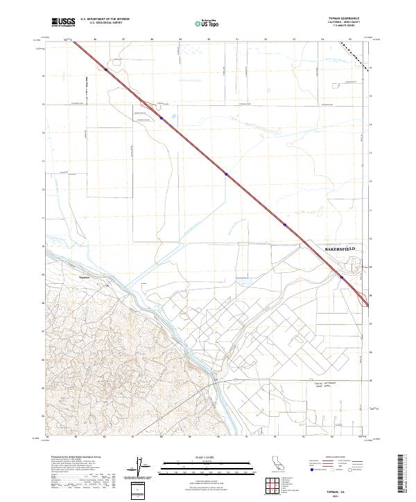 2021 Tupman2021 Print · USGSThe western San Joaquin Valley at the start of the 2020s shows a landscape of industrial-scale water management and petroleum extraction. Trace the massive California Aqueduct as it passes Tupman and the elevations of the Elk Hills.
 - 2022 Map of Oil Center, 2022 Print
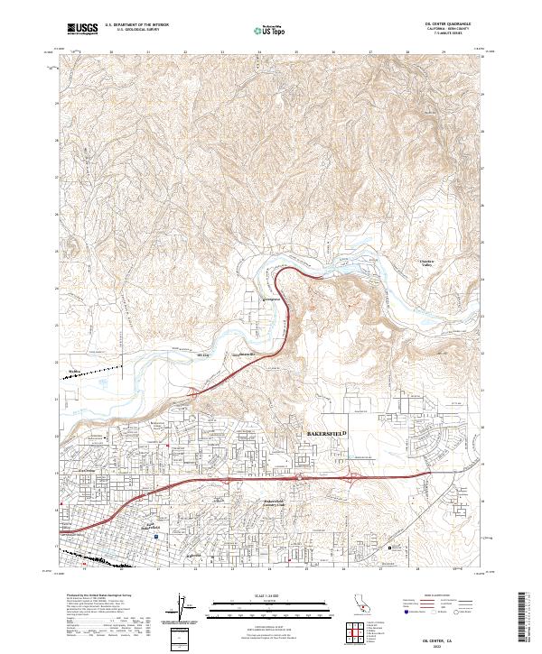 2022 Oil Center2022 Print · USGSBakersfield and its northeastern oil-rich uplands are shown here as the city meets the river valley. Researchers can trace neighborhood growth and industrial sites from Oil City and Goodmanville to the Greenlawn Memorial Park.
 - 2022 Map of Oildale, 2022 Print
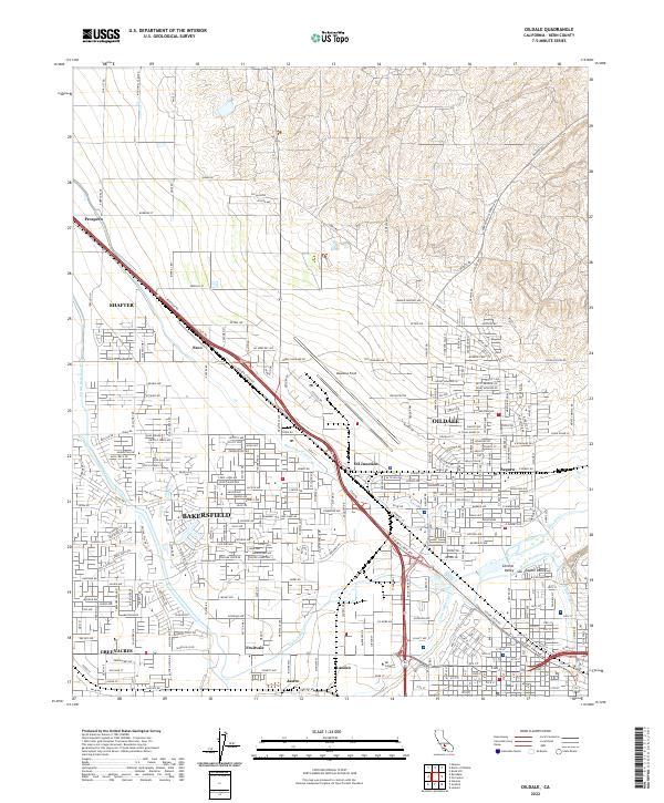 2022 Oildale2022 Print · USGSThe northern reaches of Bakersfield are shown in contemporary detail, capturing the intersection of major irrigation projects and oil industry transit. Researchers can trace historic locales like Oildale and Fruitvale or locate regional landmarks such as Meadows Field.
End of results
Showing maps 1-9 of 9
Top cities near Bakersfield
Top neighborhoods of Bakersfield
- Quailwood historical maps
- Kern historical maps
- Wible Orchard historical maps
- Kern City historical maps
- The Polo Greens historical maps
Frequently asked questions
- What are the different types of historical maps available for Bakersfield?
- What is the oldest map of Bakersfield?
- Where can I purchase historical maps of Bakersfield for my home or office?
- Where can I download high-res historical maps of Bakersfield?
- Are there historical topographic maps available for Bakersfield?
- Is there historical aerial imagery available for Bakersfield?
- Where are historical maps of Bakersfield sourced from?