1920s Maps of Los Angeles, California
Explore 40 historic maps of Los Angeles from the 1920s. These maps offer a rare glimpse into what life looked like during the 1920s — showing old roads, neighborhoods, homes, and landmarks that have changed or disappeared over time.
Whether you're researching your family's past, planning a metal detecting trip, or studying how Los Angeles's landscape evolved across the 1920s, these high-resolution maps are a powerful tool for exploring the history of this region.
- Focus on a specific era: All maps on this page are from the 1920s, giving you a focused view of this time period.
- See what’s changed: Compare century-old streets, trails, and buildings to today's modern landscape using overlays and satellite layers.
- Research with precision: Use these maps for genealogy, historical research, land use analysis, or educational projects.
- View, download, or print: Maps are fully viewable online in high resolution, and can be downloaded or printed for your own records.
Start exploring Los Angeles's history through authentic maps from the 1920s. This is your window into the past.
Los Angeles, CA maps
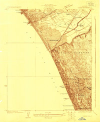
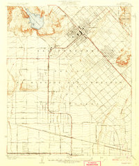
(40)- 1920 Map of Santa Monica
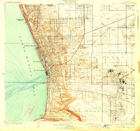
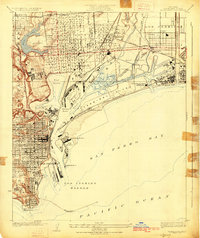
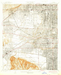
 1920 Santa Monica1920 Print · USGSThe Los Angeles basin and San Fernando Valley are captured here just after the war as agriculture gives way to early suburban sprawl. Genealogists and historians can trace the early grids of Beverly Hills, Sawtelle, and Van Nuys alongside the sprawling Salt Lake Oil Fields.
 - 1921 Map of Santa Monica
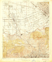
 1921 Santa Monica1921 Print · USGSLos Angeles and the San Fernando Valley are captured here just as the suburban boom began to accelerate. Genealogists and researchers can trace the rail-connected origins of Lankershim, Universal City, and the Salt Lake Oil Fields.3 unique versions available
 - 1923 Map of Venice
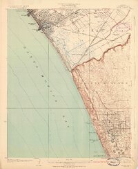
 1923 Venice1923 Print · USGSThe Los Angeles coastline was a mix of seaside resorts and industrial pioneers in the early twenties. Genealogists and historians can trace early residential blocks in Venice or locate vanished landmarks like the Del Rey Gun Club and the Standard Oil Refinery.
 - 1923 Map of Wilmington
 1923 Wilmington1923 Print · USGSThe Los Angeles waterfront was a hub of rapid industrial and military growth in the early twenties. Genealogists and historians can trace the early rail yards of the Pacific Electric, the footprint of Fort Mc Arthur Lower Res, and the busy wharves of Fish Harbor.
 - 1923 Map of Watts
 1923 Watts1923 Print · USGSSouth-central Los Angeles is seen here during its mid-twenties transition into a major metropolitan corridor. Researchers can trace early street grids and rail lines through the City of Watts, Lynwood, and schools like Willowbrook School.
 - 1924 Map of Alhambra
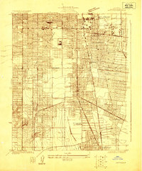
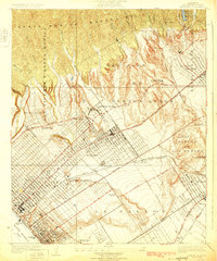
 1924 Alhambra1924 Print · USGSThe Los Angeles basin is captured here during the mid-twenties as streetcar suburbs and oil derricks began to reshape the landscape. Genealogists and researchers can trace early neighborhoods like Belvidere Gardens or locate family sites near Evergreen Cem and Granada School.
 - 1924 Map of Inglewood
 1924 Inglewood1924 Print · USGSCoastal Los Angeles County is seen in the mid-twenties as the oil and rail industries reshaped the land. Trace early schools and industrial roots like the Standard Oil Company, the Naval Radio Sta, and the Pacific Electric lines.
 - 1924 Map of Torrance
 1924 Torrance1924 Print · USGSThe South Bay of Los Angeles is captured here in the mid-1920s as coastal resort towns and industrial hubs like Torrance began to flourish. Researchers can trace the early rail-driven economy through the Pacific Electric Car Shops, Llewellyn Iron Works, and the seaside Pacific Electric Pier.2 unique versions available
 - 1924 Map of Van Nuys
 1924 Van Nuys1924 Print · USGSThe San Fernando Valley is shown in the mid-1920s as early citrus groves and ranch lands began giving way to organized town grids. Researchers can trace the original routes of the Pacific Electric and find landmarks like the Encino Country Club and Guernsey.
 - 1924 Map of Venice
 1924 Venice1924 Print · USGSThe Los Angeles coastline in the mid-twenties shows a rapidly developing landscape of seaside piers and industrial refineries. Trace early transit routes along the Pacific Electric railway and locate vanished landmarks like the Motordrome or the Recreation Gun Club.3 unique versions available
 - 1924 Map of Compton
 1924 Compton1924 Print · USGSThe Los Angeles basin near Compton and Gardena was a landscape of citrus groves and oil derricks in the mid-twenties. Genealogists and researchers can trace local landmarks like the Woodlawn Cemetery, the Dominguez Ranch, and schools including Carson School.
 - 1924 Map of Hollywood
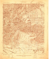
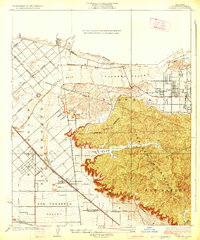
 1924 Hollywood1924 Print · USGSLos Angeles and Hollywood are captured during a decade of explosive growth, when oil derricks and electric rail lines still dominated the landscape. Genealogists and transit historians can trace the Pacific Electric Santa Monica Line through Beverly Hills and locate early landmarks like Fairfax School.
 - 1924 Map of Watts
 1924 Watts1924 Print · USGSSouth Los Angeles and its neighboring industrial suburbs come to life in the mid-1920s as a burgeoning network of rail lines and residential grids. Researchers can trace early school sites like Willowbrook School and large-scale industrial landmarks including the Goodyear Rubber Co.2 unique versions available
 - 1925 Map of Sawtelle
 1925 Sawtelle1925 Print · USGSWest Los Angeles in the mid-twenties shows a landscape of grand ranchos and early suburban grids. You can trace the Pacific Electric rail lines connecting Sawtelle and Beverley Hills or locate the sprawling Soldiers Home and its cemetery.2 unique versions available
 - 1925 Map of Wilmington
 1925 Wilmington1925 Print · USGSThe harbor district and Palos Verdes foothills come alive in this mid-twenties survey of a rapidly industrializing coastline. Trace the early maritime infrastructure of Wilmington and San Pedro, from the Canal St Sta to the Fish Harbor and Terminal Island.3 unique versions available
 - 1925 Map of San Pedro Hills
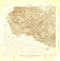 1925 San Pedro Hills1925 Print · USGSThe Palos Verdes Peninsula is captured during the mid-twenties, showing a landscape of dramatic coastal bluffs and early hilltop developments. Trace early roads and land use at the Palos Verdes Club and the coastal settlements of San Pedro and Walteria.
 - 1925 Map of Sylmar
 1925 Sylmar1925 Print · USGSThe northern San Fernando Valley is captured here in the mid-twenties, showing a landscape of emerging infrastructure and public institutions. Trace early water and power networks at the Upper San Fernando Reservoir or locate local landmarks like the El Retiro School for Girls and Sylmar.
 - 1925 Map of Chatsworth
 1925 Chatsworth1925 Print · USGSThe western San Fernando Valley appears here in the mid-1920s as a landscape of new reservoirs and expanding rail lines. Genealogists and local historians can trace the early streets of Chatsworth, the grounds of Oakwood Cemetery, and the historic El Escorpion tract.
 - 1926 Map of Van Nuys
 1926 Van Nuys1926 Print · USGSThe San Fernando Valley is shown during its mid-twenties growth, before the post-war suburban boom transformed its citrus and ranch lands. Trace the early townites of Van Nuys and Encino, or follow the winding Mulholland Highway through the Santa Monica Mountains.4 unique versions available
 - 1926 Map of Hollywood
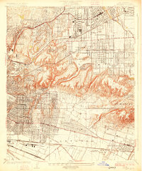
 1926 Hollywood1926 Print · USGSMid-1920s Los Angeles is captured here during a period of incredible growth, where extensive oil fields and interurban rail lines still defined the landscape. Genealogists and historians can trace the early development of Beverly Hills, the dense Oil Wells of La Brea, and the grounds of the Hollywood Cemetery.2 unique versions available
 - 1926 Map of Burbank
 1926 Burbank1926 Print · USGSThe San Fernando Valley was transitioning from orchards to suburbs in the mid-twenties. Genealogists and historians can trace the early layouts of Lankershim, Universal City, and the Hollywood Bowl as the city boundary pushed north.3 unique versions available
 - 1926 Map of Sunland
 1926 Sunland1926 Print · USGSThe northern San Fernando Valley and Tujunga foothills appear here in the mid-twenties, just as early transit and utility lines began shaping the basin. Trace the original tracks of the Southern Pacific San Fernando Line and early settlements like Sunland and Roscoe.2 unique versions available
 - 1926 Map of Alhambra
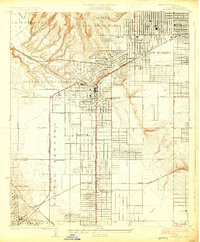
 1926 Alhambra1926 Print · USGSAlhambra and its neighboring suburbs in the mid-twenties show a landscape transitioning from rural ranchos to dense residential grids. Genealogists and historians can trace family locations near San Gabriel Mission, Evergreen Cemetery, and early schools like Granada School.4 unique versions available
 - 1927 Map of Chatsworth
 1927 Chatsworth1927 Print · USGSIn the mid-1920s, the western San Fernando Valley was a landscape of emerging townsets and critical water infrastructure. Trace early street grids and rail lines near Chatsworth, Owensmouth, and the Chatsworth Reservoir.
 - 1927 Map of Pacoima
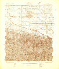
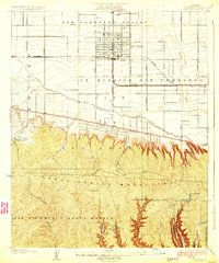
 1927 Pacoima1927 Print · USGSThe northern San Fernando Valley is seen here during the mid-1920s as early citrus groves and ranch lands began giving way to a modern street grid. Researchers can trace the layout of early communities like Mission Acres and Pacoima or locate the historic grounds of the San Fernando Mission.4 unique versions available
Showing maps 1-25 of 40
Top cities near Los Angeles
- Long Beach historical maps
- Glendale historical maps
- Torrance historical maps
- Pasadena historical maps
- Simi Valley historical maps
- Inglewood historical maps
See more
Top neighborhoods of Los Angeles
- Pacific Palisades historical maps
- Harbor Pines historical maps
- Dana Strand Village historical maps
- Los Angeles Eco Village historical maps
- Thenard historical maps
- Studio City Neighborhood Council District historical maps
See more
Frequently asked questions
- What are the different types of historical maps available for Los Angeles?
- What is the oldest map of Los Angeles?
- Where can I purchase historical maps of Los Angeles for my home or office?
- Where can I download high-res historical maps of Los Angeles?
- Are there historical topographic maps available for Los Angeles?
- Is there historical aerial imagery available for Los Angeles?
- Where are historical maps of Los Angeles sourced from?