1950s Maps of Los Angeles, California
Explore 25 historic maps of Los Angeles from the 1950s. These maps offer a rare glimpse into what life looked like during the 1950s — showing old roads, neighborhoods, homes, and landmarks that have changed or disappeared over time.
Whether you're researching your family's past, planning a metal detecting trip, or studying how Los Angeles's landscape evolved across the 1950s, these high-resolution maps are a powerful tool for exploring the history of this region.
- Focus on a specific era: All maps on this page are from the 1950s, giving you a focused view of this time period.
- See what’s changed: Compare century-old streets, trails, and buildings to today's modern landscape using overlays and satellite layers.
- Research with precision: Use these maps for genealogy, historical research, land use analysis, or educational projects.
- View, download, or print: Maps are fully viewable online in high resolution, and can be downloaded or printed for your own records.
Start exploring Los Angeles's history through authentic maps from the 1950s. This is your window into the past.
Los Angeles, CA maps
(25)- 1950 Map of Beverly Hills, 1952 Print
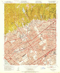 1950 Beverly Hills1952 Print · USGSBeverly Hills and the Westside are captured during a period of rapid post-war expansion along the base of the Santa Monica Mountains. Researchers can trace the legacy of the Soldiers Home, the early campus of UCLA, and the Pacific Electric rail lines.4 unique versions available
 - 1950 Map of Venice, 1952 Print
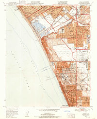 1950 Venice1952 Print · USGSThe Westside and South Bay are captured here during the post-war building boom, showing the early footprint of Los Angeles International Airport. Researchers can trace the era's infrastructure through the Pacific Electric lines, old schools like Venice High Sch, and the now-defunct Culver City Airport.2 unique versions available
 - 1950 Map of Inglewood, 1957 Print
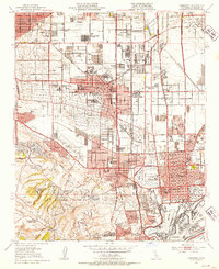
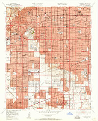 1950 Inglewood1957 Print · USGSMid-century Los Angeles County is captured here during a period of intense postwar suburban and industrial growth. Genealogists and local historians can trace the foundations of Inglewood and Hawthorne, locating landmarks like the Inglewood Park Cemetery and the Gardena Valley Airport.
 - 1951 Map of Santa Susana, 1952 Print
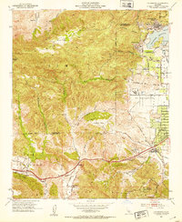
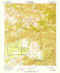 1951 Santa Susana1952 Print · USGSSimi Valley and the surrounding mountains are captured here in the early fifties, showing the region before modern suburban expansion. Researchers can trace ranching history at Tapo Ranch, locate the Santa Susana Airport, or follow the Southern Pacific line through the Santa Susana Tunnel.6 unique versions available
 - 1951 Map of San Pedro, 1953 Print
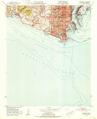 1951 San Pedro1953 Print · USGSCoastal Los Angeles at the dawn of the fifties shows a high-density harbor and military landscape. Trace the strategic layout of Fort Mac Arthur, the industrial works on Terminal Island, and family landmarks like Holy Trinity Sch.2 unique versions available
 - 1951 Map of Torrance, 1953 Print
 1951 Torrance1953 Print · USGSThe South Bay transitioned from an oil-rich landscape to a suburban powerhouse during the early fifties. Genealogists and historians can trace mid-century neighborhoods like Avalon Village and local institutions such as Los Angeles Harbor Junior College.2 unique versions available
 - 1952 Map of Inglewood
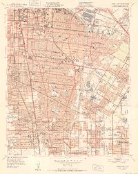
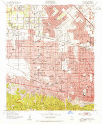
 1952 Inglewood1952 Print · USGSMid-century Los Angeles County undergoes massive post-war expansion across the South Bay and Centinela Valley. Genealogists can locate family homes near Hollywood Park, Inglewood Park Cemetery, and the Gardena Valley Airport.
 - 1952 Map of South gate
 1952 South gate1952 Print · USGSSoutheast Los Angeles is shown in the early fifties as the industrial heart of the region, where a complex network of rail and river corridors fueled rapid growth. Researchers can trace family roots at the Russian Molokan Cem or find local landmarks like St Mathias Sch and Mission Hosp.
 - 1952 Map of Calabasas, 1953 Print
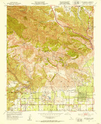
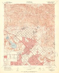
 1952 Calabasas1953 Print · USGSThe western San Fernando Valley meets the Simi Hills in the early fifties, showing a landscape of foothill ranching and early canyon communities. Genealogists can locate family landmarks like Chatsworth Lake Manor, the L A Pet Cemetery, and Las Virgenes School.9 unique versions available
 - 1952 Map of Oat Mountain, 1953 Print
 1952 Oat Mountain1953 Print · USGSThe northwest San Fernando Valley met the rugged Santa Susana range in the early fifties, just as citrus groves gave way to suburban tracts. Researchers can trace the legendary Iverson Ranch film location, the historic Southern Pacific rail tunnel, and the Oakwood Cem grounds.8 unique versions available
 - 1952 Map of Topanga, 1953 Print
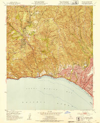 1952 Topanga1953 Print · USGSCoastal Los Angeles and the adjacent canyon country appear in the early fifties as the region began its mid-century transformation. Researchers can trace the development of Pacific Palisades, the grounds of Will Rogers State Park, and rural landmarks like Trippet Ranch.8 unique versions available
 - 1952 Map of Canoga Park, 1954 Print
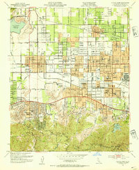 1952 Canoga Park1954 Print · USGSThe San Fernando Valley is shown during its post-war growth, transitioning from citrus groves and ranches to a bustling suburban grid. Genealogists and historians can locate dozens of mid-century schools, the Southern Pacific line, and sites like the RKO Ranch.7 unique versions available
 - 1953 Map of San Fernando, 1954 Print
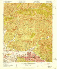
 1953 San Fernando1954 Print · USGSThe San Fernando Valley meets the mountains in the early fifties during a period of rapid suburban and industrial expansion. Genealogists and local historians can trace the San Fernando Mission, find the Whiteman Air Park, and locate long-standing medical institutions like the Olive View Sanatorium.3 unique versions available
 - 1953 Map of Sunland, 1954 Print
 1953 Sunland1954 Print · USGSThe Tujunga Valley and southern San Gabriel foothills are captured in the early 1950s, showing a mix of suburban growth and mountain ranching. Researchers can trace old family holdings like Dillon Ranch, local schools such as Plainview Ave School, and the industrial remains of the Mining Mill (Ruins).2 unique versions available
 - 1953 Map of Hollywood, 1955 Print
 1953 Hollywood1955 Print · USGSMid-century Los Angeles is captured in its post-war prime, from the studio lots of Hollywood to the rising residential hills. Genealogists and historians can trace the foundations of the film industry through RKO Studios, find family landmarks like Rosedale Cemetery, or locate vanished athletic venues such as the original Wrigley Field.2 unique versions available
 - 1953 Map of Van Nuys, 1955 Print
 1953 Van Nuys1955 Print · USGSThe San Fernando Valley enters its boom years in the early fifties, showing the transition from agricultural land to iconic suburban neighborhoods. Trace the early footprints of REPUBLIC STUDIO, the LOCKHEED AIR TERMINAL, and neighborhood landmarks like WAR MEMORIAL PARK.2 unique versions available
 - 1953 Map of Burbank, 1955 Print
 1953 Burbank1955 Print · USGSThe San Fernando Valley enters its mid-century boom in this 1950s survey of Burbank and its industrial neighbors. Trace the roots of the entertainment industry at the Walt Disney Studio or explore aviation landmarks like Lockheed Air Terminal.2 unique versions available
 - 1953 Map of Pasadena, 1955 Print
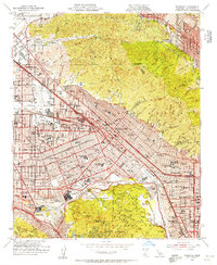
 1953 Pasadena1955 Print · USGSThe foothills of the San Gabriel Mountains meet the mid-century sprawl of Los Angeles in this detailed record of the 1950s. Genealogists and historians can locate dozens of institutions like Occidental College, Mt Lowe Military Academy, and the Rose Bowl.3 unique versions available
 - 1953 Map of Los Angeles, 1956 Print
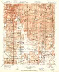
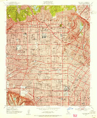
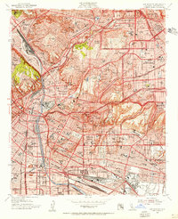 1953 Los Angeles1956 Print · USGSMid-century Los Angeles is captured here during a period of massive infrastructure growth and urban density. Genealogists and researchers can trace family roots through numerous neighborhood landmarks like Evergreen Cem, Garfield High Sch, and All Souls School.
 - 1955 Map of Los Angeles
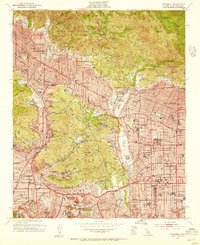
 1955 Los Angeles1955 Print · USGSThe mid-century transformation of Southern California comes into focus as the urban sprawl of Los Angeles meets the wilderness of the Santa Monica Mountains. Researchers can trace the development of post-war suburbs alongside historic landmarks like the Santa Barbara Lighthouse and early industrial sites such as the Good Luck Mine.
 - 1957 Map of Long Beach
 1957 Long Beach1957 Print · USGSThe Los Angeles coast and the Channel Islands appear here during the mid-fifties era of rapid suburbanization and naval expansion. Genealogists and researchers can locate early industrial neighborhoods like South Gate and trace military boundaries at Ft MacArthur Upper Reservation or the remote San Nicolas Island.4 unique versions available
 - 1958 Map of Long Beach
 1958 Long Beach1958 Print · USGSCoastal Southern California is shown during a mid-century period of intense suburbanization and military readiness. Genealogists and historians can trace the growth of Long Beach, identify early neighborhoods in Lakewood Village, or locate the bounds of Ft MacArthur Lower Reservation.
 - 1959 Map of Condor Peak
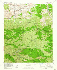
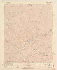 1959 Condor Peak1959 Print · USGSAngeles National Forest in the late fifties was a landscape of rugged canyons and mountain retreats within the San Gabriel range. You can trace the development of the Big Tujunga Dam or locate seasonal sites like the Burbank YMCA Camp and the Lodestone Mine.7 unique versions available
 - 1959 Map of Los Angeles
 1959 Los Angeles1959 Print · USGSCoastal California and the high desert met in a period of booming growth after the war. Researchers can trace early aviation and military history at the Point Mugu Air Missile Test Ctr or locate desert mining sites like the Double Eagle Mine.3 unique versions available
 - 1959 Map of Acton, 1961 Print
 1959 Acton1961 Print · USGSIn the late fifties, the high country north of Los Angeles balanced a legacy of mining with a new era of forestry and recreation. Map researchers can trace mountain history through sites like the Monte Cristo Mine, Switzers Camp, and the Loomis Ranch.3 unique versions available
End of results
Showing maps 1-25 of 25
Top cities near Los Angeles
- Long Beach historical maps
- Glendale historical maps
- Torrance historical maps
- Pasadena historical maps
- Simi Valley historical maps
- Inglewood historical maps
See more
Top neighborhoods of Los Angeles
- Pacific Palisades historical maps
- Harbor Pines historical maps
- Dana Strand Village historical maps
- Los Angeles Eco Village historical maps
- Thenard historical maps
- Studio City Neighborhood Council District historical maps
See more
Frequently asked questions
- What are the different types of historical maps available for Los Angeles?
- What is the oldest map of Los Angeles?
- Where can I purchase historical maps of Los Angeles for my home or office?
- Where can I download high-res historical maps of Los Angeles?
- Are there historical topographic maps available for Los Angeles?
- Is there historical aerial imagery available for Los Angeles?
- Where are historical maps of Los Angeles sourced from?