1950s Maps of Riverside County, California
Explore 116 historic maps of Riverside County from the 1950s. These maps offer a rare glimpse into what life looked like during the 1950s — showing old roads, neighborhoods, homes, and landmarks that have changed or disappeared over time.
Whether you're researching your family's past, planning a metal detecting trip, or studying how Riverside County's landscape evolved across the 1950s, these high-resolution maps are a powerful tool for exploring the history of this region.
- Focus on a specific era: All maps on this page are from the 1950s, giving you a focused view of this time period.
- See what’s changed: Compare century-old streets, trails, and buildings to today's modern landscape using overlays and satellite layers.
- Research with precision: Use these maps for genealogy, historical research, land use analysis, or educational projects.
- View, download, or print: Maps are fully viewable online in high resolution, and can be downloaded or printed for your own records.
Start exploring Riverside County's history through authentic maps from the 1950s. This is your window into the past.
Riverside County, CA maps
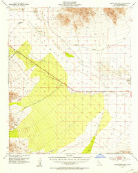
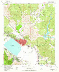
(116)- 1950 Map of Prado Dam
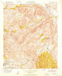
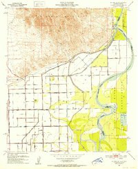
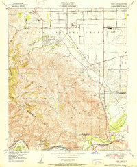 1950 Prado Dam1950 Print · USGSThe Prado Dam area at the start of the 1950s shows a unique mix of institutional expansion, aviation history, and flood control. Local researchers can trace the Cal-Aero Flight Academy, the California Institution for Men, and the Rancho Santa Ana Botanic Gardens.
 - 1950 Map of Parker
 1950 Parker1950 Print · USGSThe Lower Colorado River valley in the mid-century shows a landscape defined by massive water projects and tribal lands. Researchers can trace the Colorado River Indian Reservation boundary, the Headgate Rock Dam, and desert mining at the Blue Cloud Mine.2 unique versions available
 - 1950 Map of Pechanga
 1950 Pechanga1950 Print · USGSThe Riverside and San Diego county line in the mid-century is defined by its deep tribal history and gem-mining industry. Genealogists and historians can trace local family landmarks like Pauba Ranch, the San Gabriel Church, and the Pala Chief Mine.2 unique versions available
 - 1950 Map of Vidal
 1950 Vidal1950 Print · USGSIn the California desert during the early fifties, the rail and water networks converged at the crossing of the San Bernardino Base Line. Trace the sites of desert mining operations like the Jacklin Mine or visit the remote Vidal Junction and the railroad stop at Grommet.2 unique versions available
 - 1950 Map of Temecula
 1950 Temecula1950 Print · USGSSouthern California's inland ranching country is captured here at mid-century, spanning the border of Riverside and San Diego counties. Genealogists and local historians can trace legacy holdings like Royal Oak Ranch and find early community markers such as the Vallecitos School and Rainbow.
 - 1950 Map of Black Star Canyon
 1950 Black Star Canyon1950 Print · USGSThe Orange and Riverside County line was defined by steep canyons and mining prospects at mid-century. Researchers can trace early industrial footprints at the Black Star Coal Mine (Inactive) or locate the Hidden Ranch near the Main Divide Motorway.
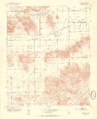
 - 1951 Map of Big Maria Mts, 1952 Print
 1951 Big Maria Mts1952 Print · USGSThe Colorado River desert frontier in the early fifties reveals a landscape of high peaks and isolated riverside outposts. Researchers can trace the Atchison Topeka and Santa Fe railroad line and locate riverside sites like River Bend Lodge and Hills Ranch.3 unique versions available
 - 1951 Map of Blythe, 1952 Print
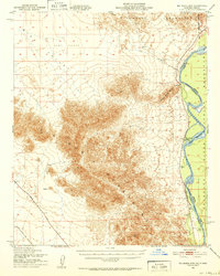
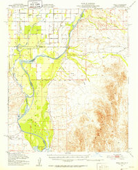
 1951 Blythe1952 Print · USGSThe Palo Verde Valley thrives as a desert agricultural hub in the early fifties, anchored by the river and the rail. Genealogists can trace the early footprints of Blythe and Ehrenberg, while researchers can follow the Atchison Topeka and Santa Fe line and the intricate levees of the Colorado River.6 unique versions available
 - 1951 Map of McCoy Wash, 1952 Print
 1951 McCoy Wash1952 Print · USGSThe Palo Verde Valley was undergoing significant agricultural expansion in the early fifties as desert mesas were reclaimed through complex irrigation. Researchers can trace the original footprint of Mesaville, the Palo Verde High School and Junior College, and the sprawling Blythe Airport.6 unique versions available
 - 1951 Map of Blythe NE, 1952 Print
 1951 Blythe NE1952 Print · USGSThe Palo Verde Valley meets the Arizona border at mid-century, where desert agriculture depends entirely on the proximity of the river. Genealogists and researchers can trace the remnants of Fertilla (Ruins), visit the Palo Verde Cemetery, and locate the Palo Verde Intake along the Colorado River.4 unique versions available
 - 1951 Map of Cibola, 1952 Print
 1951 Cibola1952 Print · USGSThe Colorado River borderlands in the early fifties are captured here as agriculture and mining define the local economy. Genealogists and historians can trace the legacy of Cibola, locate the Hart Gold Mine, or identify vanished landmarks like Taylor Ferry (Site).3 unique versions available
 - 1952 Map of Warner Springs
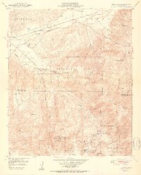
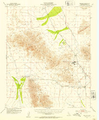
 1952 Warner Springs1952 Print · USGSThe high back-country of northern San Diego County is captured here in the early fifties, showing the mountain valleys before modern expansion. Researchers can trace remote settlements and desert outposts like San Ignacio, Combs Camp, and the legendary Warner Springs near the shores of Lake Henshaw.
 - 1952 Map of Agua Dulce
 1952 Agua Dulce1952 Print · USGSThe Coachella Valley and Santa Rosa Mountains are depicted here in the early fifties as desert travel and local industry expanded. Researchers can trace historic routes like the Truckhaven Trail and locate early landmarks such as the Flemming Saw Mill or Oasis Sch.
 - 1952 Map of Mule Wash, 1953 Print
 1952 Mule Wash1953 Print · USGSThe desert borderlands between California and Arizona come alive in this mid-century survey of the river and range. Researchers can trace the winding Colorado River and remote access points like Cibola Road and the Landing Strip.
 - 1952 Map of Midland, 1953 Print
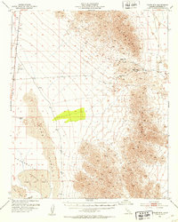
 1952 Midland1953 Print · USGSRiverside County's desert mining industry is at its height in the early fifties, centered on the company town of Midland. Historians and genealogists can trace the rail-and-mine network through the Eagle Nest Mines, Styx station, and the Black Jack Tunnel.4 unique versions available
 - 1952 Map of Mc Coy Spring, 1953 Print
 1952 Mc Coy Spring1953 Print · USGSThe Riverside County desert comes into focus during the early fifties, showing the vital watering holes of the Chuckwalla Valley. Researchers can trace the locations of Hopkins Well, the Roosevelt Mine, and the high ridges of the Mc Coy Mountains.3 unique versions available
 - 1952 Map of Sidewinder Well, 1953 Print
 1952 Sidewinder Well1953 Print · USGSRiverside County’s desert interior was a landscape of mining and infrastructure during the early fifties. Researchers can trace the routes of Corn Springs Road and locate remote operations like Aztec Mines or the essential Sidewinder Well.3 unique versions available
 - 1952 Map of Palen Mountains, 1953 Print
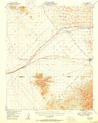
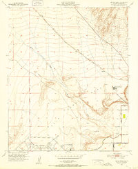
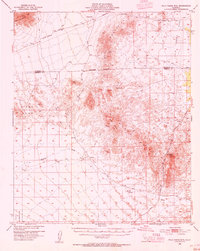
 1952 Palen Mountains1953 Print · USGSRiverside County’s high desert interior is shown here in the early fifties, centering on the remote corridor between the Granite Mountains and the valley floor. Researchers can trace infrastructure and early settlements like the Colorado River Aqueduct and Circle E Ranch.4 unique versions available
 - 1952 Map of Palo Verde, 1953 Print
 1952 Palo Verde1953 Print · USGSThe Palo Verde Valley on the California-Arizona border reveals an intricate mid-century irrigation network as farming expanded. Trace the footprints of Rannells (Site) and Taylor Ferry (Site) along the banks of the Colorado River.3 unique versions available
 - 1952 Map of Ripley, 1953 Print
 1952 Ripley1953 Print · USGSMid-century Riverside County irrigation is captured here as a sprawling network of desert canals and rail lines. Trace the development of Ripley and Nicholls Warm Springs alongside landmarks like the Neighbors Community Farm Center and the Atchison Topeka and Santa Fe railway.3 unique versions available
 - 1953 Map of San Bernardino
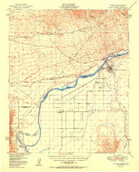
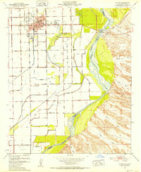
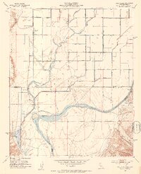
 1953 San Bernardino1953 Print · USGSSouthern California underwent massive post-war growth as suburban sprawl reached the foothills of the San Bernardino Mountains. Genealogists and historians can trace the rail-and-road roots of the Inland Empire through the Union Pacific RR and Lake Arrowhead resorts.2 unique versions available
 - 1953 Map of Elsinore
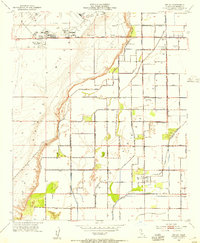
 1953 Elsinore1953 Print · USGSRiverside County in the early fifties shows a landscape of mining, rail, and lakeside growth. Genealogists and historians can trace the footprint of Elsinore and Lakeland Village, locate the Good Hope Mine, or follow the Atchison Topeka and Santa Fe through Durant Siding.9 unique versions available
 - 1953 Map of Winchester, 1954 Print
 1953 Winchester1954 Print · USGSWinchester and the surrounding San Jacinto Valley are shown in the early 1950s as the regional infrastructure began to modernize. Researchers can trace the path of the Atchison Topeka and Santa Fe railroad or locate landmarks like Ryan Field and the local Cem.7 unique versions available
 - 1953 Map of Beaumont, 1954 Print
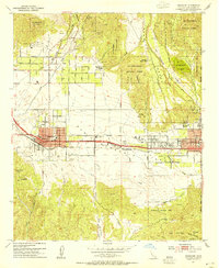 1953 Beaumont1954 Print · USGSThe San Gorgonio Pass area thrived in the early fifties as a vital transportation and agricultural hub between the peaks. Researchers can trace the mid-century layout of Beaumont and Banning, locating local landmarks like Sunnyslope Cemetery, the Southern Pacific rail line, and St Boniface School.10 unique versions available
 - 1953 Map of Palo Verde Mountains, 1954 Print
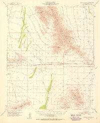
 1953 Palo Verde Mountains1954 Print · USGSThe Colorado Desert during the early 1950s reveals a landscape of volcanic peaks and historic travel corridors. You can trace the route of the Butterfield Stage Line, find the Geode Beds, and locate isolated prospects near Palo Verde Peak.5 unique versions available
Showing maps 1-25 of 116
Top cities of Riverside County
- Riverside historical maps
- Moreno Valley historical maps
- Corona historical maps
- Murrieta historical maps
- Temecula historical maps
- Jurupa Valley historical maps
See more
Frequently asked questions
- What are the different types of historical maps available for Riverside County?
- What is the oldest map of Riverside County?
- Where can I purchase historical maps of Riverside County for my home or office?
- Where can I download high-res historical maps of Riverside County?
- Are there historical topographic maps available for Riverside County?
- Is there historical aerial imagery available for Riverside County?
- Where are historical maps of Riverside County sourced from?