2020s Maps of Riverside County, California
Explore 163 historic maps of Riverside County from the 2020s. These maps offer a rare glimpse into what life looked like during the 2020s — showing old roads, neighborhoods, homes, and landmarks that have changed or disappeared over time.
Whether you're researching your family's past, planning a metal detecting trip, or studying how Riverside County's landscape evolved across the 2020s, these high-resolution maps are a powerful tool for exploring the history of this region.
- Focus on a specific era: All maps on this page are from the 2020s, giving you a focused view of this time period.
- See what’s changed: Compare century-old streets, trails, and buildings to today's modern landscape using overlays and satellite layers.
- Research with precision: Use these maps for genealogy, historical research, land use analysis, or educational projects.
- View, download, or print: Maps are fully viewable online in high resolution, and can be downloaded or printed for your own records.
Start exploring Riverside County's history through authentic maps from the 2020s. This is your window into the past.
Riverside County, CA maps
(163)- 2021 Map of Mule Wash, 2021 Print
 2021 Mule Wash2021 Print · USGSThe Lower Colorado River desert comes into focus in this recent survey of the Arizona-California borderlands. Researchers can trace the drainage patterns of Mule Wash and Crazy Woman Wash or study the irrigation network of the Palo Verde Valley near LEVEE RD.
 - 2021 Map of Poston, 2021 Print
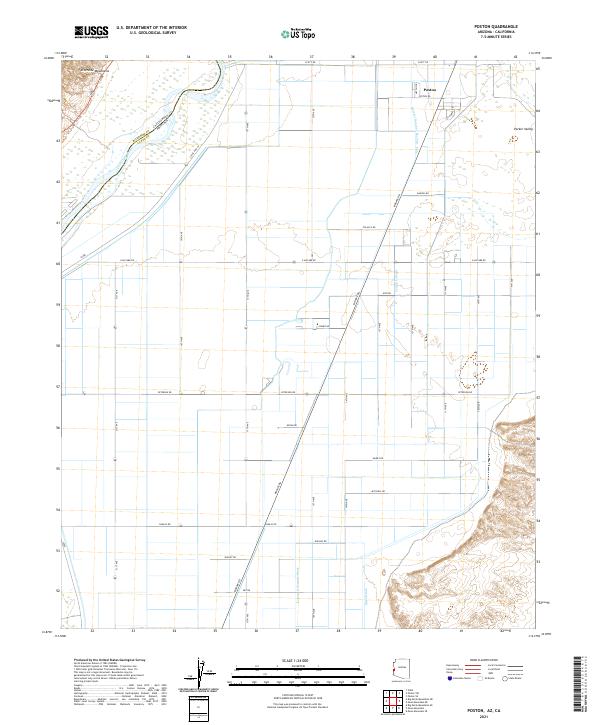 2021 Poston2021 Print · USGSPoston and the surrounding Parker Valley are shown in detail as they appeared in 2021. Genealogists and historians can trace the irrigation network from Leupp Lateral to Mesa Drain and locate local landmarks like 50 Homes Rd.
 - 2021 Map of La Paz Mountain, 2021 Print
 2021 La Paz Mountain2021 Print · USGSThe arid borderlands of Arizona and California are captured here in the early twenty-first century. Researchers can trace the desert topography through Sunshine Gulch, the heights of La Paz Mtn, and the course of Goodman Slough.
 - 2021 Map of Inca, 2021 Print
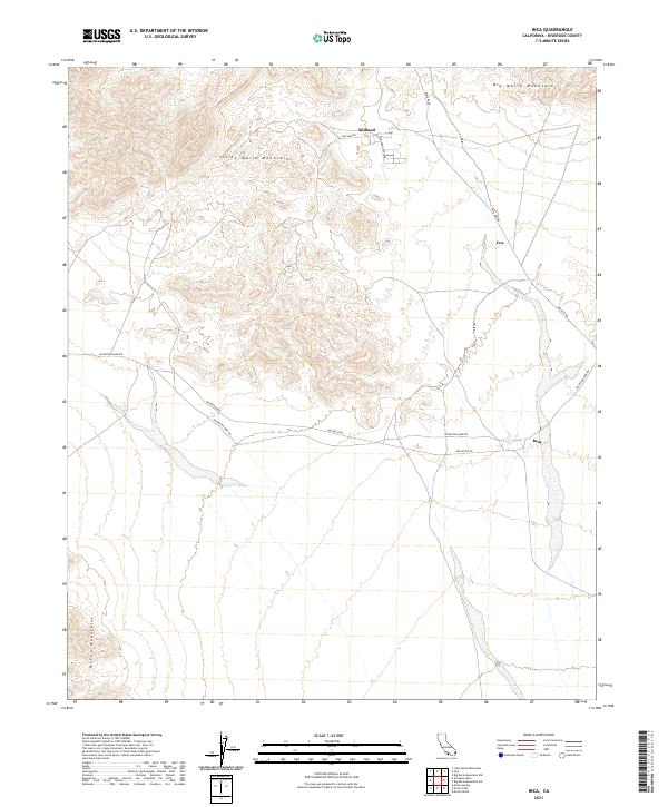 2021 Inca2021 Print · USGSRiverside County’s desert interior is captured in this recent survey, showcasing the mining and transport corridors of the Colorado Desert. Genealogists and historians can trace the roads around Midland and Inca, or follow the routes of Arlington Mine Rd and Midland Rd.
 - 2021 Map of Big Maria Mountains NE, 2021 Print
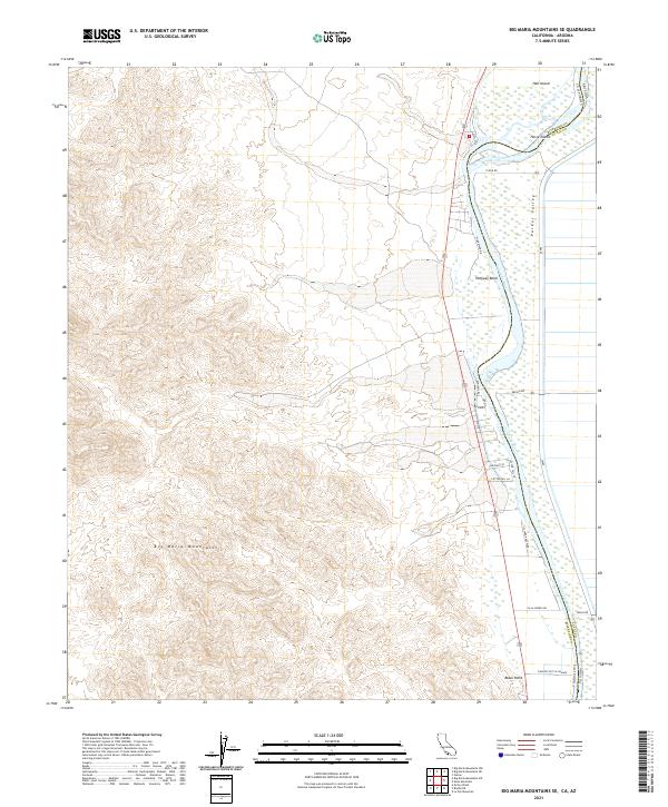
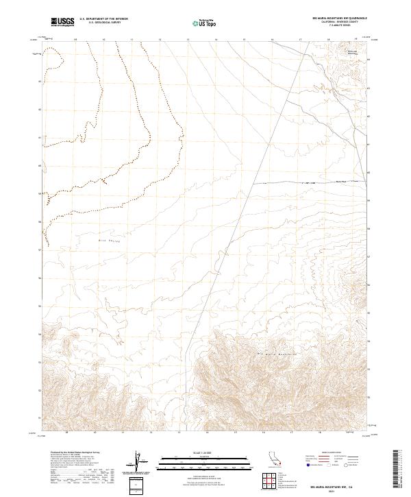
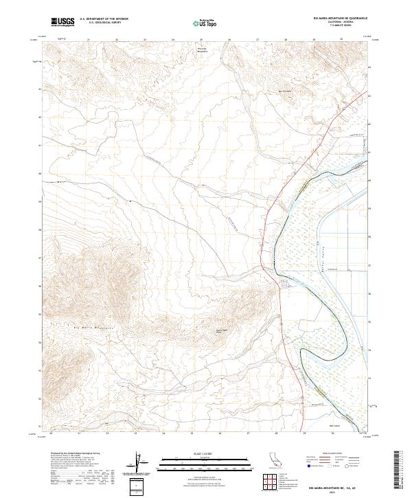 2021 Big Maria Mountains NE2021 Print · USGSThe Colorado River corridor between California and Arizona is documented here in 2021, showing where the Big Maria Mountains meet the Parker Valley. Trace desert routes like Old Blythe-Vidal Rd and river features such as Barrie Island.
 - 2021 Map of Styx, 2021 Print
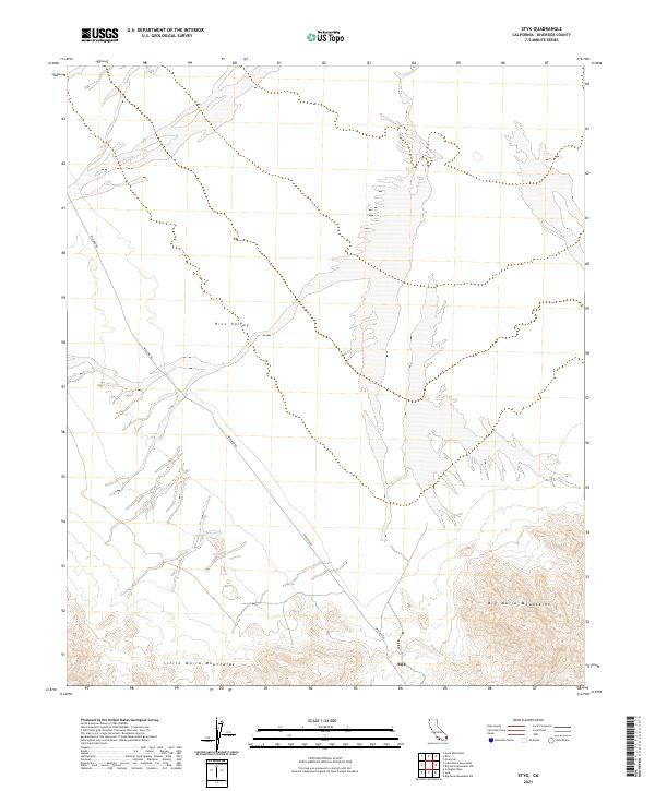 2021 Styx2021 Print · USGSStyx and the surrounding Riverside County desert are captured here in the early twenty-first century. Researchers can trace the path of Midland Rd through the alluvial plains of Rice Valley between the Big Maria Mountains and Little Maria Mountains.
 - 2021 Map of McCoy Wash, 2021 Print
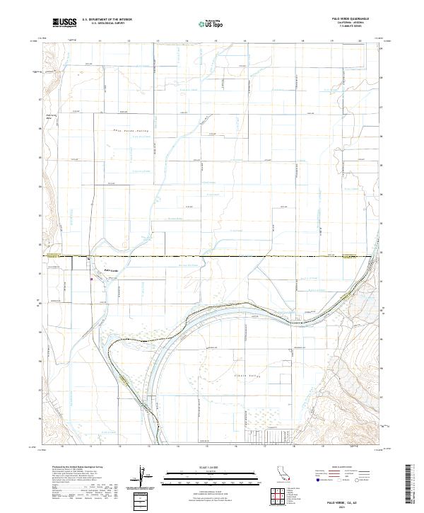
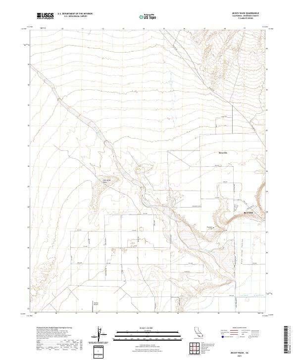 2021 McCoy Wash2021 Print · USGSThe Palo Verde Valley and the high mesa lands are shown in high detail at the start of the 2020s. Researchers can trace the layout of Blythe, the campus of Palo Verde College, and the drainage of McCoy Wash through the desert.
 - 2021 Map of Wiley Well, 2021 Print
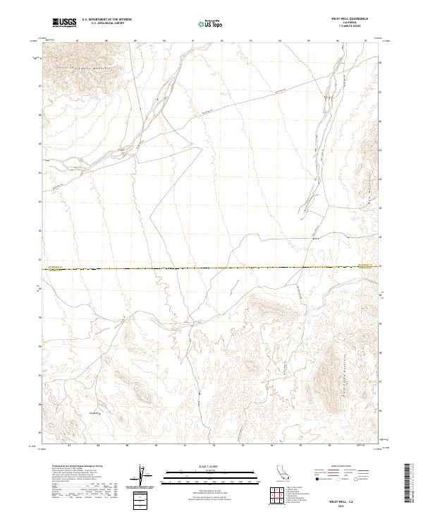 2021 Wiley Well2021 Print · USGSThe Colorado Desert backcountry near the Riverside and Imperial county line is mapped here in the early twenty-first century. Rockhounds and historians can trace the Bradshaw Trl toward the Geode Beds and Coon Hollow Campground.
 - 2021 Map of McCoy Spring, 2021 Print
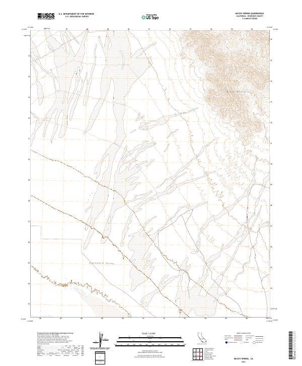 2021 McCoy Spring2021 Print · USGSThe Colorado Desert in the early 2020s remains a landscape of dramatic relief and vital water sources. Researchers can trace the high terrain of the McCoy Mountains and locate the secluded McCoy Spring overlooking the Chuckwalla Valley.
 - 2021 Map of Big Maria Mountains SE, 2021 Print
 2021 Big Maria Mountains SE2021 Print · USGSThe California and Arizona borderlands come into focus in 2021, showing the managed desert landscape along the Colorado River. Trace the development of Villa Shores Dr and Rancho Not So Grande against the backdrop of the Big Maria Mountains.
 - 2021 Map of Thumb Peak, 2021 Print
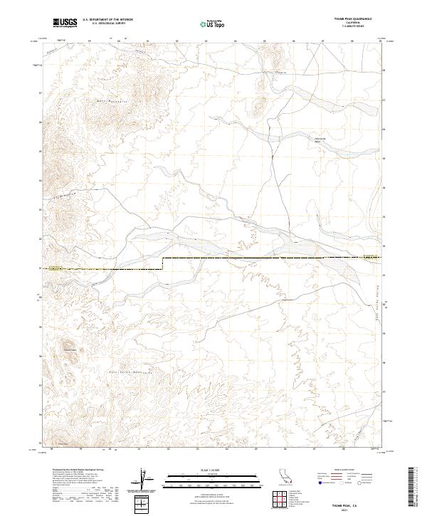 2021 Thumb Peak2021 Print · USGSThe high desert of Riverside and Imperial counties comes into focus in this recent study of the Mule Mountains and Palo Verde Mountains. You can trace the historic Bradshaw Trl and locate remote features like Clapp Spring and Thumb Peak.
 - 2021 Map of McCoy Peak, 2021 Print
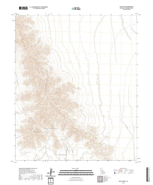 2021 McCoy Peak2021 Print · USGSThe McCoy Mountains rise out of the Chuckwalla Valley in this recent survey of the Riverside County desert. Researchers can trace remote access routes like Gas Line Rd and Black Creek Rd as they navigate the terrain around McCoy Peak.
 - 2021 Map of Big Maria Mountains NW, 2021 Print
 2021 Big Maria Mountains NW2021 Print · USGSThe California desert in the early twenty-first century reveals a stark landscape of broad basins and steep ranges. Researchers can trace the elevation changes from Rice Valley into the Big Maria Mountains and the Riverside Mountains.
 - 2021 Map of Little Maria Mountains, 2021 Print
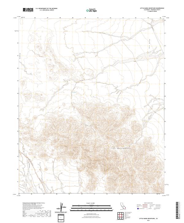 2021 Little Maria Mountains2021 Print · USGSRiverside County’s desert interior is documented here in the early twenty-first century, showcasing the intersection of high peaks and vast valleys. Modern researchers can trace remote routes like Palen Pass Rd and locate scarce water sources such as Tank Spring.
 - 2021 Map of Palo Verde, 2021 Print
 2021 Palo Verde2021 Print · USGSThe California-Arizona borderlands come into focus in this contemporary survey of the Colorado River basin. Researchers can trace the sophisticated irrigation network of the Palo Verde Valley and locate landmarks like Palo Verde Lagoon and the Bradshaw Trl.
 - 2021 Map of Blythe NE, 2021 Print
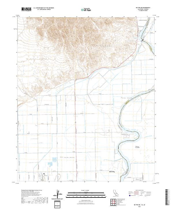 2021 Blythe NE2021 Print · USGSThe Colorado River valley at the California-Arizona border comes to life in this detailed 2021 survey of the desert and its managed wetlands. Map collectors and researchers can trace the intricate irrigation network of the Palo Verde Valley, finding the Palo Verde Cem and the winding Swallows Nest Bend.
 - 2021 Map of Arlington Mine, 2021 Print
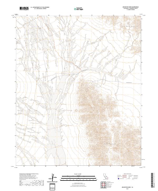 2021 Arlington Mine2021 Print · USGSIn the arid basins of Riverside County during the early twenty-first century, the desert landscape remains defined by its isolation and steep mountain ranges. Researchers can trace the rugged access routes to remote extraction sites via Arlington Mine Rd and the 66077: Palen Pass Trl.
 - 2021 Map of Hopkins Well, 2021 Print
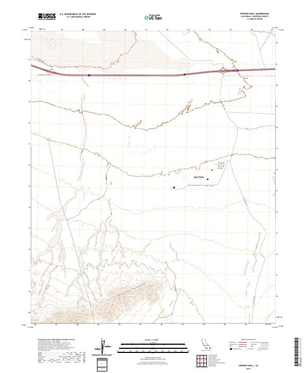 2021 Hopkins Well2021 Print · USGSRiverside County’s desert interior is captured here in the early 2020s, showing the intersection of remote transit routes and arid peaks. Trace the geography of the Little Chuckwalla Mountains and find markers for Blythe and Wileys Well Rd.
 - 2021 Map of Roosevelt Mine, 2021 Print
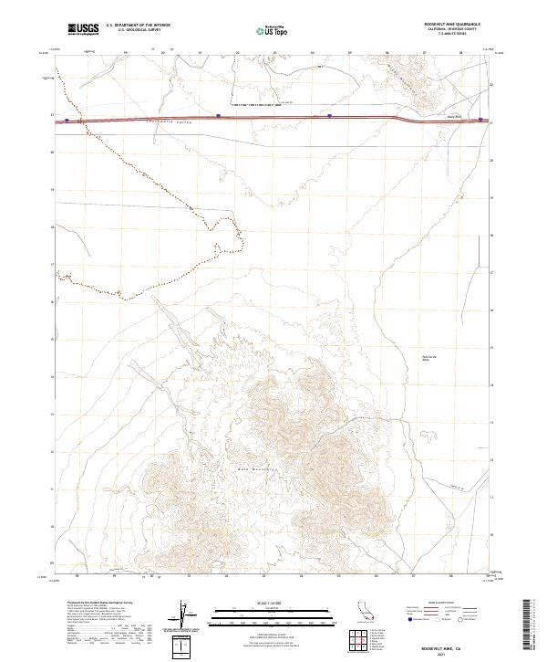 2021 Roosevelt Mine2021 Print · USGSThe arid basins and ranges of Riverside County appear here in the early twenty-first century, showing the intersection of historic desert routes and modern infrastructure. Researchers can trace the legacy of the Bradshaw Trl near the Mule Mountains and the settlement at Black Rock.
 - 2021 Map of Big Maria Mountains SW, 2021 Print
 2021 Big Maria Mountains SW2021 Print · USGSThe Colorado Desert landscape of eastern Riverside County is captured in this modern survey of the Big Maria Mountains. Local historians and explorers can trace backcountry routes like Midland Rd and Arlington Mine Rd as they pass Black Hill.
 - 2021 Map of Placer Canyon, 2021 Print
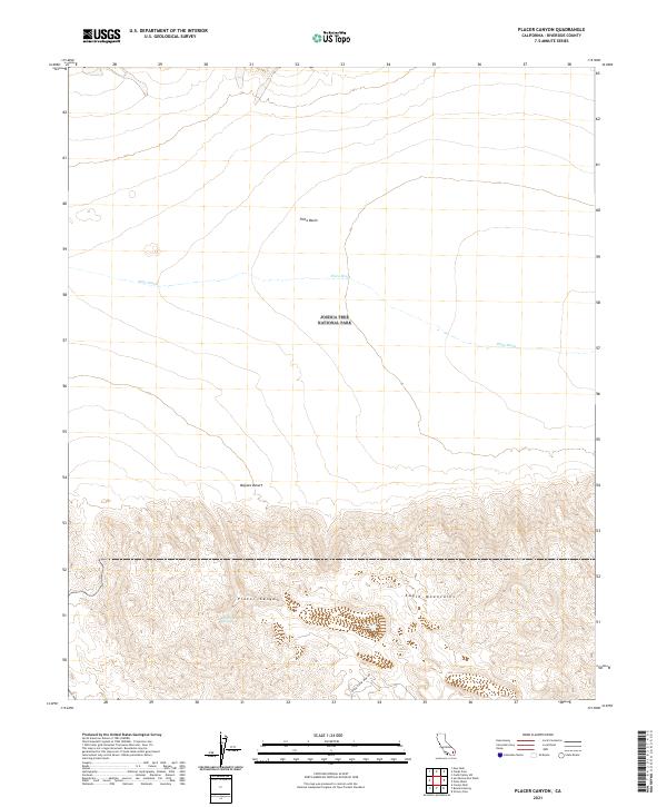 2021 Placer Canyon2021 Print · USGSRiverside County's high desert is captured here in the early twenty-first century, showing where the basin floor meets the mountain peaks. You can trace the path of Black Eagle Mine Rd or locate the remote Eagle Tank Spring within Joshua Tree National Park.
 - 2021 Map of Porcupine Wash, 2021 Print
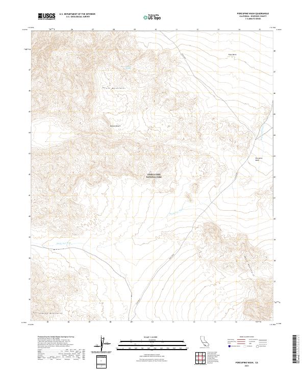 2021 Porcupine Wash2021 Print · USGSJoshua Tree National Park and the high desert of Riverside County are captured in this recent survey of the California backcountry. Researchers can trace the seasonal drainage of Smoke Tree Wash or locate the remote Pinkham Spring tucked within the Hexie Mountains.
 - 2021 Map of Aztec Mines, 2021 Print
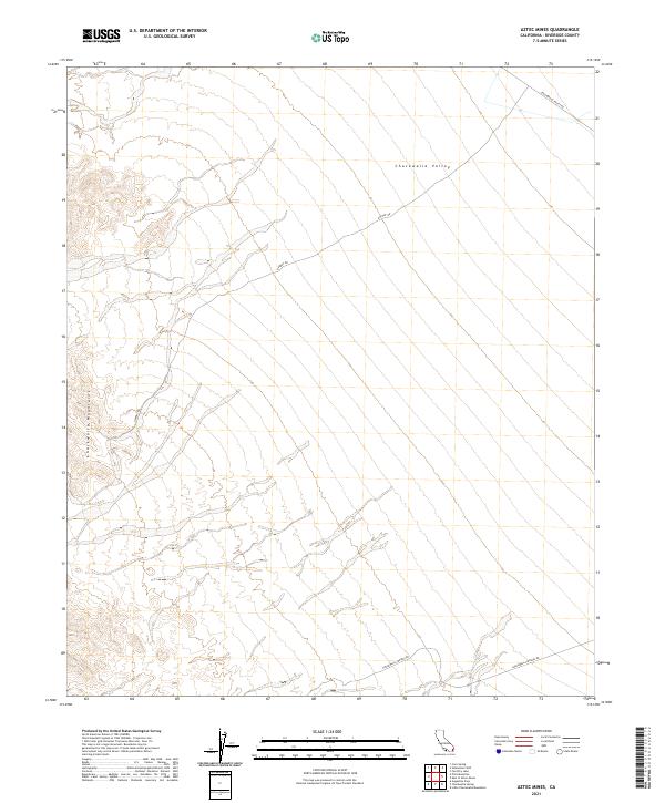 2021 Aztec Mines2021 Print · USGSRiverside County's high desert reveals its character in this modern survey of the arid lands south of the interstate. You can trace desert tracks like Dupont Rd and Chuckwalla Springs Rd as they navigate the base of the Chuckwalla Mountains.
 - 2021 Map of Mecca, 2021 Print
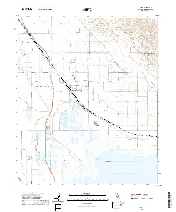 2021 Mecca2021 Print · USGSMecca and the Coachella Valley are shown here in the early twenty-first century, where desert agriculture meets the Salton Sea. Trace the paths of the Coachella Canal and Whitewater River through the grid of Mecca and into the Mecca Hills.
 - 2021 Map of Alberhill, 2021 Print
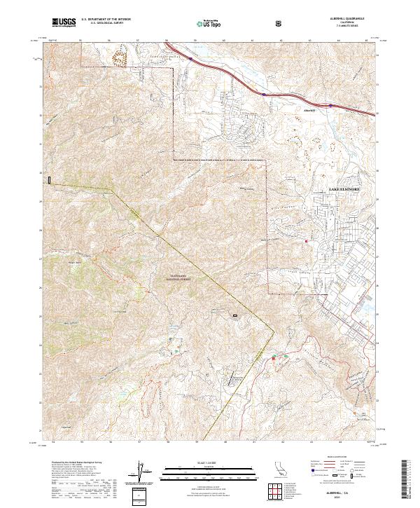 2021 Alberhill2021 Print · USGSThe Alberhill and Lake Elsinore area in the 2020s shows the meeting of modern development and protected wilderness. Local researchers can trace residential growth near Lee Lake or explore the rugged geography of the Cleveland National Forest and Trabuco Peak.
Showing maps 1-25 of 163
Top cities of Riverside County
- Riverside historical maps
- Moreno Valley historical maps
- Corona historical maps
- Murrieta historical maps
- Temecula historical maps
- Jurupa Valley historical maps
See more
Frequently asked questions
- What are the different types of historical maps available for Riverside County?
- What is the oldest map of Riverside County?
- Where can I purchase historical maps of Riverside County for my home or office?
- Where can I download high-res historical maps of Riverside County?
- Are there historical topographic maps available for Riverside County?
- Is there historical aerial imagery available for Riverside County?
- Where are historical maps of Riverside County sourced from?