Old Maps of Riverside County, California for Academic Research
Study the evolution of Riverside County with 1,058 high-resolution historic maps. Whether you're teaching, researching, or modeling changes in land use, these maps provide essential visual documentation of urban, environmental, and geographic change.
- Analyze long-term change: Track patterns in development, transportation, and natural features.
- Ideal for environmental or urban studies: Support academic projects with primary historical map data.
- Use in the classroom or lab: Educators and researchers rely on these maps to bring historical context to life.
These maps are a powerful tool for teaching, research, and visualizing how Riverside County has changed over the decades.
Riverside County, CA maps
(1,058)- 1896 Map of San Bernardino
 1896 San Bernardino1896 Print · USGSSan Bernardino and Colton emerge as vital rail junctions during the late nineteenth-century boom. Genealogists and historians can trace early citrus-belt settlements like Rosena, Mound City, and Bloomington alongside the historic Gage Canal.
 - 1897 Map of Cucamonga
 1897 Cucamonga1897 Print · USGSIn the late nineteenth century, the Inland Empire was a rapidly emerging rail and citrus hub defined by major land grants. Genealogists and researchers can trace the early footprints of Cucamonga, Ontario, and Pomona alongside the Narrow Gauge and Southern Pacific lines.
 - 1898 Map of San Bernardino
 1898 San Bernardino1898 Print · USGSThe San Bernardino valley was a critical railroad junction in the late nineteenth century, defined by rapid irrigation and mountain access. Researchers can trace the early footprints of Colton and Rialto, alongside local landmarks like Glen Helen Ranch and the industrial Quarry at Declezville.
 - 1899 Map of Redlands, 1958 Print
 1899 Redlands1958 Print · USGSThe San Bernardino Valley flourished at the end of the century as an irrigation-fed agricultural power. Trace the early citrus economy through Redlands and Mentone, or locate the Asylum at Patton and the mountain retreat at Squirrel Inn.
 - 1900 Map of Cucamonga
 1900 Cucamonga1900 Print · USGSSan Bernardino and Los Angeles Counties are shown here during the late nineteenth-century citrus boom, before urban sprawl merged these distinct agricultural colonies. Trace early rail lines through Ioamosa, Claremont, and Chino, or locate the isolated Toll House and Power House in the northern canyons.
 - 1901 Map of Southern California Sheet No. 1
 1901 Southern California Sheet No. 11901 Print · USGSGreater Los Angeles at the dawn of the twentieth century is a landscape of growing citrus towns and a burgeoning rail network. Genealogists and historians can trace the early gridded streets of Hollywood and Pasadena or locate landmarks like Bear Lake and the Cahuilla Indian Reservation.6 unique versions available
 - 1901 Map of San Jacinto
 1901 San Jacinto1901 Print · USGSRiverside County at the dawn of the twentieth century shows a landscape transitioning from tribal lands and mountain reserves to citrus and rail hubs. Genealogists can trace early homesteads and rail stops like Palm Springs Sta. and the grid of Florida or the secluded Kenworthy.9 unique versions available
 - 1901 Map of San Bernardino
 1901 San Bernardino1901 Print · USGSThe San Bernardino valley thrived as a railway and agricultural crossroads in the late nineteenth century. Genealogists and historians can trace early citrus-belt settlements like Rialto and Colton, or locate landmarks such as Arrowhead Springs and Glen Helen Ranch.8 unique versions available
 - 1901 Map of Redlands
 1901 Redlands1901 Print · USGSRedlands and the San Bernardino valley are seen here at the turn of the century as agriculture and rail networks began to reshape the landscape. Genealogists and historians can trace early irrigation ditches like the Zanja or locate vanished landmarks like the Asylum and Harlem Springs.9 unique versions available
 - 1901 Map of Elsinore
 1901 Elsinore1901 Print · USGSRiverside and the Alessandro Valley are shown here during a peak of early mining and rail expansion. Genealogists and historians can trace the Southern California RR through Perris or locate the Alberhill Coal Mine and Indian School.8 unique versions available
 - 1901 Map of San Luis Rey
 1901 San Luis Rey1901 Print · USGSNorthern San Diego County is shown at the turn of the century as a landscape of sprawling ranchos, early coastal railroads, and secluded mountain valleys. Researchers can trace the routes of the California Southern RR or locate early settlements like De Luz, Pala, and the Temecula Indian Res.8 unique versions available
 - 1901 Map of Riverside
 1901 Riverside1901 Print · USGSRiverside and its surrounding rancho lands are seen here at the start of the 1900s as irrigation canals and railroads transformed the valley. Researchers can trace the early city grid and find rural landmarks like the Cajalco Tin Mine, Casa Blanca, and Arlington.6 unique versions available
 - 1902 Map of San Gorgonio
 1902 San Gorgonio1902 Print · USGSSouthern California at the turn of the century reveals a land of high-desert ranches and remote mountain mining camps. Genealogists and historians can locate early landmarks like Box S Ranch, Old Woman Springs, and the Rose Mine.8 unique versions available
 - 1902 Map of Corona
 1902 Corona1902 Print · USGSThe Orange County and Riverside borderlands at the start of the 1900s show an era of rapid rail expansion and water engineering. Researchers can trace the early footprints of Anaheim and Orange or find vanished industry at the Santiago Coal Mine.7 unique versions available
 - 1903 Map of Ramona
 1903 Ramona1903 Print · USGSSan Diego County's high country and interior valleys are captured here at the start of the twentieth century, during a time of mountain ranching and early gold mining. Researchers can trace the early footprints of Julian, Ramona, and Mesa Grande, alongside the boundaries of the San Jacinto Forest Reserve.6 unique versions available
 - 1903 Map of Cucamonga
 1903 Cucamonga1903 Print · USGSThe Inland Empire is shown at a pivotal moment of agricultural expansion in the early twentieth century, when irrigation was transforming the valley. Trace the early rail networks of the Southern Pacific and the Santa Fe through citrus-growing centers like Ontario, Cucamonga, and Ioamosa.11 unique versions available
 - 1904 Map of Indio
 1904 Indio1904 Print · USGSThe Conchilla Desert and San Jacinto Mountains appear here at the turn of the century as the Southern Pacific rail corridor began to transform the valley. Trace early settlements and tribal lands like Cabezon Indian Res., Figtree John, and the Asbestos Mine.7 unique versions available
 - 1904 Map of Southern California Sheet No. 2
 1904 Southern California Sheet No. 21904 Print · USGSSouthern California during the early 1900s shows the transition from vast ranchos to coastal rail towns. Genealogists and researchers can trace the Southern California R.R. through Oceanside, explore old land grants like Mission Viejo, and locate early settlements from Fallbrook to Julian.5 unique versions available
 - 1904 Map of Southern California Sheet No. 1, 1905 Print
 1904 Southern California Sheet No. 11905 Print · USGSSouthern California at the dawn of the twentieth century shows a landscape of citrus groves and coastal towns connected by rail. Genealogists and historians can trace early settlements like San Juan Capistrano, find remote sites like the Rose Mine, and study the original water systems of the Santa Ana River.2 unique versions available
 - 1911 Map of Parker
 1911 Parker1911 Print · USGSThe Arizona-California borderlands are captured here in the early twentieth century as the river and rail networks began to transform the desert. Researchers can trace the development of the Colorado River Indian Reservation, the rail hub at Parker, and early mining sites like the Billy Mack Mine.3 unique versions available
 - 1931 Map of Vallecito
 1931 Vallecito1931 Print · USGSThe Colorado Desert and its surrounding ranges are mapped here in the early thirties, showcasing a landscape defined by scarce water and massive terrain. Genealogists can trace isolated desert outposts like Fig Tree John and Agua Dulce or the original footprint of Borego Springs.
 - 1931 Map of Moon Mtn, 1955 Print
 1931 Moon Mtn1955 Print · USGSThe Arizona-California borderlands are captured here in the early thirties, defined by the winding Colorado River and the stark Dome Rock Mountains. Historians and prospectors can trace mineral workings at the Valenzuella Mine and Mammoth Mine.2 unique versions available
 - 1932 Map of Moon Mtn
 1932 Moon Mtn1932 Print · USGSThe Arizona-California borderlands are captured here in the early 1930s, showing the intersection of tribal lands and desert mining. Genealogists and historians can trace the early boundaries of the Colorado River Indian Reservation and locate industrial sites like the Valenzuela Mine.2 unique versions available
 - 1933 Map of Cunningham Mtn
 1933 Cunningham Mtn1933 Print · USGSThe Arizona-California borderlands were a hub of mining and early desert transit during the early 1930s. Researchers can trace the path of the Route No. 60 Sunkist Trail and locate remote operations like the Cinnabar Mine and Beamer Well.4 unique versions available
 - 1933 Map of Prado
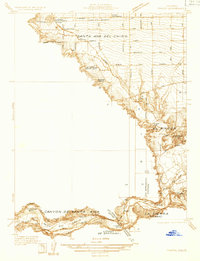 1933 Prado1933 Print · USGSIn the early 1930s, the Chino Valley was a hub of irrigation canals and rail-side settlements before later development changed the landscape. Genealogists and historians can trace old homesteads like Pellissier Ranch and schools like the California Junior Republic School.
Showing maps 1-25 of 1,058
Top cities of Riverside County
- Riverside historical maps
- Moreno Valley historical maps
- Corona historical maps
- Murrieta historical maps
- Temecula historical maps
- Jurupa Valley historical maps
See more
Frequently asked questions
- What are the different types of historical maps available for Riverside County?
- What is the oldest map of Riverside County?
- Where can I purchase historical maps of Riverside County for my home or office?
- Where can I download high-res historical maps of Riverside County?
- Are there historical topographic maps available for Riverside County?
- Is there historical aerial imagery available for Riverside County?
- Where are historical maps of Riverside County sourced from?