1980s Maps of Riverside County, California
Explore 82 historic maps of Riverside County from the 1980s. These maps offer a rare glimpse into what life looked like during the 1980s — showing old roads, neighborhoods, homes, and landmarks that have changed or disappeared over time.
Whether you're researching your family's past, planning a metal detecting trip, or studying how Riverside County's landscape evolved across the 1980s, these high-resolution maps are a powerful tool for exploring the history of this region.
- Focus on a specific era: All maps on this page are from the 1980s, giving you a focused view of this time period.
- See what’s changed: Compare century-old streets, trails, and buildings to today's modern landscape using overlays and satellite layers.
- Research with precision: Use these maps for genealogy, historical research, land use analysis, or educational projects.
- View, download, or print: Maps are fully viewable online in high resolution, and can be downloaded or printed for your own records.
Start exploring Riverside County's history through authentic maps from the 1980s. This is your window into the past.
Riverside County, CA maps
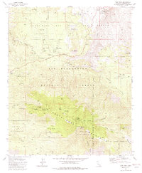
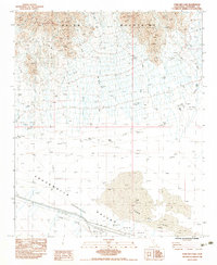
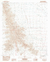
(82)- 1981 Map of Idyllwild, 1982 Print
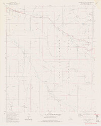
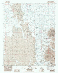
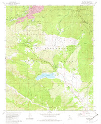 1981 Idyllwild1982 Print · USGSThe San Jacinto Mountains are shown here in the early 1980s, centered on the high-country settlements of Idyllwild and Fern Valley. Local historians can trace family-named properties like Garner Ranch and Fleming Ranch or find the route of the Pacific Crest Nat Scenic Trail.2 unique versions available
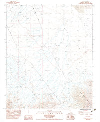
 - 1981 Map of Martinez Mtn, 1982 Print
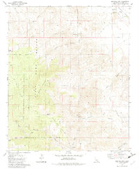 1981 Martinez Mtn1982 Print · USGSThe Riverside County desert highlands are captured here in the early eighties, showcasing the transition from national forest to valley floor. Researchers can trace the Cactus Spring Trail and locate remote water sources like Aqua Alta Spring and Martinez Spring.2 unique versions available
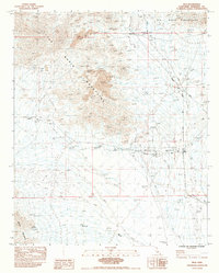
 - 1981 Map of San Jacinto Peak, 1982 Print
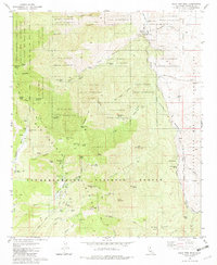
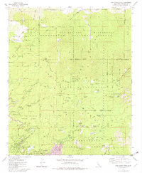 1981 San Jacinto Peak1982 Print · USGSThe mountain communities of Idyllwild and Fern Valley are captured here during the early eighties, surrounded by the high peaks of the San Jacinto Range. Researchers can trace the early path of the Pacific Crest National Scenic Trail or locate historical camps like Camp Lackey and Azalea Trails Camp.3 unique versions available
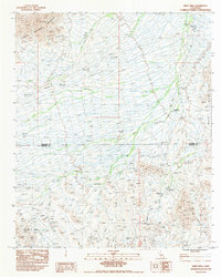
 - 1981 Map of Butterfly Peak, 1982 Print
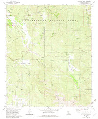 1981 Butterfly Peak1982 Print · USGSThe San Bernardino National Forest and local tribal lands are captured here in the early eighties. Genealogists and researchers can trace local landmarks like Kenworthy Station, the New Hemet Bell Mine, and Vandeventer Flat.4 unique versions available
 - 1981 Map of Toro Peak, 1982 Print
 1981 Toro Peak1982 Print · USGSThe high Santa Rosa peaks and the San Bernardino National Forest were well-established as a mix of tribal lands and remote outposts by the early 1980s. Local historians can trace the development of Alpine Village, the Cactus Spring Trail, and the Santa Rosa Indian Reservation.3 unique versions available
 - 1981 Map of Cahuilla Mtn, 1982 Print
 1981 Cahuilla Mtn1982 Print · USGSHigh-altitude desert and mountain terrain in Riverside County are documented here in the early eighties. Researchers can trace the borders of the Cahuilla Indian Reservation and locate landmarks like the Williamson Mine and Lake Riverside.3 unique versions available
 - 1981 Map of Palm View Peak, 1982 Print
 1981 Palm View Peak1982 Print · USGSRiverside County at the start of the 1980s reveals a transition from the peaks of the San Jacinto Mountains to the desert floor. Trace the Pacific Crest National Scenic Trail past landmarks like Fobes Ranch, Maynard Mine, and the Agua Caliente Indian Reservation.3 unique versions available
 - 1981 Map of Anza, 1982 Print
 1981 Anza1982 Print · USGSHigh desert valleys and tribal lands in the early eighties reveal a landscape of mountain ranches and remote outposts. Researchers can trace family-named landmarks and local sites like Anza, the Hamilton Sch, and the Cahuilla Indian Reservation.3 unique versions available
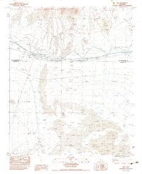
 - 1981 Map of Needles, 1987 Print
 1981 Needles1987 Print · USGSThe High Desert and Colorado River valley are seen here in the early 1980s through the unique lens of satellite imagery. Trace the isolated outposts of the AT & SF railroad at Goffs and Essex, or explore the sprawling shores of Lake Havasu.
 - 1982 Map of Blackburn Canyon
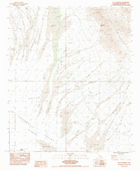
 1982 Blackburn Canyon1982 Print · USGSRiverside County’s high ridges and river forks are captured here in the early eighties, showcasing a landscape of national forest management. Researchers can trace the winding Toll Road and locate remote outposts like the Cranston FS Station and the Lookout Tower Radio Facility.4 unique versions available
 - 1982 Map of Borrego Valley, 1983 Print
 1982 Borrego Valley1983 Print · USGSThe high desert and coastal mountains of San Diego County come together in the early eighties. Researchers can trace the boundaries of the Los Coyotes Indian Reservation or locate the Desert Queen Mine and Palomar Observatory.2 unique versions available
 - 1982 Map of San Bernardino, 1983 Print
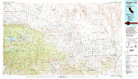
 1982 San Bernardino1983 Print · USGSThe Inland Empire and San Gabriel Valley met at a peak of suburban and industrial expansion in the early eighties. Researchers can trace the massive rail infrastructure through Cajon Pass and locate landmarks like Norton Air Force Base or the Fontana International Raceway.
 - 1982 Map of Oceanside, 1983 Print
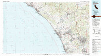 1982 Oceanside1983 Print · USGSCoastal San Diego and Orange counties are captured here in the early eighties, showing the transition from mid-century beach towns to modern suburban hubs. Genealogists and local historians can trace the Atchison Topeka and Santa Fe rail line through Cardiff-by-the-Sea or locate early developments near Lake Hodges.2 unique versions available
 - 1982 Map of Big Bear Lake, 1996 Print
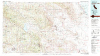
 1982 Big Bear Lake1996 Print · USGSThe San Bernardino Mountains meet the high Mojave desert in the early eighties, showing a landscape defined by mountain resorts and desert basins. Trace the historic Belleville (Site), the rail lines of the Atchison Topeka and Santa Fe, and old mining works like the Gold Belt Mine.
 - 1983 Map of Ford Dry Lake
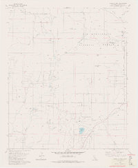
 1983 Ford Dry Lake1983 Print · USGSThe arid basins of Riverside County are captured in the early 1980s, centered on the Chuckwalla Valley (Depression). Trace the primitive 5 Jeep trails and energy corridors like the 3 UG Gas Lines near the bed of Ford Dry Lake.2 unique versions available
 - 1983 Map of Styx
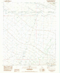
 1983 Styx1983 Print · USGSRiverside County’s desert interior is captured here in the early 1980s, centered on the railroad stop at Styx. Genealogists and industrial historians can trace the Atchison Topeka and Santa Fe line as it passes the Eagle Nest Mines and Gypsum Well (Dry).
 - 1983 Map of Inca
 1983 Inca1983 Print · USGSRiverside County’s desert mining and rail corridor comes into focus in the early 1980s as the railroad connects remote outposts and active pits. Researchers can trace the industrial landscape of the Arlington Mine and the Inca (Siding) along the Atchison Topeka and Santa Fe.
 - 1983 Map of Wiley Well
 1983 Wiley Well1983 Print · USGSRiverside and Imperial Counties were largely defined by desert transit and mineral exploration in the early 1980s. You can trace the historic Bradshaw Trail and locate sites of interest like the Geode Beds and the Mine Shaft near the county line.
 - 1983 Map of Aztec Mines
 1983 Aztec Mines1983 Print · USGSRiverside County's arid mining interior is captured here in the early eighties as mineral exploration continued in the desert ranges. Researchers can trace the layout of the Aztec Mines and locate Chuckwalla Springs near the base of the Chuckwalla Mountains.2 unique versions available
 - 1983 Map of Palen Lake
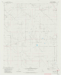
 1983 Palen Lake1983 Print · USGSThe Riverside County desert remains largely untouched in the early 1980s, centered on the arid basin between the Palen Mountains and the Palen Valley. Researchers can trace the natural hydrology of the region through the extensive Sand Dunes and the prominent Dry Lake bed.
 - 1983 Map of East of Aztec Mines
 1983 East of Aztec Mines1983 Print · USGSRiverside County’s desert interior is documented here in the early eighties, showing a landscape defined by utility corridors and arid basins. Researchers can trace the path of Chuckwalla Road, the reach of Ford Dry Lake, and the alignment of 2 Ug Gas Lines.2 unique versions available
 - 1983 Map of Arica Mountains
 1983 Arica Mountains1983 Print · USGSThe high desert border of Riverside and San Bernardino counties is captured in the early eighties as a landscape of infrastructure and isolation. Trace the path of the Colorado River Aqueduct and the Atchison Topeka and Santa Fe railroad past landmarks like Priests Well (Dry).
 - 1983 Map of McCoy Spring
 1983 McCoy Spring1983 Print · USGSRiverside County's high desert is captured here in the early 1980s, centered on the eastern edge of the Chuckwalla Valley. Researchers can trace old mineral Prospects and explore the remote terrain near McCoy Spring and Ford Dry Lake.2 unique versions available
 - 1983 Map of Mc Coy Peak
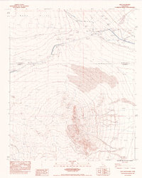
 1983 Mc Coy Peak1983 Print · USGSRiverside County's high desert terrain is captured here in the early 1980s, centered on the stark elevations of the Mc Coy Mountains. Local history researchers can trace the industrial footprint of the era through several Prospects, a Borrow Pit, and the winding path of Mc Coy Wash.
 - 1983 Map of Rice
 1983 Rice1983 Print · USGSThe Mojave Desert outpost of Rice is captured in the early 1980s, serving as a remote junction for rail and water infrastructure. Researchers can trace the Atchison Topeka and Santa Fe railroad line, an Air Field (Abandoned), and the path of the Colorado River Aqueduct.2 unique versions available
Showing maps 1-25 of 82
Top cities of Riverside County
- Riverside historical maps
- Moreno Valley historical maps
- Corona historical maps
- Murrieta historical maps
- Temecula historical maps
- Jurupa Valley historical maps
See more
Frequently asked questions
- What are the different types of historical maps available for Riverside County?
- What is the oldest map of Riverside County?
- Where can I purchase historical maps of Riverside County for my home or office?
- Where can I download high-res historical maps of Riverside County?
- Are there historical topographic maps available for Riverside County?
- Is there historical aerial imagery available for Riverside County?
- Where are historical maps of Riverside County sourced from?