1970s Maps of Riverside County, California
Explore 32 historic maps of Riverside County from the 1970s. These maps offer a rare glimpse into what life looked like during the 1970s — showing old roads, neighborhoods, homes, and landmarks that have changed or disappeared over time.
Whether you're researching your family's past, planning a metal detecting trip, or studying how Riverside County's landscape evolved across the 1970s, these high-resolution maps are a powerful tool for exploring the history of this region.
- Focus on a specific era: All maps on this page are from the 1970s, giving you a focused view of this time period.
- See what’s changed: Compare century-old streets, trails, and buildings to today's modern landscape using overlays and satellite layers.
- Research with precision: Use these maps for genealogy, historical research, land use analysis, or educational projects.
- View, download, or print: Maps are fully viewable online in high resolution, and can be downloaded or printed for your own records.
Start exploring Riverside County's history through authentic maps from the 1970s. This is your window into the past.
Riverside County, CA maps
(32)- 1970 Map of Parker SW, 1973 Print
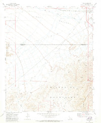
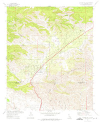
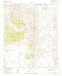
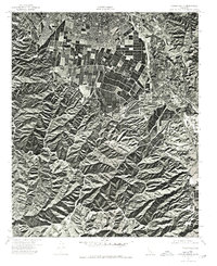
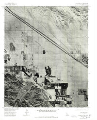
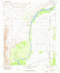 1970 Parker SW1973 Print · USGSThe Colorado River borderlands in the early seventies reveal an intensive irrigation network carved into the desert floor. Researchers can trace the water infrastructure of the Main Canal alongside local landmarks like the Colorado River Day School and Lost Lake Resort.3 unique versions available
 - 1970 Map of Blythe, 1975 Print
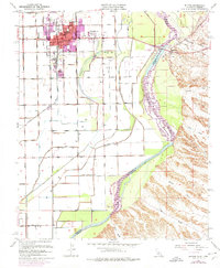 1970 Blythe1975 Print · USGSThe Colorado River valley transitioned into a modern agricultural and transit hub during the early seventies. Genealogists and local historians can trace the growth of Blythe and Ehrenberg near the Ehrenberg Cemetery and the vital Palo Verde Intake.
 - 1970 Map of San Gorgonio Mtn, 1975 Print
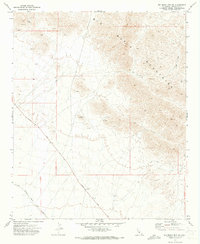
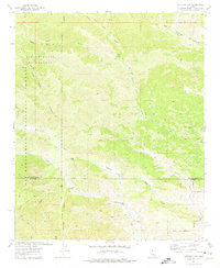
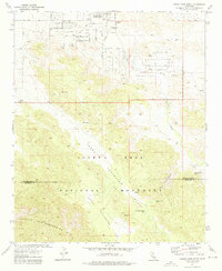
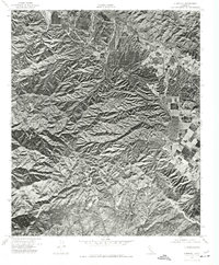
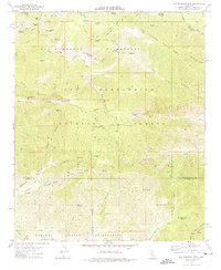 1970 San Gorgonio Mtn1975 Print · USGSThe high peaks and wild canyons of the San Bernardino mountains are captured here in the early 1970s. Researchers can trace the water and mining history of the region via the Penstock Powerhouse, Mill Creek Mine (Quarry), and remote outposts like South Fork Cabin.5 unique versions available
 - 1970 Map of Forest Falls, 1975 Print
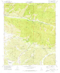 1970 Forest Falls1975 Print · USGSThe high San Bernardino mountains in the early seventies reveal a landscape shaped by surveying history and water management. Trace the Washington Monument and local landmarks like Forest Falls, Oak Glen, and the Yucaipa Aqueduct.3 unique versions available
 - 1971 Map of Vidal, 1973 Print
 1971 Vidal1973 Print · USGSVidal and the surrounding desert mining districts are documented here in the early seventies, showing a landscape defined by rail and resource extraction. Mineral hunters and historians can trace numerous workings like the Alice Mine, Gold Dollar Mine, and the secluded Holly Cem.2 unique versions available
 - 1971 Map of Big Maria Mts. NW, 1973 Print
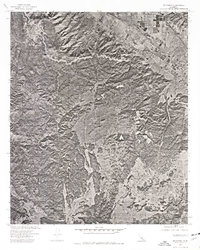
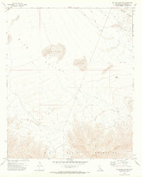 1971 Big Maria Mts. NW1973 Print · USGSRiverside County's arid interior is captured here in the early seventies, showing a landscape defined by the shifting sands of Rice Valley. Trace old mining and travel routes via the Jeep Trail network and locate a remote prospect in the Big Maria Mountains.
 - 1971 Map of Grommet, 1973 Print
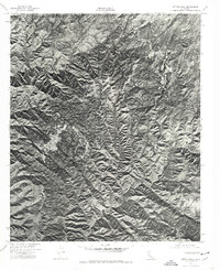
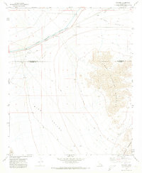 1971 Grommet1973 Print · USGSThe arid basins of the Mojave Desert come into focus in the early 1970s along the San Bernardino and Riverside county line. Trace the engineering of the Colorado River Aqueduct and the remote rail stop at Grommet.
 - 1971 Map of Big Maria Mts SW, 1973 Print
 1971 Big Maria Mts SW1973 Print · USGSRiverside County's desert mining and rail corridors are captured here in the early 1970s. Researchers can trace industrial activity along the Atchison Topeka and Santa Fe and locate specific extraction sites like Black Hill and various Prospects.2 unique versions available
 - 1972 Map of Morongo Valley, 1975 Print
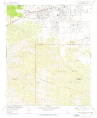
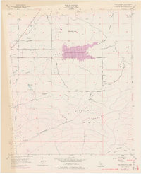
 1972 Morongo Valley1975 Print · USGSMorongo Valley in the early 1970s shows a desert community expanding along the Twentynine Palms Highway. Researchers can trace local landmarks like Covington Park, the Morongo Valley Sch, and remote ranch sites such as the T Cross K Ranch.2 unique versions available
 - 1972 Map of Catclaw Flat, 1975 Print
 1972 Catclaw Flat1975 Print · USGSSan Bernardino and Riverside counties meet in this high-desert wilderness during the early seventies. Hikers and historians can trace the original path of the Pacific Crest National Scenic Trail past Stills Landing (Ruins) and the geological landmark of Red Dome.4 unique versions available
 - 1972 Map of Yucca Valley South, 1975 Print
 1972 Yucca Valley South1975 Print · USGSThe high desert community of Yucca Valley is shown during its mid-century growth period, just as it expanded toward the mountains. Trace early desert infrastructure and local landmarks like Chuckawalla Bill Spring (Dry), the High Sch, and the rugged trails of Joshua Tree National Monument.4 unique versions available
 - 1972 Map of Indian Cove, 1975 Print
 1972 Indian Cove1975 Print · USGSThe Joshua Tree high desert during the early seventies preserves a landscape of ranching and mining history. Trace the legacy of early homesteaders and prospectors at sites like Keys Ranch, the Lang Mine, and the Wall Street Mill.2 unique versions available
 - 1972 Map of Queen Mountain, 1975 Print
 1972 Queen Mountain1975 Print · USGSTwentynine Palms and the northern reaches of Joshua Tree are captured here in the early 1970s. Trace the history of desert prospecting and early tourism through the Desert Queen Mine, the Pine City site, and the Fortynine Palms Oasis.2 unique versions available
 - 1972 Map of Joshua Tree South, 1976 Print
 1972 Joshua Tree South1976 Print · USGSThe High Desert community of Joshua Tree and the northern reaches of the monument are captured here in the early 1970s. Trace local residential growth along Skyline Drive or locate desert water sources like Coyote Hole Spring and Covington Well.2 unique versions available
 - 1973 Map of Bachelor Mtn, 1976 Print
 1973 Bachelor Mtn1976 Print · USGSInland Riverside County is shown during a transformative era of water management and rural transition in the early 1970s. Researchers can trace the development of Skinner Reservoir alongside older landmarks like Alamos Sch and the San Diego Aqueduct.
 - 1974 Map of Lake Mathews, 1975 Print
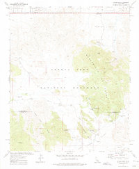
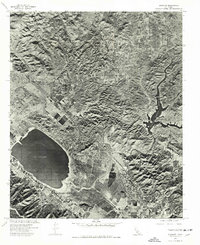
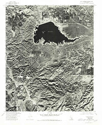 1974 Lake Mathews1975 Print · USGSRiverside County's high ridges and massive reservoir system are captured in this mid-seventies aerial study. Researchers can trace the steep geography of Dawson Canyon and the rugged slopes surrounding Estelle Mtn as they border Lake Mathews.
 - 1974 Map of Santiago Peak, 1975 Print
 1974 Santiago Peak1975 Print · USGSOrange County's high summits and deep canyons are captured in detail during the mid-seventies, showing the landscape as it appeared before major suburban growth. Researchers can trace the rugged drainage patterns of Silverado Canyon and the prominent heights of Santiago Peak.
 - 1974 Map of Corona South, 1975 Print
 1974 Corona South1975 Print · USGSRiverside and Orange County landscapes are captured in 1974 through high-resolution aerial imagery during a period of rapid suburban expansion. Researchers can trace the intersection of commercial agriculture and natural terrain through the winding path of Bedford Canyon.
 - 1974 Map of Alberhill, 1977 Print
 1974 Alberhill1977 Print · USGSThe Temescal Valley and surrounding highlands are captured in this mid-seventies orthophoto, showing the region's rugged geography. Trace the industrial footprint of Alberhill or follow the elevation change up to Trabuco Peak.
 - 1974 Map of Canada Gobernadora, 1977 Print
 1974 Canada Gobernadora1977 Print · USGSSouthern Orange County appears in detailed 1970s aerial photography, showcasing the rural canyon systems before suburban expansion. Trace the natural paths of Cañada Gobernadora, Gabino Canyon, and Lucas Canyon across the landscape.
 - 1974 Map of Wildomar, 1977 Print
 1974 Wildomar1977 Print · USGSWildomar and the surrounding foothills appear during a period of transition in the mid-1970s. Researchers can trace land development and natural drainage patterns through the Santa Ana Mountains and along Slaughterhouse Canyon.
 - 1974 Map of Sitton Peak, 1977 Print
 1974 Sitton Peak1977 Print · USGSRiverside and Orange County borderlands are shown through 1970s aerial photography just before major regional growth. Researchers can trace the sharp ridgelines of Sitton Peak and the deep drainage paths of San Mateo Canyon and Morrell Canyon.
 - 1974 Map of Elsinore, 1977 Print
 1974 Elsinore1977 Print · USGSRiverside County is captured in mid-seventies aerial detail during a period of steady expansion around its famous natural lake. Trace the development of Elsinore and Lakeland Village, or study the landscape around Railroad Canyon Reservoir.
 - 1974 Map of Black Star Canyon, 1977 Print
 1974 Black Star Canyon1977 Print · USGSThe Santa Ana Mountains are captured in detail during the mid-seventies, showing this rugged landscape before suburban expansion. Researchers can trace the original shoreline of Santiago Reservoir and the natural path of the Santa Ana River.
 - 1975 Map of Cathedral City, 1977 Print
 1975 Cathedral City1977 Print · USGSThe mid-seventies Coachella Valley comes into focus through this aerial survey as desert resorts and subdivisions begin to take shape. Researchers can trace early residential growth in Cathedral City and the rural layout of Thousand Palms.
Showing maps 1-25 of 32
Top cities of Riverside County
- Riverside historical maps
- Moreno Valley historical maps
- Corona historical maps
- Murrieta historical maps
- Temecula historical maps
- Jurupa Valley historical maps
See more
Frequently asked questions
- What are the different types of historical maps available for Riverside County?
- What is the oldest map of Riverside County?
- Where can I purchase historical maps of Riverside County for my home or office?
- Where can I download high-res historical maps of Riverside County?
- Are there historical topographic maps available for Riverside County?
- Is there historical aerial imagery available for Riverside County?
- Where are historical maps of Riverside County sourced from?