Old Maps of El Mirage, California for Hiking & Exploration
Hike through history with 29 historic maps of El Mirage. Explore old trails, ghost towns, and forgotten backroads — perfect for outdoor adventurers and local explorers.
- Rediscover forgotten places: Map out old mining camps, roads, and footpaths that no longer exist on modern maps.
- Layer with modern tools: Combine with LiDAR or satellite views to plan hikes through historical terrain.
- Made for exploration: Popular among hikers, overlanders, and local history lovers.
Use these maps to find adventure and explore the hidden past of El Mirage.
El Mirage, CA maps
(29)- 1930 Map of El Mirage
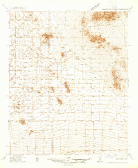
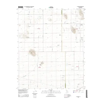
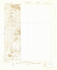 1930 El Mirage1930 Print · USGSThe high desert frontier along the Los Angeles and San Bernardino county line is captured here in the early thirties. Genealogists and desert historians can trace the isolated Walton Place and find early water sources like the lonely Well near Wilsona Road.
 - 1930 Map of Angle
 1930 Angle1930 Print · USGSThe high desert of the Antelope Valley comes into focus in 1930, capturing the region just as early roads began to define the terrain. Researchers can trace the path of the Palmdale-Victorville Road and locate an isolated desert Well.
 - 1932 Map of Angle
 1932 Angle1932 Print · USGSAntelope Valley was a sparsely inhabited desert frontier in the early 1930s as surveyors began formalizing the county lines. Researchers can trace the early jurisdictional divide between Los Angeles Co and San Bernardino Co near a lone Well.2 unique versions available
 - 1933 Map of El Mirage
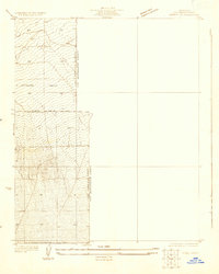
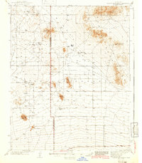
 1933 El Mirage1933 Print · USGSHigh desert homesteads and early roadways mark the transition into the Antelope Valley during the early 1930s. Researchers can trace the specific location of Walton Place or follow the paths of El Mirage Road and Avenue P across the county line.2 unique versions available
 - 1937 Map of Shadow Mountains
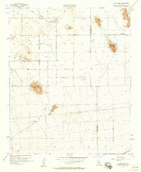
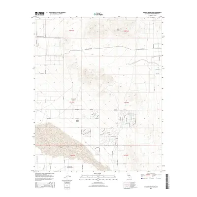
 1937 Shadow Mountains1937 Print · USGSThe High Desert border of San Bernardino and Los Angeles counties appears here as a landscape of isolated 1930s ranching outposts. Genealogists can trace family-named sites like Walton Place, Engelbrecht Place, and the Hibbard Ranch.2 unique versions available
 - 1942 Map of Shadow Mountains
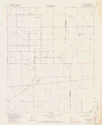
 1942 Shadow Mountains1942 Print · USGSThe High Desert at the start of the war reveals a landscape of isolated homesteads and early aviation landmarks. Genealogists and desert historians can locate family outposts like Walton Place and Hess Ranch or trace the early Palmdale Victorville Road.2 unique versions available
 - 1953 Map of San Bernardino
 1953 San Bernardino1953 Print · USGSSouthern California underwent massive post-war growth as suburban sprawl reached the foothills of the San Bernardino Mountains. Genealogists and historians can trace the rail-and-road roots of the Inland Empire through the Union Pacific RR and Lake Arrowhead resorts.2 unique versions available
 - 1955 Map of Shadow Mountains, 1957 Print
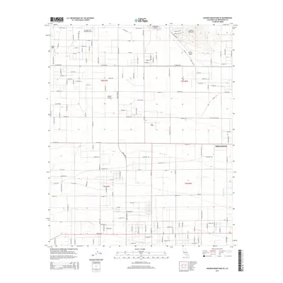
 1955 Shadow Mountains1957 Print · USGSThe Shadow Mountains come into sharp focus in the mid-fifties, revealing a Mojave landscape active with mining and aviation. Researchers can trace historic mining operations like the Rabbit Hole Mine, locate family sites at Hess Ranch, and explore the perimeter of El Mirage Lake.4 unique versions available
 - 1955 Map of Shadow Mountains SE, 1957 Print
 1955 Shadow Mountains SE1957 Print · USGSThe high desert of San Bernardino County comes into focus mid-century, showing the early infrastructure of the El Mirage Valley. Researchers can trace the development of rural routes like Old Phelan Road and locate landmarks such as El Mirage Field.4 unique versions available
 - 1956 Map of San Bernardino
 1956 San Bernardino1956 Print · USGSSouthern California's Inland Empire and High Desert come into focus in the mid-fifties as agriculture gives way to suburban and military growth. Trace early rail lines like the Pacific Electric or find remote landmarks like Camp Rock Mine and George AFB.
 - 1956 Map of El Mirage, 1957 Print
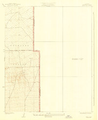
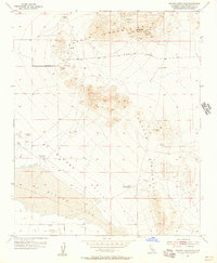
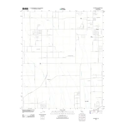
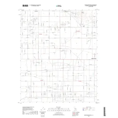
 1956 El Mirage1957 Print · USGSThe high desert along the Los Angeles and San Bernardino county line comes into focus in the mid-1950s. Genealogists and researchers can trace the early road network and find historic landmarks like Moody Springs, the Three Sisters peaks, and the Gray Butte Field (Abandoned).5 unique versions available
 - 1957 Map of San Bernardino
 1957 San Bernardino1957 Print · USGSSouthern California's Inland Empire and High Desert met during the postwar expansion of the late fifties. Genealogists and historians can trace the growth of San Bernardino and Redlands alongside remote landmarks like Edwards AFB and the Camp Rock Mine.
 - 1958 Map of San Bernardino, 1975 Print
 1958 San Bernardino1975 Print · USGSSouthern California’s Inland Empire and High Desert come into focus during the mid-century boom, showing the rise of suburbs and massive military installations. Researchers can trace the rail networks of the Union Pacific RR or locate landmarks like Norton AFB and Big Bear Lake.
 - 1959 Map of San Bernardino
 1959 San Bernardino1959 Print · USGSSouthern California underwent a massive transformation in the late fifties as suburban growth and military power reshaped the desert and valley. Researchers can trace the legacy of the Union Pacific Railroad and locate early footprints of Joshua Tree National Monument and Edwards Air Force Base.
 - 1966 Map of San Bernardino
 1966 San Bernardino1966 Print · USGSThe San Bernardino Valley and Mojave Desert met during a period of massive military and suburban growth in the mid-sixties. Genealogists and historians can trace the development of Edwards Air Force Base, old desert mines like the Bagdad Chase Mine, and mountain communities near Big Bear Lake.
 - 1968 Map of El Mirage, 1969 Print
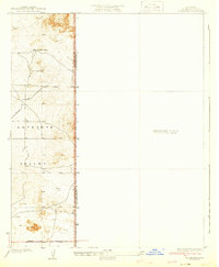
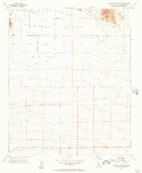
 1968 El Mirage1969 Print · USGSEl Mirage Valley and the high desert borderlands are shown here in the late sixties as aviation and rail infrastructure reshaped the landscape. Researchers can find the 36 Field (Abandoned) airfield, the Southern Pacific railroad line, and local landmarks like Black Butte.
 - 1982 Map of Victorville
 1982 Victorville1982 Print · USGSThe High Desert during the early eighties reveals a landscape of massive aerospace installations and growing desert communities. Researchers can trace the sprawling boundaries of Edwards Air Force Base alongside the vital California Aqueduct and the rail hub at Barstow.2 unique versions available
 - 2012 Map of Shadow Mountains, 2012 Print
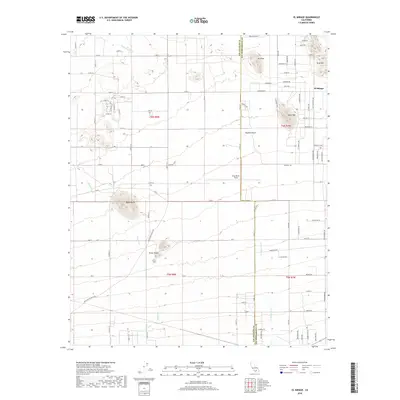
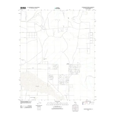 2012 Shadow Mountains2012 Print · USGSCovers El Mirage, including San Bernardino County, United States, and other nearby areas
 - 2012 Map of Shadow Mountains SE, 2012 Print
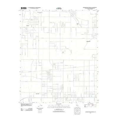 2012 Shadow Mountains SE2012 Print · USGSCovers El Mirage, including Adelanto, Piñon Hills, and other nearby areas
 - 2012 Map of El Mirage, 2012 Print
 2012 El Mirage2012 Print · USGSCovers El Mirage, including Piñon Hills, San Bernardino County, and other nearby areas
 - 2015 Map of Shadow Mountains, 2015 Print
 2015 Shadow Mountains2015 Print · USGSCovers El Mirage, including San Bernardino County, United States, and other nearby areas
 - 2015 Map of Shadow Mountains SE, 2015 Print
 2015 Shadow Mountains SE2015 Print · USGSCovers El Mirage, including Adelanto, Piñon Hills, and other nearby areas
 - 2015 Map of El Mirage, 2015 Print
 2015 El Mirage2015 Print · USGSCovers El Mirage, including Piñon Hills, San Bernardino County, and other nearby areas
 - 2018 Map of Shadow Mountains SE, 2018 Print
 2018 Shadow Mountains SE2018 Print · USGSCovers El Mirage, including Adelanto, Piñon Hills, and other nearby areas
 - 2018 Map of El Mirage, 2018 Print
 2018 El Mirage2018 Print · USGSCovers El Mirage, including Piñon Hills, San Bernardino County, and other nearby areas
Showing maps 1-25 of 29
Top cities near El Mirage
- Victorville historical maps
- Hesperia historical maps
- Adelanto historical maps
- Piñon Hills historical maps
Frequently asked questions
- What are the different types of historical maps available for El Mirage?
- What is the oldest map of El Mirage?
- Where can I purchase historical maps of El Mirage for my home or office?
- Where can I download high-res historical maps of El Mirage?
- Are there historical topographic maps available for El Mirage?
- Is there historical aerial imagery available for El Mirage?
- Where are historical maps of El Mirage sourced from?