1900s (20th Century) Maps of Bent County, Colorado
Explore 54 historic maps of Bent County from the 1900s (20th Century). These maps offer a rare glimpse into what life looked like during the 1900s — showing old roads, neighborhoods, homes, and landmarks that have changed or disappeared over time.
Whether you're researching your family's past, planning a metal detecting trip, or studying how Bent County's landscape evolved across the 1900s, these high-resolution maps are a powerful tool for exploring the history of this region.
- Focus on a specific era: All maps on this page are from the 1900s, giving you a focused view of this time period.
- See what’s changed: Compare century-old streets, trails, and buildings to today's modern landscape using overlays and satellite layers.
- Research with precision: Use these maps for genealogy, historical research, land use analysis, or educational projects.
- View, download, or print: Maps are fully viewable online in high resolution, and can be downloaded or printed for your own records.
Start exploring Bent County's history through authentic maps from the 1900s. This is your window into the past.
Bent County, CO maps
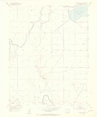
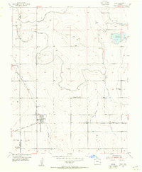
(54)- 1952 Map of Lamar West, 1954 Print
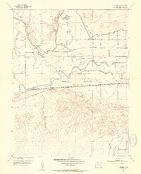
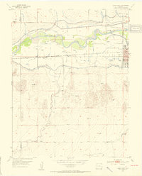 1952 Lamar West1954 Print · USGSThe river valley west of Lamar was a vital corridor for both historic wagon routes and modern irrigation during the early fifties. Genealogists and historians can trace the Old Santa Fe Trail alongside local landmarks like Dry Creek School and Crawford Cem.4 unique versions available
 - 1953 Map of Hasty, 1954 Print
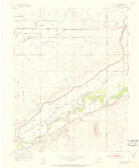
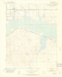
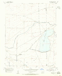
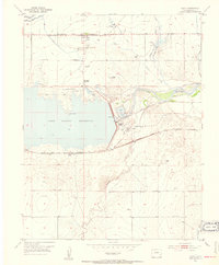 1953 Hasty1954 Print · USGSBent County at mid-century reveals the transformation of the Arkansas River valley following the creation of a major reservoir. Genealogists and historians can locate Hasty, the Union Valley Cemetery, and the original path of the Old Santa Fe Trail.5 unique versions available
 - 1953 Map of Prowers, 1954 Print
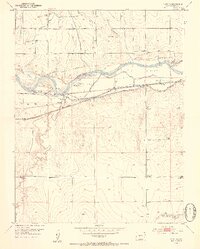 1953 Prowers1954 Print · USGSBent County in the early fifties shows the heavy footprint of the high plains irrigation and rail network. Researchers can trace the path of the Old Santa Fe Trail and locate sites like Old Fort Lyon (Ruins) and Prowers.3 unique versions available
 - 1953 Map of Las Animas, 1954 Print
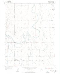
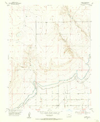
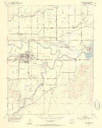 1953 Las Animas1954 Print · USGSBent County during the early fifties reveals a landscape shaped by river junctions and the legacy of the Santa Fe Trail. Researchers can locate the Boggsville site, the Fort Lyon Veterans Hospital, and the rural Rixey School among the valley's complex irrigation ditches.6 unique versions available
 - 1953 Map of Cornelia, 1954 Print
 1953 Cornelia1954 Print · USGSSoutheast Colorado's river-fed agriculture is at its height in the mid-fifties, showing the complex canal networks of the high plains. Researchers can trace the path of the Atchison Topeka and Santa Fe railroad past local landmarks like Cornelia School and the Las Animas State Fish Hatchery.3 unique versions available
 - 1953 Map of Hadley, 1954 Print
 1953 Hadley1954 Print · USGSThe Arkansas River valley in the early fifties shows a transition from frontier history to modern irrigation. Genealogists and historians can trace the Old Fort Bent (Ruins), the settlement of Hadley, and the rural East Holbrook Church.3 unique versions available
 - 1953 Map of Kreybill, 1954 Print
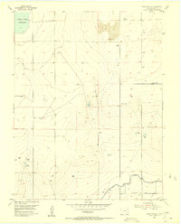
 1953 Kreybill1954 Print · USGSBent County, Colorado, is captured here in the early fifties during the era of mid-century water reclamation. Genealogists and historians can trace the Old Santa Fe Trail through the area or locate local landmarks like Kreybill Sch and Beethurst.4 unique versions available
 - 1954 Map of Lamar, 1964 Print
 1954 Lamar1964 Print · USGSSoutheastern Colorado and the Kansas borderlands appear here in the mid-fifties, dominated by the vital Arkansas River irrigation network. Researchers can trace the development of river towns like Lamar and La Junta alongside the Amity Cemetery and several major reservoirs.3 unique versions available
 - 1955 Map of McClave, 1956 Print
 1955 McClave1956 Print · USGSBent County's agricultural heartland is documented in the mid-1950s, showing a complex network of prairie irrigation. Researchers can trace the Atchison Topeka and Santa Fe rail line and the historic Fort Lyon Canal past McClave and Keesee.
 - 1955 Map of Tree Top Ranch, 1956 Print
 1955 Tree Top Ranch1956 Print · USGSThe ranching country of Bent County is captured here in the mid-1950s, showing a landscape defined by irrigation and water rights. Researchers can trace the path of the Fort Lyon Canal, the Kicking Bird Canal, and an Old Railroad Grade on Levee.2 unique versions available
 - 1955 Map of Mc Intosh Ranch, 1956 Print
 1955 Mc Intosh Ranch1956 Print · USGSBent County ranching and irrigation systems are captured here in the mid-fifties, showing the vital water infrastructure of the high plains. Genealogists and researchers can locate family sites such as Mc Intosh Ranch or trace the Fort Lyon Storage Canal and an early Landing Field (Aband).2 unique versions available
 - 1955 Map of Lubers, 1956 Print
 1955 Lubers1956 Print · USGSBent County's agricultural and rail heartland is captured in the mid-fifties, showing the vital irrigation systems of the High Plains. Researchers can trace the Atchison Topeka and Santa Fe line through Lubers and the complex Fort Lyon Canal.2 unique versions available
 - 1955 Map of Bishop Ranch, 1956 Print
 1955 Bishop Ranch1956 Print · USGSBent County ranching and irrigation are frozen in time here during the mid-fifties. Genealogists and local historians can trace family operations at Bishop Ranch or the Cordes-Oberlander Ranch while locating water infrastructure like the Fort Lyon Canal.3 unique versions available
 - 1955 Map of Lewis Ranch, 1956 Print
 1955 Lewis Ranch1956 Print · USGSThe high plains of Otero and Bent Counties appear here in the mid-1950s as a landscape defined by ranching and complex water engineering. Researchers can trace historic homesteads like Lewis Ranch and Inge Ranch alongside the extensive Fort Lyon Storage Canal network.2 unique versions available
 - 1955 Map of Wiley, 1956 Print
 1955 Wiley1956 Print · USGSIn the mid-1950s, the irrigation-dependent plains of Prowers and Bent Counties centered on the railroad town of Wiley. Researchers can trace the development of the region's water rights and schools like Cactus View Sch (Aban'd) and West Riverview Sch.2 unique versions available
 - 1955 Map of La Junta, 1966 Print
 1955 La Junta1966 Print · USGSSoutheastern Colorado during the mid-fifties is captured here as a sprawling network of ranching outposts and rail sidings. Researchers can locate vanished landmarks like the Sunderland School, trace the isolated Lycan Post Office, or find the Bomb target (abandoned) on the western plains.3 unique versions available
 - 1958 Map of La Junta
 1958 La Junta1958 Print · USGSSoutheast Colorado and the Kansas borderlands appear in the late fifties as a landscape of isolated ranching outposts and vital rail junctions. Researchers can trace the lineage of vanished post offices and rural school sites like the Lycan Post Office and Sunderland School.2 unique versions available
 - 1958 Map of Lamar
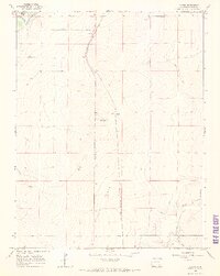
 1958 Lamar1958 Print · USGSThe High Plains of Eastern Colorado and Western Kansas in the late fifties reveal a landscape tied to the Arkansas River and the rails. Trace the heritage of the river valley through Fort Lyon, the Atchison Topeka and Santa Fe RR, and rural landmarks like Kendrick Church.2 unique versions available
 - 1966 Map of Toonerville SE, 1969 Print
 1966 Toonerville SE1969 Print · USGSHigh plains ranching territory in Bent County is captured during the mid-sixties, showing the meticulous division of the land. Researchers can trace historical property lines and drainage features like Caddoa Creek, Penrose Draw, and the Cameron terrain marker.
 - 1966 Map of Gilpin, 1969 Print
 1966 Gilpin1969 Print · USGSBent County ranching and rail lines are captured here during the mid-1960s. Genealogists and historians can trace the Atchison Topeka and Santa Fe railroad through Gilpin or locate early water systems like the Rule Ditch.2 unique versions available
 - 1966 Map of Toonerville, 1969 Print
 1966 Toonerville1969 Print · USGSBent County in the mid-1960s reveals a landscape of high plains rail stops and vital water infrastructure. Researchers can trace the Atchison Topeka and Santa Fe line through Toonerville and Ruxton or locate family landmarks like the McAfee Windmill.
 - 1966 Map of Toonerville NE, 1969 Print
 1966 Toonerville NE1969 Print · USGSBent County terrain in the mid-sixties reveals a landscape defined by ranching utility and remote high-plains water management. Researchers can trace the path of Rule Creek, locate the isolated Landing Strip, and find early local industry at the Gravel Pits.
 - 1966 Map of Hackamore Ranch, 1970 Print
 1966 Hackamore Ranch1970 Print · USGSThe Purgatoire River valley in Bent County is captured here in the mid-1960s, showing a landscape defined by ranching and irrigation. Trace local landmarks like Hackamore Ranch, the J J Windmill, and the winding Highland Canal through the canyons.
 - 1966 Map of Turkey Canyon, 1970 Print
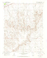
 1966 Turkey Canyon1970 Print · USGSThe Purgatoire River valley in Bent County was a remote landscape of canyons and arroyos during the mid-1960s. Researchers can locate specific water sources like the Kelly Water Hole and trace the deep reaches of Turkey Canyon and Baker Canyon.
 - 1966 Map of Thompson Arroyo, 1970 Print
 1966 Thompson Arroyo1970 Print · USGSRanching lands and arid arroyos define this Otero County landscape in the mid-1960s. Genealogists and historians can trace family-named features like Miller Mesa or locate the Drive-in Theater and Circle I Waters Spring across the plains.2 unique versions available
Showing maps 1-25 of 54
Top cities of Bent County
Frequently asked questions
- What are the different types of historical maps available for Bent County?
- What is the oldest map of Bent County?
- Where can I purchase historical maps of Bent County for my home or office?
- Where can I download high-res historical maps of Bent County?
- Are there historical topographic maps available for Bent County?
- Is there historical aerial imagery available for Bent County?
- Where are historical maps of Bent County sourced from?