1960s Maps of Delta County, Colorado
Explore 40 historic maps of Delta County from the 1960s. These maps offer a rare glimpse into what life looked like during the 1960s — showing old roads, neighborhoods, homes, and landmarks that have changed or disappeared over time.
Whether you're researching your family's past, planning a metal detecting trip, or studying how Delta County's landscape evolved across the 1960s, these high-resolution maps are a powerful tool for exploring the history of this region.
- Focus on a specific era: All maps on this page are from the 1960s, giving you a focused view of this time period.
- See what’s changed: Compare century-old streets, trails, and buildings to today's modern landscape using overlays and satellite layers.
- Research with precision: Use these maps for genealogy, historical research, land use analysis, or educational projects.
- View, download, or print: Maps are fully viewable online in high resolution, and can be downloaded or printed for your own records.
Start exploring Delta County's history through authentic maps from the 1960s. This is your window into the past.
Delta County, CO maps
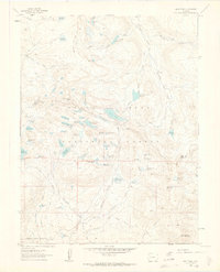
(40)- 1960 Map of Leadville
 1960 Leadville1960 Print · USGSThe Colorado high country in the mid-fifties comes alive through its mining camps, river valleys, and rail lines. Trace the industrial legacy of the Climax Molybdenum Mine and explore the alpine reaches of the Camp Hale Military Reservation.2 unique versions available
 - 1960 Map of Montrose
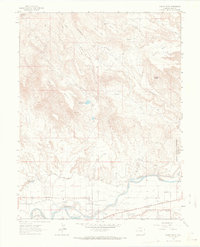
 1960 Montrose1960 Print · USGSThe Colorado high country in the mid-fifties is captured here during a period of steady ranching and persistent mining. Researchers can trace the path of the Denver & Rio Grande Western RR or locate small settlements like Somerset, Maher, and Sargent.2 unique versions available
 - 1960 Map of Moab
 1960 Moab1960 Print · USGSThe canyonlands and high plateaus of the Utah-Colorado border are shown here during the mid-century uranium boom. Researchers can trace the river-and-rail corridors of the Colorado River and the Denver and Rio Grande Western near Moab and Uravan.3 unique versions available
 - 1960 Map of Grand Junction
 1960 Grand Junction1960 Print · USGSThe Grand Junction area at the dawn of the 1960s shows a landscape of river-valley agriculture and high-plateau extraction. Researchers can trace the path of the dismantled railroad and find vanished sites like Watson and Sego.2 unique versions available
 - 1960 Map of Leon Peak, 1963 Print
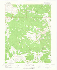
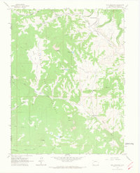
 1960 Leon Peak1963 Print · USGSHigh on the Grand Mesa in the early sixties, this survey captures a landscape defined by complex water engineering and high-country ranching. Trace the path of the Leon Tunnel, the Leon Drift Fence, and reservoirs like Colby Horse Park Reservoir.5 unique versions available
 - 1961 Map of Electric Mountain, 1963 Print
 1961 Electric Mountain1963 Print · USGSHigh-altitude ranching and forest management define this corner of the Rockies in the early sixties. Researchers can trace the legacy of family-run operations at Novella Bell Ranch or locate backcountry landmarks like Chimney Rocks and the West Muddy Ranger Sta.4 unique versions available
 - 1961 Map of Porter Mountain, 1963 Print
 1961 Porter Mountain1963 Print · USGSThe high plateau of the Mesa and Delta county line is captured in the early sixties as a hub of forest management and water engineering. Researchers can trace historic irrigation routes like the Silver Spruce Ditch and primitive access paths including the Stubb Jeep Trail near Porter Mountain.4 unique versions available
 - 1961 Map of Chalk Mountain, 1963 Print
 1961 Chalk Mountain1963 Print · USGSThe high mesa country of Delta County in the early 1960s was a landscape defined by forest management and water engineering. You can trace the network of high-altitude irrigation pools like Holy Terror Res and Skimmed Milk Res or locate the Lombard Slides.7 unique versions available
 - 1961 Map of Spruce Mountain, 1964 Print
 1961 Spruce Mountain1964 Print · USGSMesa County and the surrounding national forests are captured here in the early 1960s during a period of high-country ranching and resource exploration. Trace the locations of Buzzard Cow Camp and Oil Well Camp, or locate the Drill Hole and old Pack Trail through the timber.4 unique versions available
 - 1962 Map of Moab
 1962 Moab1962 Print · USGSThe canyon country of southeastern Utah and western Colorado is captured here in the early sixties, showing the reach of the Denver and Rio Grande Western through the desert. Researchers can trace the layout of mining settlements like Uravan and old railroad stops at Cisco and Sagers Station.
 - 1962 Map of Leadville
 1962 Leadville1962 Print · USGSThe Colorado high country in the early sixties was a rugged landscape of mining camps, military training grounds, and emerging ski towns. Researchers can trace the legacy of Camp Hale, locate the Molybdenum mine near Leadville, and follow the Denver and Rio Grande Western RR through the canyons.
 - 1962 Map of Grand Junction
 1962 Grand Junction1962 Print · USGSThe Western Slope of the early sixties comes into focus here, showing the irrigation-driven growth of the valley and the surrounding high desert. Trace the path of the Denver and Rio Grande Western RR or locate old outposts like Atchee and Dragon.
 - 1962 Map of North Delta, 1966 Print
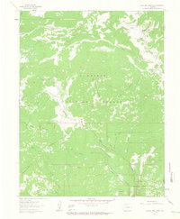
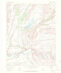
 1962 North Delta1966 Print · USGSThe Gunnison River valley in the early sixties was a landscape of intensive irrigation and railroad transport. Researchers can trace family history through sites like Memory Gardens Cemetery, the settlement of North Delta, and the prominent Adobe Buttes.3 unique versions available
 - 1962 Map of Orchard City, 1966 Print
 1962 Orchard City1966 Print · USGSIn the early sixties, the high desert terrain around Orchard City was transformed by an extensive network of irrigation ditches and canals. Genealogists and historians can trace local life through the Fairview School, the Eckert PO, and the Denver and Rio Grande Western rail line.5 unique versions available
 - 1962 Map of Delta, 1966 Print
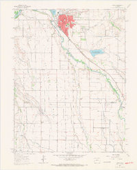 1962 Delta1966 Print · USGSWestern Slope agriculture and river-junction life are captured here in the early sixties as irrigation transformed the high mesas. Researchers can trace the sprawling canal systems and find local landmarks like Pea Green Cem, Columbine Sch, and the Garnet Mesa Reservoir.3 unique versions available
 - 1963 Map of Bull Mountain, 1967 Print
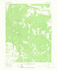
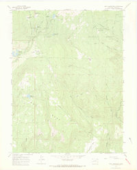
 1963 Bull Mountain1967 Print · USGSGunnison and Delta counties were primarily defined by high-country ranching and forest management in the early 1960s. Genealogists and historians can trace seasonal family outposts like Harry Parker Place and the Hotchkiss Sheep Camp along the Drift Trail.5 unique versions available
 - 1964 Map of Grand Junction
 1964 Grand Junction1964 Print · USGSThe Colorado-Utah borderlands are shown here in the mid-1960s, a period when the river-valley settlements and high-desert rail outposts defined the region. Researchers can trace the legacy of remote camps like Atchee and Dragon or follow the agricultural expansion around Grand Junction and Fruita.
 - 1964 Map of Leadville
 1964 Leadville1964 Print · USGSColorado's high country is captured here during the mid-1960s, showing the intersection of mining history and mountain transport. Trace the legacy of high-altitude industry at the Climax Molybdenum Mine or follow the rails of the Colorado and Southern Ry past Leadville.
 - 1964 Map of Moab
 1964 Moab1964 Print · USGSThe canyonlands of eastern Utah and western Colorado are captured here in the mid-1960s, a time when uranium mining shaped the local economy. Researchers can trace the river-and-rail network through Sinbad Valley and locate mining outposts like Uravan and Vancorum.
 - 1964 Map of Minnesota Pass, 1967 Print
 1964 Minnesota Pass1967 Print · USGSThe high ridges of the Gunnison National Forest are captured here in the mid-1960s. Follow historic high-country routes like the Sunset Trail and Smith Trail to remote landmarks like Minnesota Pass and Mount Gunnison.3 unique versions available
 - 1964 Map of Somerset, 1967 Print
 1964 Somerset1967 Print · USGSCoal mining and rail transport define this Gunnison County canyon during the mid-sixties. Researchers can trace the industrial footprint of the Oliver Mine and Bear Mine along the Denver and Rio Grande Western line.4 unique versions available
 - 1965 Map of Grand Junction
 1965 Grand Junction1965 Print · USGSWestern Colorado and eastern Utah appear at a mid-century crossroads, where the irrigated orchards of the Grand Valley meet the high desert plateaus. Trace the Denver & Rio Grande Western RR as it connects Grand Junction to early settlements like Westwater and Cisco.2 unique versions available
 - 1965 Map of Moab
 1965 Moab1965 Print · USGSSoutheast Utah and Western Colorado are mapped here in the mid-sixties, showcasing a landscape of high plateaus and deep river canyons. Genealogists and historians can trace the mining-era towns of Uravan and Paradox or locate remote landmarks like Castleton and Dead Horse Point.
 - 1965 Map of Gray Reservoir, 1968 Print
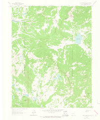
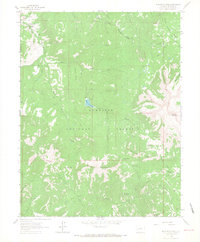
 1965 Gray Reservoir1968 Print · USGSDelta County's high mesa country is captured here in the mid-1960s, showing the intersection of two national forests and a complex high-altitude irrigation system. Researchers can trace the era's ranching and mining infrastructure through features like the Burdick Mine, Schoneman Ditch Camp, and the winding Overland Ditch.4 unique versions available
 - 1965 Map of Point Creek, 1968 Print
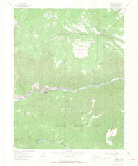
 1965 Point Creek1968 Print · USGSDelta County ranching and river life are captured here in the mid-sixties, where the desert meets the high timber. Trace the path of the Denver and Rio Grande Western rail line along the Gunnison River or locate the Star Nelson Ranch.3 unique versions available
Showing maps 1-25 of 40
Top cities of Delta County
- Delta historical maps
- Orchard City historical maps
- Cedaredge historical maps
- Paonia historical maps
- Hotchkiss historical maps
- Crawford historical maps
Frequently asked questions
- What are the different types of historical maps available for Delta County?
- What is the oldest map of Delta County?
- Where can I purchase historical maps of Delta County for my home or office?
- Where can I download high-res historical maps of Delta County?
- Are there historical topographic maps available for Delta County?
- Is there historical aerial imagery available for Delta County?
- Where are historical maps of Delta County sourced from?