Old Maps of Delta County, Colorado for Academic Research
Study the evolution of Delta County with 227 high-resolution historic maps. Whether you're teaching, researching, or modeling changes in land use, these maps provide essential visual documentation of urban, environmental, and geographic change.
- Analyze long-term change: Track patterns in development, transportation, and natural features.
- Ideal for environmental or urban studies: Support academic projects with primary historical map data.
- Use in the classroom or lab: Educators and researchers rely on these maps to bring historical context to life.
These maps are a powerful tool for teaching, research, and visualizing how Delta County has changed over the decades.
Delta County, CO maps
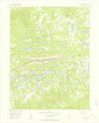
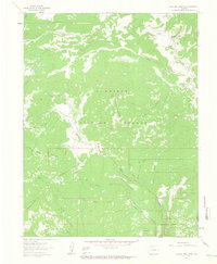
(227)- 1938 Map of Mt. Gunnison
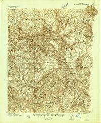 1938 Mt. Gunnison1938 Print · USGSGunnison County is shown here in the late 1930s, a period defined by high-altitude ranching and the early development of the North Fork valley. Genealogists and historians can trace the locations of old working camps and ranch sites like Davenport Ranch, Berdine, and Hammond Cow Camp.5 unique versions available
 - 1945 Map of Mount Gunnison
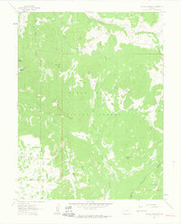
 1945 Mount Gunnison1945 Print · USGSGunnison and Delta counties are shown in the mid-1940s during a time when high-country cabins and stock trails defined the landscape. Researchers can trace the Munsey Ruby Stock Driveway or locate remote sites like Bardine and Snowshoe Cabin.2 unique versions available
 - 1955 Map of Olathe NW, 1956 Print
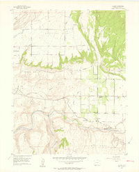
 1955 Olathe NW1956 Print · USGSDelta and Montrose counties in the mid-1950s showcase a high-desert landscape transformed by irrigation and rail. Researchers can trace the path of the Denver and Rio Grande Western railroad or locate old waterworks like the East Selig Canal and Peach Valley Dam No 1.5 unique versions available
 - 1955 Map of Black Ridge, 1956 Print
 1955 Black Ridge1956 Print · USGSWestern Colorado's landscape is captured here in the mid-1950s as water management and rugged geography shaped the county line. Researchers can trace irrigation history through the Scenic Ditch or locate landmarks like Green Mountain Reservoir No 1 and Red Canyon.6 unique versions available
 - 1955 Map of Grand Mesa, 1957 Print
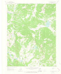
 1955 Grand Mesa1957 Print · USGSMesa County and Delta County high country in the mid-fifties was a landscape of high-altitude reservoirs and foot trails. Researchers can trace the development of mountain retreats at Grand Mesa Christian Association or locate the Ward Lake Ranger Sta and Columbine Chapel.5 unique versions available
 - 1955 Map of Lazear, 1957 Print
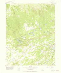
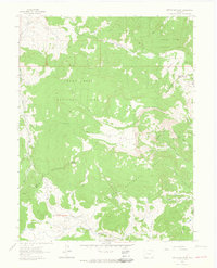
 1955 Lazear1957 Print · USGSDelta County's agricultural and canyon lands are captured here in the mid-fifties as the local school system consolidated and irrigation matured. Researchers can trace the Denver and Rio Grande Western tracks through Lazear and find the Rogers Mesa Community House.8 unique versions available
 - 1955 Map of Skyway, 1957 Print
 1955 Skyway1957 Print · USGSGrand Mesa’s high-country reservoirs and alpine camps are captured here during the mid-fifties, showing the region's transition into a recreational hub. Genealogists and researchers can trace family-named sites like the Beaser Homestead or locate old ranching outposts such as Hallenbeck Cow Camp.6 unique versions available
 - 1956 Map of Montrose, 1963 Print
 1956 Montrose1963 Print · USGSThe Colorado western slope in the late fifties and early sixties shows a landscape defined by the Denver & Rio Grande Western RR and the Gunnison River. Trace the development of Blue Mesa Reservoir or locate high-country sites like the Bachelor Mine.3 unique versions available
 - 1956 Map of Moab, 1972 Print
 1956 Moab1972 Print · USGSThe Colorado Plateau and La Sal Mountains appear here in the mid-fifties, just as the uranium boom and energy exploration were reshaping the Four Corners. Researchers can trace the Denver and Rio Grande Western through Cisco or locate the remote outpost of Uravan and Looking Glass Rock.3 unique versions available
 - 1956 Map of Grand Junction, 1973 Print
 1956 Grand Junction1973 Print · USGSThe Grand Valley and its surrounding high plateaus are captured here in the mid-twentieth century as the region's ranching and rail heritage remained central. Researchers can trace the path of the Denver & Rio Grande Western RR through Grand Junction or locate remote outposts like Dragon and Atchee.2 unique versions available
 - 1957 Map of Leadville, 1978 Print
 1957 Leadville1978 Print · USGSHigh-country mining and rail transport define the central Colorado Rockies during the mid-to-late twentieth century. Researchers can trace the industrial footprints of Gilman and Climax, find small rail stops like Malta, and follow the Denver and Rio Grande Western RR.2 unique versions available
 - 1959 Map of Grand Junction
 1959 Grand Junction1959 Print · USGSThe Grand Valley and the high plateaus of the Colorado-Utah border come into focus in the late fifties as irrigation and rail lines define the landscape. Local historians can trace several industrial outposts labeled as abandoned, including Watson and Dragon, alongside the Denver and Rio Grande Western RR.
 - 1959 Map of Moab
 1959 Moab1959 Print · USGSSoutheast Utah and Western Colorado are mapped here in the late fifties, just as the uranium boom was transforming the remote canyon lands. Genealogists and historians can trace the foundations of Moab and Nucla, or locate mining sites and landmarks like Uravan and Dead Horse Point.
 - 1959 Map of Leadville
 1959 Leadville1959 Print · USGSThe Colorado high country in the late fifties is a landscape of mining history and military training, from the streets of Leadville to the Camp Hale grounds. Genealogists and historians can trace the Denver and Rio Grande Western RR alongside now-deserted sites like Ashcroft and Independence.
 - 1959 Map of Montrose
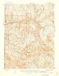
 1959 Montrose1959 Print · USGSWestern Colorado in the late fifties is defined by the high peaks and river valleys of the Southern Rockies. Genealogists and historians can trace the paths of the Denver & Rio Grande Western RR or locate mountain settlements like Crawford, Lazear, and Doyleville.
 - 1960 Map of Leadville
 1960 Leadville1960 Print · USGSThe Colorado high country in the mid-fifties comes alive through its mining camps, river valleys, and rail lines. Trace the industrial legacy of the Climax Molybdenum Mine and explore the alpine reaches of the Camp Hale Military Reservation.2 unique versions available
 - 1960 Map of Montrose
 1960 Montrose1960 Print · USGSThe Colorado high country in the mid-fifties is captured here during a period of steady ranching and persistent mining. Researchers can trace the path of the Denver & Rio Grande Western RR or locate small settlements like Somerset, Maher, and Sargent.2 unique versions available
 - 1960 Map of Moab
 1960 Moab1960 Print · USGSThe canyonlands and high plateaus of the Utah-Colorado border are shown here during the mid-century uranium boom. Researchers can trace the river-and-rail corridors of the Colorado River and the Denver and Rio Grande Western near Moab and Uravan.3 unique versions available
 - 1960 Map of Grand Junction
 1960 Grand Junction1960 Print · USGSThe Grand Junction area at the dawn of the 1960s shows a landscape of river-valley agriculture and high-plateau extraction. Researchers can trace the path of the dismantled railroad and find vanished sites like Watson and Sego.2 unique versions available
 - 1960 Map of Leon Peak, 1963 Print
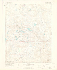 1960 Leon Peak1963 Print · USGSHigh on the Grand Mesa in the early sixties, this survey captures a landscape defined by complex water engineering and high-country ranching. Trace the path of the Leon Tunnel, the Leon Drift Fence, and reservoirs like Colby Horse Park Reservoir.5 unique versions available
 - 1961 Map of Electric Mountain, 1963 Print
 1961 Electric Mountain1963 Print · USGSHigh-altitude ranching and forest management define this corner of the Rockies in the early sixties. Researchers can trace the legacy of family-run operations at Novella Bell Ranch or locate backcountry landmarks like Chimney Rocks and the West Muddy Ranger Sta.4 unique versions available
 - 1961 Map of Porter Mountain, 1963 Print
 1961 Porter Mountain1963 Print · USGSThe high plateau of the Mesa and Delta county line is captured in the early sixties as a hub of forest management and water engineering. Researchers can trace historic irrigation routes like the Silver Spruce Ditch and primitive access paths including the Stubb Jeep Trail near Porter Mountain.4 unique versions available
 - 1961 Map of Chalk Mountain, 1963 Print
 1961 Chalk Mountain1963 Print · USGSThe high mesa country of Delta County in the early 1960s was a landscape defined by forest management and water engineering. You can trace the network of high-altitude irrigation pools like Holy Terror Res and Skimmed Milk Res or locate the Lombard Slides.7 unique versions available
 - 1961 Map of Spruce Mountain, 1964 Print
 1961 Spruce Mountain1964 Print · USGSMesa County and the surrounding national forests are captured here in the early 1960s during a period of high-country ranching and resource exploration. Trace the locations of Buzzard Cow Camp and Oil Well Camp, or locate the Drill Hole and old Pack Trail through the timber.4 unique versions available
 - 1962 Map of Moab
 1962 Moab1962 Print · USGSThe canyon country of southeastern Utah and western Colorado is captured here in the early sixties, showing the reach of the Denver and Rio Grande Western through the desert. Researchers can trace the layout of mining settlements like Uravan and old railroad stops at Cisco and Sagers Station.
Showing maps 1-25 of 227
Top cities of Delta County
- Delta historical maps
- Orchard City historical maps
- Cedaredge historical maps
- Paonia historical maps
- Hotchkiss historical maps
- Crawford historical maps
Frequently asked questions
- What are the different types of historical maps available for Delta County?
- What is the oldest map of Delta County?
- Where can I purchase historical maps of Delta County for my home or office?
- Where can I download high-res historical maps of Delta County?
- Are there historical topographic maps available for Delta County?
- Is there historical aerial imagery available for Delta County?
- Where are historical maps of Delta County sourced from?