Old Maps of Collier County, Florida for Academic Research
Study the evolution of Collier County with 324 high-resolution historic maps. Whether you're teaching, researching, or modeling changes in land use, these maps provide essential visual documentation of urban, environmental, and geographic change.
- Analyze long-term change: Track patterns in development, transportation, and natural features.
- Ideal for environmental or urban studies: Support academic projects with primary historical map data.
- Use in the classroom or lab: Educators and researchers rely on these maps to bring historical context to life.
These maps are a powerful tool for teaching, research, and visualizing how Collier County has changed over the decades.
Collier County, FL maps
(324)- 1956 Map of Miami, 1963 Print
 1956 Miami1963 Print · USGSSouthern Florida experiences post-war expansion in the 1950s, even as the wilderness remains dominant across the southern peninsula. Genealogists and historians can trace suburban growth in Opa-locka and Perrine or locate remote sites like the Tamiami Ranger Station.5 unique versions available
 - 1956 Map of West Palm Beach, 1964 Print
 1956 West Palm Beach1964 Print · USGSSouth Florida during the mid-fifties exhibits a fascinating balance between expanding coastal cities and the vast interior wetlands. Researchers can trace the development of inland settlements like Immokalee and Okeelanta or locate vanished landmarks like Chosen and Buckingham Cem.2 unique versions available
 - 1957 Map of West Palm Beach
 1957 West Palm Beach1957 Print · USGSSouthern Florida in the mid-fifties reveals a landscape defined by massive drainage canals and the early expansion of the Gold Coast. Genealogists and historians can trace industrial outposts like the Sugar plant and Everglades Labor Center, or locate the Jupiter Auxiliary Air Force Base.
 - 1958 Map of West Palm Beach
 1958 West Palm Beach1958 Print · USGSSouth Florida in the late fifties was a land of transition between massive agricultural works and rapid coastal growth. Genealogists and historians can trace old canal networks, early rail lines like the Florida East Coast, and landmarks like the Moore Haven Lock or Jupiter Auxiliary Air Force Base.2 unique versions available
 - 1958 Map of Miami
 1958 Miami1958 Print · USGSSoutheast Florida in the late fifties reveals a coastal boom held in balance with the wild sawgrass and mangroves of Everglades National Park. Trace the paths of the Florida East Coast RR through Homestead or locate the U S Marine Corps Air Station during the height of the Cold War.
 - 1958 Map of Corkscrew SE, 1959 Print
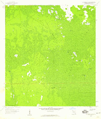
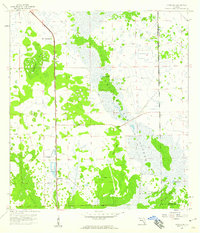
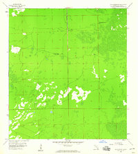
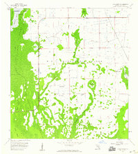 1958 Corkscrew SE1959 Print · USGSCollier County's western Everglades are documented here in the late fifties, showcasing a landscape of interconnected wetlands and hammocks. Naturalists and historians can trace early conservation boundaries at Corkscrew Swamp Sanctuary and locate numerous Flowing Wells.3 unique versions available
 - 1958 Map of Bonita Springs, 1959 Print
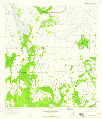
 1958 Bonita Springs1959 Print · USGSCoastal Southwest Florida comes alive in the late fifties, showing the early growth of Bonita Springs and its surrounding wetlands. Researchers can trace the original rail corridor of the Atlantic Coast Line and find mid-century landmarks like the Drive-in Theater and Crest Lawn Cem.5 unique versions available
 - 1958 Map of Belle Meade, 1959 Print
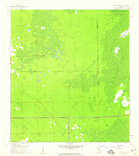
 1958 Belle Meade1959 Print · USGSThe Collier County coast is captured here in the late fifties, showing the interplay between tidal marshes and early settlements. Genealogists and historians can trace Old Marco Junction and Belle Meade before modern development changed the landscape.5 unique versions available
 - 1958 Map of Corkscrew NW, 1959 Print
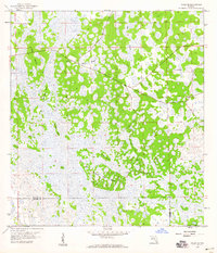
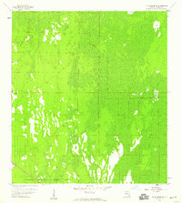
 1958 Corkscrew NW1959 Print · USGSThe Everglades borderlands of Lee and Collier Counties appear in the late fifties as a landscape of vast wetlands and emergent islands. Researchers can trace the early boundaries of the Corkscrew Swamp Sanctuary and locate features like Panther Island and the Flowing Well.4 unique versions available
 - 1958 Map of Catherine Island, 1959 Print
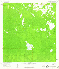
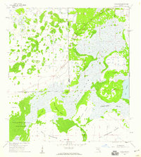
 1958 Catherine Island1959 Print · USGSThe Florida Everglades in the late fifties remain an expansive wetland wilderness, mapped here through the intricate strands of Collier County. Trace the locations of ancient Indian Mounds and the isolated Pennington Post Camp deep within the Fakahatchee Strand.3 unique versions available
 - 1958 Map of Felda SE, 1959 Print
 1958 Felda SE1959 Print · USGSIn the late 1950s, the border of Hendry and Collier counties remained a wet expanse of sloughs and hammocks. Local historians can trace the remote network of islands and drainage patterns, from the Keri Lookout Tower to the named reaches of Wild Cow Island and Lime Slough.2 unique versions available
 - 1958 Map of Immokalee, 1959 Print
 1958 Immokalee1959 Print · USGSImmokalee and the surrounding Everglades borderlands appear in the late fifties as a growing railroad town. Trace the local community through Buthne Sch, the Atlantic Coast Line tracks, and landmarks like Bunker Hill and Lake Trafford.3 unique versions available
 - 1958 Map of Felda, 1959 Print
 1958 Felda1959 Print · USGSHendry County's marshy interior is shown in the late 1950s, a time when rail travel still centered on the Atlantic Coast Line. Researchers can locate community centers like Mt Zion Ch and the rail-stop at Felda (Station) amidst the Twelvemile Slough.3 unique versions available
 - 1958 Map of Sunniland, 1959 Print
 1958 Sunniland1959 Print · USGSCollier County's interior was a frontier of industry and swamp in the late fifties. You can trace the Atlantic Coast Line railroad past Sunniland to find several Oil Well sites and the archaeological marker of an Indian Mound.3 unique versions available
 - 1958 Map of Naples South, 1959 Print
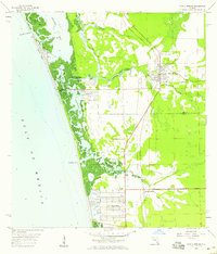
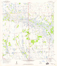
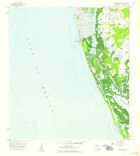 1958 Naples South1959 Print · USGSCoastal Florida in the late fifties shows the early expansion of Naples and its waterfront canal systems. Trace the original shoreline and tidal passes from Gordon Pass south to the undeveloped reaches of Rookery Bay and Little Marco Pass.5 unique versions available
 - 1958 Map of Belle Meade NE, 1959 Print
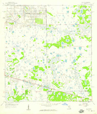
 1958 Belle Meade NE1959 Print · USGSCollier County’s interior wetlands appear in detail just before the late twentieth-century expansion into the Big Cypress region. Researchers can trace early land use around Big Corkscrew Island, the remote Camp, and the drainage patterns of Stumpy Strand.4 unique versions available
 - 1958 Map of Immokalee NE, 1959 Print
 1958 Immokalee NE1959 Print · USGSCollier and Hendry counties meet in this late 1950s survey of the Florida Everglades, showing a landscape defined by hammocks and wetlands. Researchers can trace the path of the Atlantic Coast Line railroad and locate the isolated settlement of Thorp.4 unique versions available
 - 1958 Map of Belle Meade NW, 1959 Print
 1958 Belle Meade NW1959 Print · USGSCollier County's southern interior in the late fifties was a remote landscape of cypress and marsh. Genealogists and historians can trace early outposts like Panther Camp and Kingsville Camp along a new road marked Under Construction.6 unique versions available
 - 1958 Map of Immokalee SW, 1959 Print
 1958 Immokalee SW1959 Print · USGSThe northern Everglades in the late fifties was a wilderness of cypress strands and isolated islands. Local historians can trace early industry and terrain landmarks like Big Corkscrew Island, the Oil Well, and Camp Keats.4 unique versions available
 - 1958 Map of Corkscrew SW, 1959 Print
 1958 Corkscrew SW1959 Print · USGSThe western Everglades at the edge of the Lee and Collier County line appear here in their natural, mid-century state. Researchers can trace the boundaries of the Corkscrew Swamp Sanctuary and the wild reaches of Horseshoe Marsh.4 unique versions available
 - 1958 Map of Belle Meade SE, 1959 Print
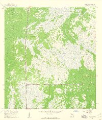
 1958 Belle Meade SE1959 Print · USGSCollier County was a frontier of cypress and sawgrass in the late fifties, where the landscape was defined more by water than by roads. Researchers can trace the path of the Old Railroad Grade and the primitive Mule Lot Road as they cut through the northern reaches of Collier Seminole State Park.3 unique versions available
 - 1958 Map of Naples North, 1959 Print
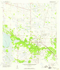
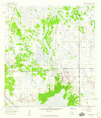
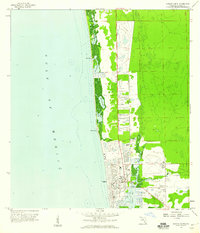 1958 Naples North1959 Print · USGSCoastal Florida in the late fifties shows a landscape of burgeoning development and pristine waterways. Genealogists and historians can trace the footprint of early schools like Carver Sch, the Naples Airport, and the winding Gordon River before modern expansion.6 unique versions available
 - 1958 Map of Alva SE, 1959 Print
 1958 Alva SE1959 Print · USGSFlorida's interior wetlands near the Lee and Hendry county line are shown here in the late fifties as early residential planning began to take hold. Genealogists and historians can trace the early grid of Lehigh Acres alongside landmarks like the Corkscrew Lookout Tower and Twelvemile Slough.3 unique versions available
 - 1958 Map of Corkscrew, 1959 Print
 1958 Corkscrew1959 Print · USGSCollier and Lee counties are shown here in the late fifties, dominated by the intricate wetland systems of the Big Cypress region. Genealogists and researchers can trace the early footprints of Corkscrew and isolated settlements like Ruess Island amidst Corkscrew Swamp.3 unique versions available
 - 1959 Map of Miles City, 1960 Print
 1959 Miles City1960 Print · USGSCollier County’s interior swamp and wet prairie are captured in the late fifties as a landscape of isolated strands and railroad outposts. Researchers can locate the Miles City Lookout Tower, trace the Atlantic Coast Line tracks, and find remote features like Model T Flat.4 unique versions available
Showing maps 1-25 of 324
Top cities of Collier County
- Immokalee historical maps
- Immokalee historical maps
- Naples historical maps
- Marco Island historical maps
- Lely Resort historical maps
- Pelican Bay historical maps
See more
Frequently asked questions
- What are the different types of historical maps available for Collier County?
- What is the oldest map of Collier County?
- Where can I purchase historical maps of Collier County for my home or office?
- Where can I download high-res historical maps of Collier County?
- Are there historical topographic maps available for Collier County?
- Is there historical aerial imagery available for Collier County?
- Where are historical maps of Collier County sourced from?