1970s Maps of Collier County, Florida
Explore 26 historic maps of Collier County from the 1970s. These maps offer a rare glimpse into what life looked like during the 1970s — showing old roads, neighborhoods, homes, and landmarks that have changed or disappeared over time.
Whether you're researching your family's past, planning a metal detecting trip, or studying how Collier County's landscape evolved across the 1970s, these high-resolution maps are a powerful tool for exploring the history of this region.
- Focus on a specific era: All maps on this page are from the 1970s, giving you a focused view of this time period.
- See what’s changed: Compare century-old streets, trails, and buildings to today's modern landscape using overlays and satellite layers.
- Research with precision: Use these maps for genealogy, historical research, land use analysis, or educational projects.
- View, download, or print: Maps are fully viewable online in high resolution, and can be downloaded or printed for your own records.
Start exploring Collier County's history through authentic maps from the 1970s. This is your window into the past.
Collier County, FL maps
(26)- 1972 Map of Monroe Station NE, 1976 Print
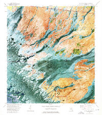
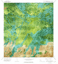
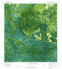
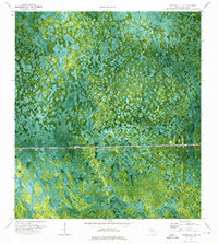
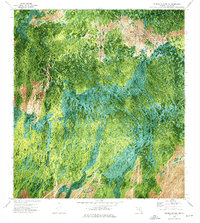 1972 Monroe Station NE1976 Print · USGSThe Collier County interior in the early seventies reveals a landscape of cypress strands and wet prairies. Trace the remote path of Monument Road as it passes near Buckskin Strand and the open expanse of Lost Dog Prairie.3 unique versions available
 - 1972 Map of Weavers Station, 1976 Print
 1972 Weavers Station1976 Print · USGSThe Florida Everglades meet the Gulf coast in the early 1970s, showcasing the intricate balance of cypress strands and coastal prairies. Researchers can trace the path of the Tamiami Trail as it passes Roadside Park and the headwaters of the Fakahatchee River.3 unique versions available
 - 1972 Map of Burns Lake, 1976 Print
 1972 Burns Lake1976 Print · USGSCollier County's wet prairies and cypress strands are captured in this early 1970s orthophotomap just as the modern conservation era began. Researchers can trace the path of the Tamiami Trail and locate remote features like Burns Lake and Windmill Prairie.2 unique versions available
 - 1972 Map of Ochopee, 1976 Print
 1972 Ochopee1976 Print · USGSThe Florida Everglades of the early seventies are revealed here through a detailed orthophotomap of the cypress strands and prairies north of the Tamiami Trail. Researchers can trace the Old Railroad Grade between Copeland and Jerome or locate landmarks like the Lee Cypress area.2 unique versions available
 - 1973 Map of Gator Hook Swamp, 1975 Print
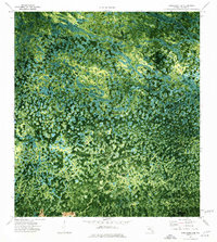
 1973 Gator Hook Swamp1975 Print · USGSThe Florida Everglades and Big Cypress wilderness are captured here in the early seventies, detailing the complex hydrology of the cypress strands. You can trace the historic Tamiami Trail, locate the Roadside Park, and follow paths like the Airboat Trail through the Gator Hook Swamp.2 unique versions available
 - 1973 Map of Fortymile Bend, 1975 Print
 1973 Fortymile Bend1975 Print · USGSThe Florida Everglades in the early 1970s reveal a landscape of ancestral hammocks and modern infrastructure. Genealogists and historians can trace specific family locations such as Pete Osceolas Farm, Jessie Willies Camp, and Smallpox Tommies Camp.3 unique versions available
 - 1973 Map of Cape Romano, 1976 Print
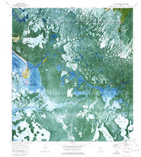
 1973 Cape Romano1976 Print · USGSThe Collier County coast in the early seventies reveals a labyrinth of mangrove islands and shifting sands at the edge of the Gulf. Trace the natural shorelines of Kice Island and Big Morgan Island or study the dangerous Cape Romano Shoals.
 - 1973 Map of Marco Island, 1976 Print
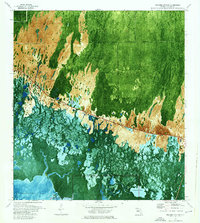
 1973 Marco Island1976 Print · USGSCoastal Collier County undergoes a dramatic transition in the early seventies as new canal-front developments rise from the mangroves. Genealogists and local historians can trace the growth of Marco and Goodland, identifying local landmarks like St Marks Ch and the Old Railroad Grade.3 unique versions available
 - 1973 Map of Fiftymile Bend, 1976 Print
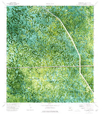
 1973 Fiftymile Bend1976 Print · USGSThe Florida Everglades meet the jet age in the early 1970s at the intersection of the Tamiami Trail and the county line. Researchers can trace the massive runways of the Dade-Collier Airport alongside local landmarks like Fiftymile Bend and the Trail Gospel Center.3 unique versions available
 - 1973 Map of North Of Fiftymile Bend, 1976 Print
 1973 North Of Fiftymile Bend1976 Print · USGSCollier County’s interior wetlands appear in detailed aerial imagery during the early 1970s, revealing the natural state of the Everglades. Researchers can trace the path of the Corn Dance Trail and locate isolated landmarks like Threemile Island or a distant Hammock.2 unique versions available
 - 1973 Map of Monroe Station, 1976 Print
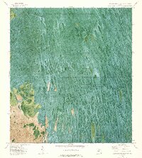
 1973 Monroe Station1976 Print · USGSThe Florida Everglades and Big Cypress region in the early seventies reveal a landscape of remote outposts and swamp strands. Researchers can trace the Dismantled Logging Tram, locate Monroe Station, and see the layout of Indian Village.
 - 1973 Map of Royal Palm Hammock, 1976 Print
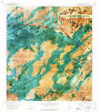
 1973 Royal Palm Hammock1976 Print · USGSThe coastal wilds of Collier County are captured here in the early 1970s, showing the intersection of new canals and ancient mangrove forests. Researchers can trace the development of the Tamiami Trail corridor near Remuda Ranch and identify landmarks like Grocery Place and Dismal Key.
 - 1973 Map of North of Fortymile Bend, 1976 Print
 1973 North of Fortymile Bend1976 Print · USGSThe Florida Everglades in the early seventies are seen here in detail through aerial photography and topographic mapping. Researchers can trace historic land use at Mari Law Seminole Village and Sam Franks Old Farm while observing the water management of Conservation Area No 3A.2 unique versions available
 - 1974 Map of Everglades City, 1976 Print
 1974 Everglades City1976 Print · USGSThe Florida Gulf Coast and the labyrinthine mangrove keys are captured in the mid-1970s just as the park's modern boundaries were well-established. Researchers can trace the Wilderness Waterway past Jack Daniels Key or locate the historic Fakahatchee Cem near the coast.2 unique versions available
 - 1974 Map of Everglades 2 SW, 1976 Print
 1974 Everglades 2 SW1976 Print · USGSThe Florida Everglades meet the interior wetlands during the mid-seventies in this detailed orthophotomap of the Big Cypress Seminole Indian Reservation. Researchers can locate community landmarks like Ahfachkee Day Sch and the site of Browns Indian Trading Post (Ruins) amidst the strands.2 unique versions available
 - 1974 Map of Immokalee 4 NW, 1976 Print
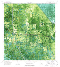
 1974 Immokalee 4 NW1976 Print · USGSCollier County wetlands are captured in the mid-1970s through this detailed orthophotomap, showing the landscape just as industrial transit reached the interior. Genealogists and historians can trace local outposts like Charlie Billie Camp and Ten Pen Camp near Little Marsh.2 unique versions available
 - 1974 Map of Immokalee 1 SW, 1976 Print
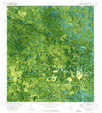 1974 Immokalee 1 SW1976 Print · USGSSouth Florida's swampy interior is captured in the mid-seventies, showing the intersection of natural hammocks and modern infrastructure. Genealogists and historians can trace landmarks like Doctors Hammock, Dozier Hammock, and the drainage works of the Levee.2 unique versions available
 - 1974 Map of Immokalee 1 SE, 1976 Print
 1974 Immokalee 1 SE1976 Print · USGSThe Florida Everglades and Big Cypress swamp are seen here in the mid-seventies just as modern water management reached these remote stretches. Genealogists and historians can trace the Seminole Indian Reservation boundary and natural features like Cow Bone Island and Canoe Lake Strand.3 unique versions available
 - 1974 Map of Chokoloskee, 1976 Print
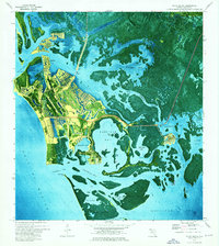
 1974 Chokoloskee1976 Print · USGSThe coastal wilderness of the Everglades in the mid-seventies reveals the isolated fishing and pioneer outposts of the Ten Thousand Islands. Genealogists and historians can trace the footprints of Chokoloskee and Plantation Island, while following the Wilderness Waterway past the Cem and Lopez Campsite.3 unique versions available
 - 1974 Map of Immokalee 4 SW, 1976 Print
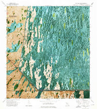
 1974 Immokalee 4 SW1976 Print · USGSCollier County’s subtropical interior is captured in the mid-seventies through this detailed orthophotomap of the Everglades. Trace the path of the Old Railroad Grade as it navigates through Deep Lake Strand and the open expanse of Airplane Prairie.3 unique versions available
 - 1974 Map of Everglades 3 SW, 1976 Print
 1974 Everglades 3 SW1976 Print · USGSThe Florida Everglades interior is captured in high-resolution detail during the mid-1970s, showcasing the native landscape across the Collier Co border. Researchers can trace the precise boundaries of the Florida State Miccosukee Indian Reservation and study the natural distribution of tree islands.2 unique versions available
 - 1974 Map of Immokalee 4 NE, 1976 Print
 1974 Immokalee 4 NE1976 Print · USGSThe Big Cypress wilderness in the mid-seventies is captured here as the modern toll road begins to pierce the swamp. Researchers can trace the winding paths of the Kissimmee Dark Strand or locate remote outposts like Fruit Fly Camp and Whidden Lake.2 unique versions available
 - 1974 Map of Everglades 3 NW, 1976 Print
 1974 Everglades 3 NW1976 Print · USGSThe Florida Everglades in the mid-1970s reveal a landscape of vast wetlands and engineering efforts to manage them. Trace the boundaries of the Miccosukee Indian Reservation and locate remote landing strips near Doctors Prairie.3 unique versions available
 - 1974 Map of Immokalee 4 SE, 1976 Print
 1974 Immokalee 4 SE1976 Print · USGSCollier County’s remote wetlands are captured in the mid-seventies, showing the isolated camps and essential airstrips of the Everglades. Researchers can locate Osceola Camp, trace the namesake Wagon Wheel, or find landmarks like Sugar Mill Mound and Turkey Foot.2 unique versions available
 - 1974 Map of Panther Key, 1976 Print
 1974 Panther Key1976 Print · USGSThe Collier County coastline is captured in the mid-1970s, revealing the complex labyrinth of the Ten Thousand Islands. Researchers can trace the shifting boundaries of Everglades National Park and find local landmarks like Camp Lulu Key and Panther Key.
Showing maps 1-25 of 26
Top cities of Collier County
- Immokalee historical maps
- Immokalee historical maps
- Naples historical maps
- Marco Island historical maps
- Lely Resort historical maps
- Pelican Bay historical maps
See more
Frequently asked questions
- What are the different types of historical maps available for Collier County?
- What is the oldest map of Collier County?
- Where can I purchase historical maps of Collier County for my home or office?
- Where can I download high-res historical maps of Collier County?
- Are there historical topographic maps available for Collier County?
- Is there historical aerial imagery available for Collier County?
- Where are historical maps of Collier County sourced from?