
1973 Map of Fiftymile Bend
USGS Topo · Published 1976About this map
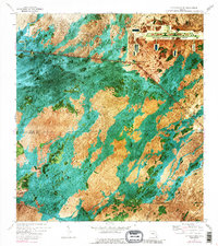
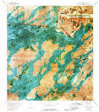
Dade-Collier Transition and Training Airport stands as a massive geometric clearing in the Florida Everglades, a striking contrast to the surrounding sawgrass and hammocks of the early 1970s. This orthophotomap, produced from 1971 aerial photography, captures the intersection of the Tamiami Trail and the Tamiami Canal as they cut southeast through the cypress and marl prairies. The landscape is dotted with small settlements and family-named landmarks like Fiftymile Bend, Paolita Station, and Pinecrest.
Find a feature on this map
25 named features on this map. Tap any name to fly to it.
Don’t see what you’re looking for? This feature index may not catch every label — zoom into the map to look around manually.
Map Details
Editions of this 1973 Fiftymile Bend Map
3 editions found
Other maps of this area

1956 · Miami
USGS Topo · 1:250,000

1958 · Miami
USGS Topo · 1:250,000

1972 · Shark Valley Lookout Tower
USGS Topo · 1:24,000

1972 · Monroe Station NE
USGS Topo · 1:24,000

1972 · Lostmans Trail
USGS Topo · 1:24,000

1972 · Big Boy Lake
USGS Topo · 1:24,000

1973 · Fortymile Bend
USGS Topo · 1:24,000

1973 · North Of Fiftymile Bend
USGS Topo · 1:24,000

1973 · Monroe Station
USGS Topo · 1:24,000
1973 · North of Fortymile Bend
USGS Topo · 1:24,000