1960s Maps of Fort Defiance Agency
Explore 49 historic maps of Fort Defiance Agency from the 1960s. These maps offer a rare glimpse into what life looked like during the 1960s — showing old roads, neighborhoods, homes, and landmarks that have changed or disappeared over time.
Whether you're researching your family's past, planning a metal detecting trip, or studying how Fort Defiance Agency's landscape evolved across the 1960s, these high-resolution maps are a powerful tool for exploring the history of this region.
- Focus on a specific era: All maps on this page are from the 1960s, giving you a focused view of this time period.
- See what’s changed: Compare century-old streets, trails, and buildings to today's modern landscape using overlays and satellite layers.
- Research with precision: Use these maps for genealogy, historical research, land use analysis, or educational projects.
- View, download, or print: Maps are fully viewable online in high resolution, and can be downloaded or printed for your own records.
Start exploring Fort Defiance Agency's history through authentic maps from the 1960s. This is your window into the past.
Fort Defiance Agency maps
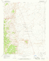
- 1960 Map of Flagstaff
 1960 Flagstaff1960 Print · USGSNorthern Arizona at the dawn of the sixties shows a landscape defined by mesa-top Hopi villages and the burgeoning railroad hub of Flagstaff. Trace the path of U.S. 66 past Meteor Crater or locate historic trading posts like Gray Mountain Trading Post.2 unique versions available
 - 1961 Map of Marble Canyon
 1961 Marble Canyon1961 Print · USGSThe northern Arizona desert in the early sixties reveals a landscape of tribal lands and canyon crossings. Trace the old river life at Lees Ferry, find the Uranium mill at Tuba City, and locate the iconic Elephant Feet landmarks.
 - 1962 Map of Flagstaff
 1962 Flagstaff1962 Print · USGSNorthern Arizona in the early sixties showcases the intersection of Tribal lands, national forests, and the busy Route 66 corridor. Trace historic roadside stops and landmarks like Meteor Crater, the Buck-Rodgers Trading Post, and the ancient village of Old Oraibi.
 - 1962 Map of Gallup
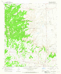
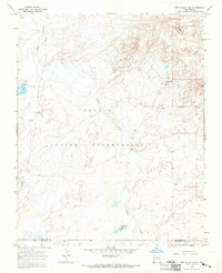
 1962 Gallup1962 Print · USGSThe high plateau and mountains surrounding Gallup in the early sixties reveal a landscape defined by tribal lands, coal mining, and the rail corridor. Researchers can locate remote trading posts, the Gibson Coal Mine, and the historic Window Rock capital.
 - 1962 Map of Saint Johns
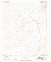
 1962 Saint Johns1962 Print · USGSEastern Arizona and the New Mexico borderlands come alive in the early sixties, showing a landscape of high-plateau ranching and early national monuments. Trace the path of the Atchison Topeka and Santa Fe or locate old water sources like Salado Springs and Lyman Reservoir.
 - 1963 Map of Twin Lakes, 1967 Print
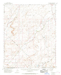
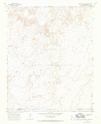
 1963 Twin Lakes1967 Print · USGSMcKinley County is shown in the early sixties as a landscape of reservation life and high-desert terrain. Genealogists and historians can trace the paths of the Wagon Trail and locate landmarks like the Tohlakai Trading Post and Twin Lakes.
 - 1963 Map of Big Rock Hill, 1967 Print
 1963 Big Rock Hill1967 Print · USGSMcKinley County, New Mexico, is captured here in the early sixties as a landscape of remote ranching and desert mining. Genealogists and historians can locate family-named sites such as Tom Ranch, the Woolly Tommy Mine, and Bethlehem Ch.2 unique versions available
 - 1963 Map of Tse Bonita School, 1967 Print
 1963 Tse Bonita School1967 Print · USGSMcKinley County, New Mexico, is shown in the early sixties as a terrain of named washes and tribal lands. Researchers can trace the local mining history and desert landmarks like the Window Rock Dump Coal Mine and the Tse Bonita Sch.2 unique versions available
 - 1963 Map of Hard Ground Flats, 1967 Print
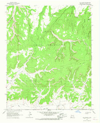
 1963 Hard Ground Flats1967 Print · USGSThe Navajo Nation's high-desert canyons and mesas are captured here in the early sixties, showing a landscape of intense geological relief. Researchers can locate vital water sources like Red Water Pond and historic Ruins near Peach Spring Canyon.2 unique versions available
 - 1963 Map of Oak Spring, 1967 Print
 1963 Oak Spring1967 Print · USGSThe Navajo Indian Reservation in the 1960s reveals a landscape of high mesas and deep drainage systems before widespread modern development. Genealogists and historians can trace essential desert water sources like Oak Spring or locate early industrial sites such as the Coal Well.2 unique versions available
 - 1966 Map of White Cone, 1968 Print
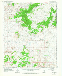 1966 White Cone1968 Print · USGSThe high desert of northeastern Arizona is revealed here in the 1960s, showing the intersection of tribal lands and distinctive volcanic topography. Researchers can locate vital desert water sources like Sand Spring and trace the profiles of Tesihim Butte and Deshgish Butte.
 - 1966 Map of Egloffstein Butte, 1968 Print
 1966 Egloffstein Butte1968 Print · USGSNavajo and Hopi lands are documented during the mid-sixties, showing the intricate network of washes and springs that sustained life here. Researchers can locate vital water sources like Awatobi Spring and Kalbito Springs, or trace landmarks like Egloffstein Butte.
 - 1966 Map of Keams Canyon, 1968 Print
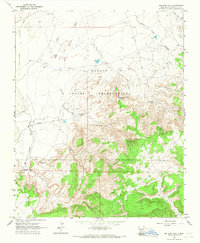
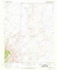
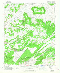 1966 Keams Canyon1968 Print · USGSThe Hopi and Navajo tribal lands in the mid-1960s reveal a landscape of ancestral sites and high-desert outposts. Researchers can locate remote settlements like Low Mountain alongside historical points like the Kit Carson Inscription Picnic Area and Jeddito.
 - 1966 Map of Tovar Mesa, 1968 Print
 1966 Tovar Mesa1968 Print · USGSThe Hopi and Navajo lands of northern Arizona are captured in the mid-1960s, showing a landscape defined by vital water sources and plateau landmarks. Researchers can trace the network of springs and reservoirs like Little Burro Spring and Red Clay Dam along the sweeping Tovar Mesa.2 unique versions available
 - 1966 Map of Sheep Springs, 1969 Print
 1966 Sheep Springs1969 Print · USGSSan Juan County at the mid-century reveals the arid landscape of the Navajo Indian Reservation along the Route 666 corridor. Genealogists and researchers can trace the vicinity of Sheep Springs and the isolated Black House near Grey Mesa.2 unique versions available
 - 1966 Map of Great Bend, 1969 Print
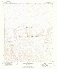
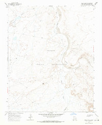 1966 Great Bend1969 Print · USGSSan Juan County in the mid-1960s was a landscape of remote desert plateaus and seasonal watercourses. Genealogists and historians can trace industrial footprints at Mines near Day Mesa or follow the winding Chaco River past the Great Bend.
 - 1966 Map of Grey Hill Spring, 1969 Print
 1966 Grey Hill Spring1969 Print · USGSThe high desert of the Navajo Nation in the mid-1960s is captured here, showing the remote borderlands between San Juan and McKinley counties. Researchers can trace seasonal waterways like Salt Springs Wash and locate vital desert water sources such as Grey Hill Spring and isolated wells.2 unique versions available
 - 1966 Map of Naschitti, 1969 Print
 1966 Naschitti1969 Print · USGSThe Navajo Nation's high-desert landscape comes to life in the late 1960s, showing the early infrastructure of the Naschitti community. Local historians can trace the course of the 666 highway and locate seasonal drainage points like Naschitti Wash and Salt Springs Wash.2 unique versions available
 - 1966 Map of The Pillar 3 SW, 1969 Print
 1966 The Pillar 3 SW1969 Print · USGSNorthern New Mexico's high-desert landscape across the border of San Juan Co and McKinley Co appears here in the mid-1960s. Genealogists and historians can trace the vast boundaries of the Navajo Indian Reservation and its natural drainage systems.2 unique versions available
 - 1966 Map of The Pillar 3 NW, 1969 Print
 1966 The Pillar 3 NW1969 Print · USGSThe Navajo Indian Reservation in the mid-sixties reveals a high-desert landscape centered on the broad, sandy Chaco River. Researchers can trace the path of early infrastructure like the local Pipeline and find water sources including Indian Cr and a lone Well.2 unique versions available
 - 1966 Map of Crystal, 1969 Print
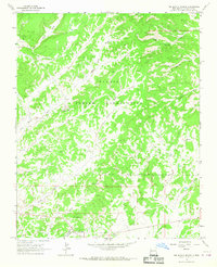
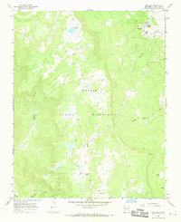
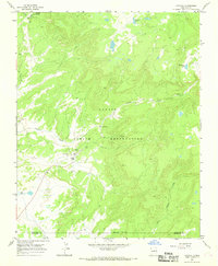 1966 Crystal1969 Print · USGSThe Chuska Mountains region of Northwest New Mexico is documented here in the mid-1960s within the Navajo Indian Reservation. Family historians and researchers can locate the Crystal settlement, a local Cem, and high-altitude water sources like Todacheene Lake.3 unique versions available
 - 1966 Map of The Pillar 3 SE, 1969 Print
 1966 The Pillar 3 SE1969 Print · USGSThe Navajo Nation in the mid-1960s is captured here at a moment of quiet industrial and ranching utility. Researchers can locate specific water management sites like the Spillway and Riser or trace land use near White Rock and a lone Mine.2 unique versions available
 - 1966 Map of Toadlena, 1969 Print
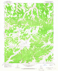
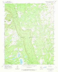
 1966 Toadlena1969 Print · USGSToadlena and the surrounding high reservation lands come to life in this mid-century survey of the Chuska Mountains foothills. Trace essential water sources like Big Water Spring and Toadlena Lake alongside local landmarks like Toh-ni-tsa Lookout.2 unique versions available
 - 1966 Map of Washington Pass, 1969 Print
 1966 Washington Pass1969 Print · USGSThe Navajo Indian Reservation high country in the mid-1960s is mapped here in detail as it crosses the San Juan and McKinley county lines. Researchers can trace remote water sources like Cottonwood Spring and trek the primitive Jeep Trail near Washington Pass.2 unique versions available
 - 1967 Map of Gallup
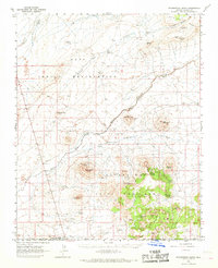
 1967 Gallup1967 Print · USGSThe high desert of New Mexico and Arizona comes into focus in the mid-1960s, centered on the railroad and ranching hub of Gallup. Genealogists and historians can trace routes through Zuni Pueblo, identify old rail stops like Houck, or locate the Aqua Fria Post Office.
Showing maps 1-25
Top cities near Fort Defiance Agency
Top neighborhoods of Fort Defiance Agency
- Chakpahu historical maps
- Navajo historical maps
- Twin Buttes historical maps
- Naschitti historical maps
- Buffalo Springs historical maps
- Twin Lakes historical maps
See more
Frequently asked questions
- What are the different types of historical maps available for Fort Defiance Agency?
- What is the oldest map of Fort Defiance Agency?
- Where can I purchase historical maps of Fort Defiance Agency for my home or office?
- Where can I download high-res historical maps of Fort Defiance Agency?
- Are there historical topographic maps available for Fort Defiance Agency?
- Is there historical aerial imagery available for Fort Defiance Agency?
- Where are historical maps of Fort Defiance Agency sourced from?