1970s Maps of Fort Defiance Agency
Explore 76 historic maps of Fort Defiance Agency from the 1970s. These maps offer a rare glimpse into what life looked like during the 1970s — showing old roads, neighborhoods, homes, and landmarks that have changed or disappeared over time.
Whether you're researching your family's past, planning a metal detecting trip, or studying how Fort Defiance Agency's landscape evolved across the 1970s, these high-resolution maps are a powerful tool for exploring the history of this region.
- Focus on a specific era: All maps on this page are from the 1970s, giving you a focused view of this time period.
- See what’s changed: Compare century-old streets, trails, and buildings to today's modern landscape using overlays and satellite layers.
- Research with precision: Use these maps for genealogy, historical research, land use analysis, or educational projects.
- View, download, or print: Maps are fully viewable online in high resolution, and can be downloaded or printed for your own records.
Start exploring Fort Defiance Agency's history through authentic maps from the 1970s. This is your window into the past.
Fort Defiance Agency maps
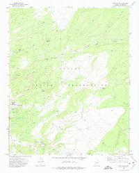
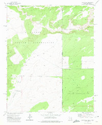
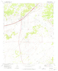
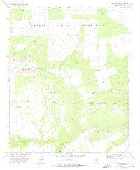
(76)- 1970 Map of Standing Rock NW, 1973 Print
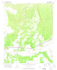
 1970 Standing Rock NW1973 Print · USGSMcKinley County, New Mexico, is captured in the early 1970s, showcasing the high-desert terrain within the Navajo Indian Reservation. Researchers can trace the courses of Standing Rock Wash and find the site of a lonely Well.
 - 1970 Map of Toyee, 1973 Print
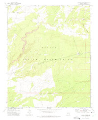
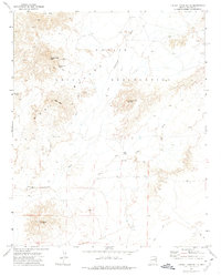
 1970 Toyee1973 Print · USGSMcKinley County, New Mexico, is shown here as it appeared in the early 1970s, focused on the high desert terrain of the Navajo Nation. Researchers can trace the layout of the settlement at Toyee, find remote water sources like Toyee Spring, and locate the Standing Rock Landing Strip.
 - 1970 Map of Red Lake Well, 1973 Print
 1970 Red Lake Well1973 Print · USGSThe Navajo Indian Reservation in the early seventies was a landscape of sparse water and cattle ranching. Trace the vital desert hydrology at Red Lake Well (Flowing) and the drainage of Indian Creek across this high-elevation terrain.
 - 1970 Map of Ear Rock, 1973 Print
 1970 Ear Rock1973 Print · USGSThe Navajo Indian Reservation in McKinley County appears here just as modern infrastructure began to bisect the high desert landscape. Researchers can trace historic water sources and landmarks like Ear Rock, Big Thumb Spring, and the expansive Coyote Wash.
 - 1970 Map of Coyote Canyon NW, 1974 Print
 1970 Coyote Canyon NW1974 Print · USGSTraditional Navajo territory in the early seventies shows a landscape defined by vital water points and sparse infrastructure. Researchers can locate remote landmarks like White Water Spring, Buffalo Springs, and the Gallup Pumping Sta.
 - 1970 Map of Chuska Lake, 1974 Print
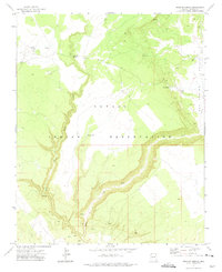
 1970 Chuska Lake1974 Print · USGSThe Navajo Indian Reservation in the early seventies reveals a landscape of high-desert water management and local education. Trace the area's development around Chuska Lake, Chuska Sch, and the winding Coal Mine Road.
 - 1970 Map of Coyote Canyon, 1974 Print
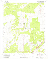
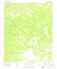
 1970 Coyote Canyon1974 Print · USGSThe Navajo Indian Reservation comes into focus during the early seventies, centered on the settlement of Coyote Canyon. Researchers can locate ancient Cliff Dwellings, scattered Ruins, and landmarks like Dzil Nda Kai Mountain.
 - 1971 Map of Wide Ruins, 1974 Print
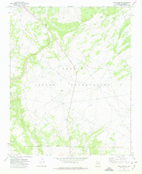
 1971 Wide Ruins1974 Print · USGSThe Navajo Indian Reservation in the 1970s is documented here through its network of isolated water sources and trading hubs. Researchers can trace land use through landmarks like the Wide Ruins Trading Post and family-named features such as Autsidy Smith Well.
 - 1971 Map of Burntwater Wash, 1975 Print
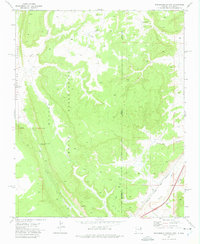
 1971 Burntwater Wash1975 Print · USGSThe high desert of Apache County comes alive in the early seventies, centered on the Burntwater Trading Post and its surrounding desert washes. Genealogists and historians can trace water rights and remote outposts through Broken Home Well, Box Canyon Springs, and the Atchison Topeka and Santa Fe Railroad Grade.
 - 1971 Map of Joe Woody Well, 1975 Print
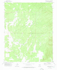 1971 Joe Woody Well1975 Print · USGSHigh-elevation plateau life on the Navajo Indian Reservation during the early seventies is defined by its water and utility networks. Trace the pathways between Joe Woody Well, the Oak Ridge Lookout Tower, and the Window Rock Pumping Station.
 - 1971 Map of Hunters Point, 1975 Print
 1971 Hunters Point1975 Print · USGSThe Navajo Nation borderlands come into focus in the early seventies, detailing the valley around Black Creek. Genealogists and researchers can locate family-named landmarks like John Nez Well and Tabaha Well, alongside the Hunters Point Boarding Sch.
 - 1971 Map of Chafin Well, 1975 Print
 1971 Chafin Well1975 Print · USGSThe high-desert borderlands of Arizona and New Mexico are captured in the early seventies, marking the intersection of the Navajo Indian Reservation and Zuni Indian Reservation. Trace remote outposts and water sources like G H Begaye Well and Good Luck Spring.2 unique versions available
 - 1971 Map of Tudecoz Spring, 1975 Print
 1971 Tudecoz Spring1975 Print · USGSThe Navajo Indian Reservation in the early seventies shows a remote landscape of high plateaus and vital water sources. Trace the path of Wide Ruin Wash or locate isolated infrastructure like the Na Des Bah Well and the secluded Landing Strip.
 - 1971 Map of Uranium Spring, 1975 Print
 1971 Uranium Spring1975 Print · USGSApache County's reservation lands come into focus during the early 1970s, showing a landscape defined by vital water sources and ranching infrastructure. Researchers can trace the path of Black Creek and locate remote outposts like Burnside Well, Uranium Spring, and scattered Prospects.
 - 1971 Map of High Lonesome Well, 1975 Print
 1971 High Lonesome Well1975 Print · USGSThe Arizona-New Mexico state line and the Zuni Indian Reservation meet in this early 1970s high-desert survey. Researchers can trace remote ranching infrastructure including High Lonesome Well, Beacon 56, and the Old Indian Reservation Boundary.
 - 1971 Map of Sanders, 1975 Print
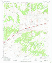
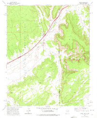
 1971 Sanders1975 Print · USGSIn the high desert of eastern Arizona during the early seventies, the rail-and-river corridor through Sanders reveals a landscape of trade and transit. Researchers can trace the Atchison Topeka and Santa Fe line past the Cedar Point Trading Post and remote landmarks like Emigrant Springs.
 - 1971 Map of Surrender Canyon, 1975 Print
 1971 Surrender Canyon1975 Print · USGSThe Arizona-New Mexico borderlands within the Navajo Indian Reservation are documented here in the early 1970s. Trace the path of the Atchison Topeka and Santa Fe railroad or locate remote landmarks like Tea Pot and Surrender Canyon.
 - 1971 Map of Chambers, 1975 Print
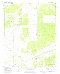
 1971 Chambers1975 Print · USGSChambers and the surrounding high desert of Apache County are captured here in the early seventies, centered on the vital rail and river corridor. Researchers can locate the Mc Carrell Memorial Cem, trace the Atchison Topeka and Santa Fe line, and find ranching landmarks like Peplote Windmill.
 - 1971 Map of Pine Springs, 1975 Print
 1971 Pine Springs1975 Print · USGSThe Navajo Indian Reservation in the early seventies shows a landscape of remote ranching and critical water points. Researchers can trace the layout of Pine Springs, find the remote Landing Strip, and locate essential sites like Timber Well.
 - 1971 Map of Tolapai Spring, 1975 Print
 1971 Tolapai Spring1975 Print · USGSThe Navajo Indian Reservation in Apache County is shown in the early seventies, a landscape where remote ranching met new industrial mining. Trace water sources like Tolapai Spring and Bluebird Well alongside the Open Pit Mine.
 - 1971 Map of Lupton, 1975 Print
 1971 Lupton1975 Print · USGSIn the early 1970s, this borderland between Arizona and New Mexico was a critical transit point for the Atchison Topeka and Santa Fe railroad. Researchers can find deep-country water sources and Navajo landmarks such as Lupton Chapter House, Begay Well, and Keetsoel Spring.
 - 1971 Map of Antelope Lake, 1975 Print
 1971 Antelope Lake1975 Print · USGSThe Navajo Indian Reservation in Apache County was a landscape of high-desert water management and remote infrastructure in the early 1970s. Researchers can locate seasonal water at Antelope Lake, trace the route of a major Pipeline, and find the Landing Strip and Pumping Station.
 - 1971 Map of Wide Ruins SW, 1975 Print
 1971 Wide Ruins SW1975 Print · USGSThe Navajo Indian Reservation in northeastern Arizona is captured here during the early seventies, showing a landscape of mesas and high-desert terrain. Researchers can locate remote infrastructure such as the Water Tank and industrial features like the southern Quarry.
 - 1971 Map of Houck, 1975 Print
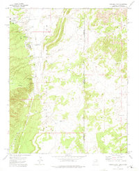
 1971 Houck1975 Print · USGSThe Puerco River valley in the early seventies shows the vital transportation corridor where the railroad and interstate meet. Genealogists and historians can locate the Big Arrow Trading Post, several mission sites like Tegakwitha Mission, and the local Cem.
 - 1972 Map of Turkey Track Butte, 1974 Print
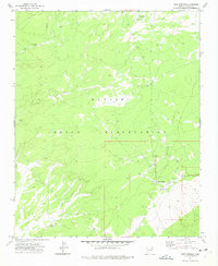
 1972 Turkey Track Butte1974 Print · USGSThe border between the Hopi Indian Reservation and the Navajo Indian Reservation is captured in the early 1970s. Researchers can trace remote desert routes and water sources like Mexican Rest Spring, the Salt Water Tank, and several old ruins.
Showing maps 1-25 of 76
Top cities near Fort Defiance Agency
Top neighborhoods of Fort Defiance Agency
- Chakpahu historical maps
- Navajo historical maps
- Twin Buttes historical maps
- Naschitti historical maps
- Buffalo Springs historical maps
- Twin Lakes historical maps
See more
Frequently asked questions
- What are the different types of historical maps available for Fort Defiance Agency?
- What is the oldest map of Fort Defiance Agency?
- Where can I purchase historical maps of Fort Defiance Agency for my home or office?
- Where can I download high-res historical maps of Fort Defiance Agency?
- Are there historical topographic maps available for Fort Defiance Agency?
- Is there historical aerial imagery available for Fort Defiance Agency?
- Where are historical maps of Fort Defiance Agency sourced from?