1900s (20th Century) Maps of Ware County, Georgia
Explore 54 historic maps of Ware County from the 1900s (20th Century). These maps offer a rare glimpse into what life looked like during the 1900s — showing old roads, neighborhoods, homes, and landmarks that have changed or disappeared over time.
Whether you're researching your family's past, planning a metal detecting trip, or studying how Ware County's landscape evolved across the 1900s, these high-resolution maps are a powerful tool for exploring the history of this region.
- Focus on a specific era: All maps on this page are from the 1900s, giving you a focused view of this time period.
- See what’s changed: Compare century-old streets, trails, and buildings to today's modern landscape using overlays and satellite layers.
- Research with precision: Use these maps for genealogy, historical research, land use analysis, or educational projects.
- View, download, or print: Maps are fully viewable online in high resolution, and can be downloaded or printed for your own records.
Start exploring Ware County's history through authentic maps from the 1900s. This is your window into the past.
Ware County, GA maps
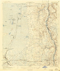
(54)- 1918 Map of Folkston
 1918 Folkston1918 Print · USGSSoutheast Georgia and the Florida borderlands are captured here during the height of the regional timber and rail era. Genealogists can trace family footprints at Traders Hill, old schools like Davis School, and the early rail stations at Uptonville and Mattox.3 unique versions available
 - 1918 Map of Moniac
 1918 Moniac1918 Print · USGSThe borderlands of Georgia and Florida come alive in this 1917 survey of the Okeefenokee fringe and the St. Marys River. Researchers can trace the railroad economy through St George and Moniac, or locate family sites like Olivers Mill and the Chesser School.2 unique versions available
 - 1942 Map of Moniac
 1942 Moniac1942 Print · USGSThe Georgia-Florida borderlands were defined by the wilderness of the Okefenokee Swamp and the tracks of the Georgia Southern and Florida railroad. Genealogists and historians can locate old landmarks like Olivers Mill, Deep Creek Church, and several rural schools including Chesser School and Dunn Creek School.2 unique versions available
 - 1953 Map of Waycross, 1967 Print
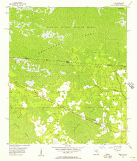
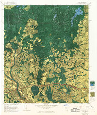
 1953 Waycross1967 Print · USGSSouth Georgia's agricultural and rail heartland is captured here in the mid-1950s, showing a vast network of timber and farming towns. Researchers can trace the rail lines connecting Waycross and Tifton or locate landmarks like Jefferson Davis State Park and Lake Blackshear.2 unique versions available
 - 1954 Map of Valdosta, 1967 Print
 1954 Valdosta1967 Print · USGSThe South Georgia and North Florida borderlands are captured here in the mid-fifties, showing the deep timber and wetland networks of the coastal plain. Researchers can trace the path of the Atlantic Coast Line through Valdosta or explore the interior of the Okefenokee Swamp.2 unique versions available
 - 1956 Map of Eddy, 1957 Print
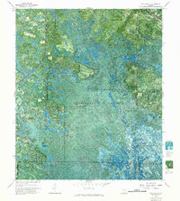
 1956 Eddy1957 Print · USGSThe Florida-Georgia borderlands are captured here in the mid-1950s, dominated by the intersection of rail transit and vast wetlands. You can trace the Southern railroad through the settlement of Eddy and locate the Eddy Lookout Tower deep within the Okefenokee Swamp.
 - 1956 Map of Sargent, 1957 Print
 1956 Sargent1957 Print · USGSThe Florida-Georgia borderlands are captured here in the mid-1950s, highlighting the wild interior where the Southern railroad bisects the great swamps. Trace the isolated outposts of Sargent and Ewing or explore the drainage of White Arm Bay.
 - 1958 Map of Valdosta
 1958 Valdosta1958 Print · USGSSouth Georgia and North Florida are captured here in the mid-fifties, showing the vast Okefenokee Swamp and the vital timber and rail corridors connecting the two states. Researchers can locate the footprint of Moody Air Force Base, trace the Live Oak Perry and Gulf railroad, or find early community sites like Bakers Mill and Paradise Church.
 - 1958 Map of Waycross
 1958 Waycross1958 Print · USGSSoutheast Georgia in the late fifties remains a landscape of deep river basins and vital rail junctions. Genealogists and historians can trace family-named landmarks and rural hubs like Union Church, South Georgia College, and the sprawling Okefenokee Swamp.2 unique versions available
 - 1959 Map of Valdosta
 1959 Valdosta1959 Print · USGSThe Georgia-Florida borderlands in the mid-fifties reveal a landscape of massive blackwater swamps and emerging military aviation hubs. Genealogists and historians can trace rail-stop towns like Fargo and Stockton or explore the interior reaches of the Okefenokee Swamp and Billys Island.
 - 1965 Map of Chesser Island, 1966 Print
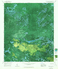
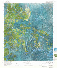
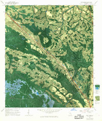
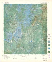 1965 Chesser Island1966 Print · USGSThe Okefenokee National Wildlife Refuge is shown in detail during the mid-sixties via this unique experimental photomap. Researchers can trace the Suwanee Canal and locate remote camps and landmarks like Camp Cornelia, Chesser Island, and Goose House Gap.3 unique versions available
 - 1965 Map of Chase Prairie, 1967 Print
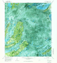
 1965 Chase Prairie1967 Print · USGSThe Okefenokee wilderness in the mid-sixties reveals a landscape of massive open prairies and historical timber trails. Trace the path of the Dismantled Logging Tram or locate the ancient Indian Mounds preserved on Floyds Island.
 - 1965 Map of Blackjack Island, 1967 Print
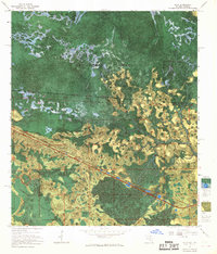
 1965 Blackjack Island1967 Print · USGSThe Okefenokee Swamp is seen here in the mid-1960s through an experimental photomap based on 1963 aerial imagery. Researchers can trace the legacy of local timber harvesting via the Dismantled Logging Tram or explore the landscape of Blackjack Island and Blackjack Lake.
 - 1966 Map of Billys Island, 1967 Print
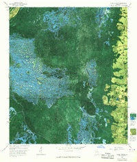
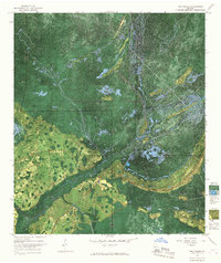
 1966 Billys Island1967 Print · USGSThe Okefenokee swamp interior is captured here in the mid-sixties, showing the transition from a timber landscape to a protected refuge. Genealogists and historians can locate the Lee Cem, the traces of a Dismantled Logging Tram, and the site of Camp Stephen Foster.2 unique versions available
 - 1966 Map of The Pocket, 1967 Print
 1966 The Pocket1967 Print · USGSThe Suwannee River headwaters and the southern Okefenokee Swamp are captured here in the mid-1960s. Researchers can trace the path of a Dismantled Logging Tram and locate family-named landmarks like Mixons Hammock and Jack Island.
 - 1966 Map of Cravens Island, 1968 Print
 1966 Cravens Island1968 Print · USGSWare County and the Okefenokee Swamp are captured in this mid-century photomap during an era of experimental cartography. Researchers can trace the heritage of the timber industry through a Dismantled Logging Tram and local landmarks like Mc Leods Mill.
 - 1967 Map of Strange Island
 1967 Strange Island1967 Print · USGSThe Georgia wetlands in the late sixties reveal a landscape defined by the vast Okefenokee Swamp. Trace the history of regional timber harvesting through a Dismantled Tram Logging route and locate remote points like Indian Mound Island.2 unique versions available
 - 1967 Map of Moniac, 1968 Print
 1967 Moniac1968 Print · USGSThe Georgia-Florida state line meets the great swamp in the late sixties, where the river and rail lines converge. Trace local history at Moniac and Baxter, find the Moniac Cem, or follow the Dismantled Logging Tram through the marsh.
 - 1967 Map of Waycross SE, 1968 Print
 1967 Waycross SE1968 Print · USGSThe northern reaches of the Okefenokee are captured here in the late sixties, showcasing a labyrinth of named islands and aquatic prairies. Researchers can trace the legacy of the regional timber industry via the Dismantled Logging Tram and the small settlement at Braganza.
 - 1967 Map of Spooner, 1968 Print
 1967 Spooner1968 Print · USGSSoutheast Georgia's dense marshlands are captured in detail during the late 1960s as federal surveyors mapped the hydrologic complexity of the Okefenokee Swamp. Genealogists and historians can locate isolated points of interest like Antioch Ch, the junction at The Wye, and the historic Dismal Logging Tram.2 unique versions available
 - 1967 Map of Sargent, 1968 Print
 1967 Sargent1968 Print · USGSThe Georgia-Florida borderlands come alive in this late-sixties experimental survey, where the great southern swamps meet the rail line. Researchers can trace the Southern railroad through the Okefenokee Swamp past Sargent and Moorehead.
 - 1967 Map of Fort Mudge, 1968 Print
 1967 Fort Mudge1968 Print · USGSThe Okefenokee wilderness in the late sixties reveals a landscape shaped by timber interests and conservation. Researchers can trace the Seaboard Coast Line through Fort Mudge and locate the Indian Mounds near Billy Landing Island.
 - 1967 Map of Eddy, 1968 Print
 1967 Eddy1968 Print · USGSThe Florida-Georgia borderlands near the Okefenokee Swamp are captured in the late 1960s, showing a remote landscape of wetlands and rails. Trace the path of the Southern railroad past the Radio Lookout Tower and islands like Mitchell Island.
 - 1967 Map of Hoboken West, 1969 Print
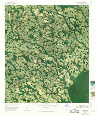
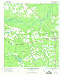 1967 Hoboken West1969 Print · USGSBrantley and Ware counties are shown in the late 1960s, a period defined by the timber industry and the railroad's path through the pine flatwoods. Genealogists can trace family names through numerous rural landmarks like Thrift Cem, St Johns Ch, and the community of Schlatterville.2 unique versions available
 - 1967 Map of Waycross West, 1969 Print
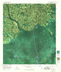
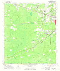 1967 Waycross West1969 Print · USGSWestern Ware County in the late sixties shows the expansion of Waycross toward the wetlands of Cloughs Bay. Researchers can trace rural church history at Old Ruskin Ch or locate old rail stops like Eightmile Post and Wahoma.2 unique versions available
Showing maps 1-25 of 54
Top cities of Ware County
Frequently asked questions
- What are the different types of historical maps available for Ware County?
- What is the oldest map of Ware County?
- Where can I purchase historical maps of Ware County for my home or office?
- Where can I download high-res historical maps of Ware County?
- Are there historical topographic maps available for Ware County?
- Is there historical aerial imagery available for Ware County?
- Where are historical maps of Ware County sourced from?